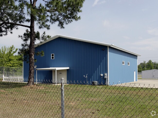
Property Record
8202 Remount Rd, North Little Rock, AR 72118


NEARBY LISTINGS FOR SALE OR LEASE
Property Detail
8202 Remount Rd
33N-002-00-001-00
E1/2 EXC 170,000 SQ FT REFERRED TO IN LEASE AGREEMENT DATED 2-15-88 TO NORTHAIRE INC AND EXC 66,000 SQ FT DATED 5-03-90 TO FEWELL & ASSOC INC AND EXC 40,070 SQ FT REFERRED TO IN LEASE AGREEMENT DATED 4-23-84 AND LEASE AGREEMENT DATED 8-8-83 BOTH TO V
Officebuilding
Pulaski
X
Arkansas
05119C0335G
5,wc-
2025
392.03 AC
2025
North Little Rock
003712
Little Rock/N Little Rock
166,470 SF
Little Rock-North Little Rock-Conway, AR
DEMOGRAPHICS near 8202 Remount Rd
1 Mile
3 Mile
5 Mile
2024 Total Population
1,240
39,761
86,491
2029 Population
1,212
39,315
86,455
Pop Growth 2024-2029
(2.26%)
(1.12%)
(0.04%)
Average Age
43
40
40
2024 Total Households
488
16,989
37,639
HH Growth 2024-2029
(2.25%)
(1.19%)
(0.03%)
Median Household Inc
$95,639
$58,086
$54,096
Avg Household Size
2.50
2.30
2.20
2024 Avg HH Vehicles
2.00
2.00
2.00
Median Home Value
$216,058
$166,675
$169,709
Median Year Built
1976
1974
1976
Nearby Places
Map Layers
Map Styles
 Street
 Aerial
- Restaurants
- Banks
- Shops
- Fitness
- Groceries
PUBLIC TRANSPORTATION
COMMUTER RAIL
Little Rock Union Station (Texas Eagle - Amtrak)
DRIVE
WALK
Distance
Little Rock Union Station (Texas Eagle - Amtrak)
15 min
7.4 mi
AIRPORT
Bill and Hillary Clinton Ntl/Adams Field
DRIVE
WALK
Distance
Bill and Hillary Clinton Ntl/Adams Field
20 min
11.6 mi
Freight Ports
Port of Shreveport
DRIVE
WALK
Distance
Port of Shreveport
262 min
240.5 mi
Nearby Properties
Address
Land Use
TOTAL SIZE
Lot Size
Zoning
Address
Land Use
TOTAL SIZE
Lot Size
Zoning
316,927 SF
50.65 AC
Address
Land Use
TOTAL SIZE
Lot Size
Zoning
195,404 SF
25.19 AC
Address
Land Use
TOTAL SIZE
Lot Size
Zoning
141,362 SF
14.25 AC
Address
Land Use
TOTAL SIZE
Lot Size
Zoning
73,763 SF
23.09 AC
Address
Land Use
TOTAL SIZE
Lot Size
Zoning
219,330 SF
24.14 AC
Address
Land Use
TOTAL SIZE
Lot Size
Zoning
23,934.60 AC
Address
Land Use
TOTAL SIZE
Lot Size
Zoning
83,431 SF
10.99 AC
Address
Land Use
TOTAL SIZE
Lot Size
Zoning
49,995 SF
12.92 AC
Address
Land Use
TOTAL SIZE
Lot Size
Zoning
154,854 SF
5.40 AC
Address
Land Use
TOTAL SIZE
Lot Size
Zoning
56,643 SF
9.46 AC
Address
Land Use
TOTAL SIZE
Lot Size
Zoning
48,142 SF
10.99 AC
Address
Land Use
TOTAL SIZE
Lot Size
Zoning
8,520 SF
11.30 AC
Address
Land Use
TOTAL SIZE
Lot Size
Zoning
49,393 SF
5.31 AC
Address
Land Use
TOTAL SIZE
Lot Size
Zoning
38,493 SF
15.79 AC
Address
Land Use
TOTAL SIZE
Lot Size
Zoning
14,311 SF
10.47 AC
Address
Land Use
TOTAL SIZE
Lot Size
Zoning
126,416 SF
9.83 AC
Address
Land Use
TOTAL SIZE
Lot Size
Zoning
3,306 SF
8.33 AC
Address
Land Use
TOTAL SIZE
Lot Size
Zoning
8,345 SF
6.88 AC
Address
Land Use
TOTAL SIZE
Lot Size
Zoning
84,276 SF
2.59 AC
Address
Land Use
TOTAL SIZE
Lot Size
Zoning
35,645 SF
7.97 AC
Address
Land Use
TOTAL SIZE
Lot Size
Zoning
48,507 SF
4.25 AC
Address
Land Use
TOTAL SIZE
Lot Size
Zoning
7,975 SF
3.96 AC
Address
Land Use
TOTAL SIZE
Lot Size
Zoning
3,793 SF
6.19 AC
Address
Land Use
TOTAL SIZE
Lot Size
Zoning
15,165 SF
4.70 AC
Address
Land Use
TOTAL SIZE
Lot Size
Zoning
35,178 SF
5.62 AC
Address
Land Use
TOTAL SIZE
Lot Size
Zoning
44,705 SF
8.10 AC
Address
Land Use
TOTAL SIZE
Lot Size
Zoning
12,990 SF
5.72 AC
Address
Land Use
TOTAL SIZE
Lot Size
Zoning
97,980 SF
5.89 AC
Address
Land Use
TOTAL SIZE
Lot Size
Zoning
24,678 SF
108.23 AC
The World's #1 Commercial Real Estate Marketplace
Connect with us
© 2026 CoStar Group
The information above has been obtained from sources believed reliable. While we do not doubt its accuracy we have not verified it and make no guarantee, warranty or representation about it. It is your responsibility to independently confirm its accuracy and completeness. Any projections, opinions, assumptions, or estimates used are for example only and do not represent the current or future performance of the property. The value of this transaction to you depends on tax and other factors which should be evaluated by your tax, financial, and legal advisors. You and your advisors should conduct a careful, independent investigation of the property to determine to your satisfaction the suitability of the property for your needs.