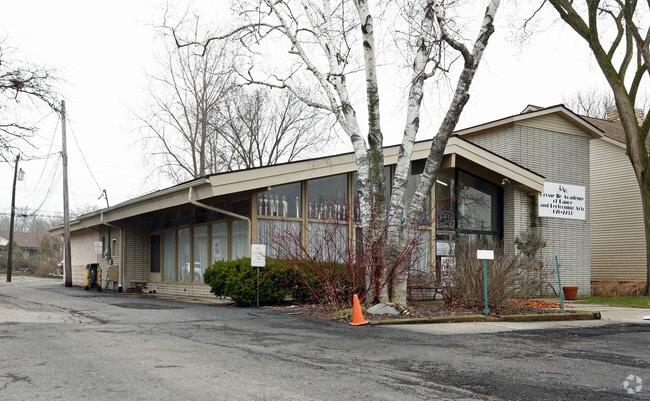
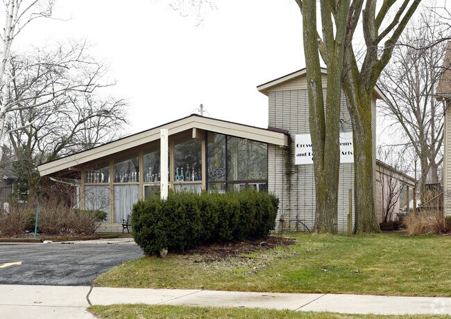
Property Record
8205 Macomb St, Grosse Ile, MI 48138

Property Detail
8205 Macomb St
73-028-01-0029-003
552D29C E 50FT LOT 29 EAST SIDE HORACE GRAYS SUB PC 552 L4 P39 WCR
Officebuilding
WAYNE
MSD
Michigan
B and X Area of moderate flood hazard, usually the area between the limits of the 100-year and 500-year floods.
29
2025
0.37 AC
2025
Downriver South
596200
Detroit
1,742 SF
Detroit-Warren-Dearborn, MI
NEARBY LISTINGS FOR SALE OR LEASE
DEMOGRAPHICS near 8205 Macomb St
1 mile
3 mile
5 mile
2025 Total Population
3,307
19,158
61,990
2030 Population
3,264
18,852
60,767
Pop Growth 2025-2030
(1.30%)
(1.60%)
(1.97%)
Average Age
46
46
44
2025 Total Households
1,360
8,285
26,738
HH Growth 2025-2030
(1.32%)
(1.65%)
(2.03%)
Median Household Inc
$126,880
$94,763
$81,594
Avg Household Size
2.40
2.30
2.30
2025 Avg HH Vehicles
2.00
2.00
2.00
Median Home Value
$377,129
$276,924
$230,698
Median Year Built
1976
1967
1968
Nearby Places
Map Layers
Map Styles
 Street
 Aerial
Layers
 Traffic
 Biking
Places
Listings with unknown addresses are not visible on the map
- Restaurants
- Banks
- Shops
- Fitness
- Groceries
PUBLIC TRANSPORTATION
AIRPORT
Detroit Metro Wayne County
Drive
Walk
Distance
Detroit Metro Wayne County
36 min
19.4 mi
Windsor International
Drive
Walk
Distance
Windsor International
57 min
33.8 mi
Nearby Properties
Address
Land Use
TOTAL SIZE
Lot Size
Zoning
Address
Land Use
TOTAL SIZE
Lot Size
Zoning
2,651,867 SF
137.23 AC
I-3
Address
Land Use
TOTAL SIZE
Lot Size
Zoning
155,600 SF
83.84 AC
R1
Address
Land Use
TOTAL SIZE
Lot Size
Zoning
2,160 SF
334.88 AC
I1
Address
Land Use
TOTAL SIZE
Lot Size
Zoning
143,496 SF
3.73 AC
RM-2
Address
Land Use
TOTAL SIZE
Lot Size
Zoning
58,149 SF
11.40 AC
B2-COM
Address
Land Use
TOTAL SIZE
Lot Size
Zoning
62,039 SF
Address
Land Use
TOTAL SIZE
Lot Size
Zoning
40,136 SF
42.97 AC
R-1-D
Address
Land Use
TOTAL SIZE
Lot Size
Zoning
50,880 SF
4.87 AC
R-1-F
Address
Land Use
TOTAL SIZE
Lot Size
Zoning
133.65 AC
MU REDEV
Address
Land Use
TOTAL SIZE
Lot Size
Zoning
354,969 SF
23.78 AC
I2
Address
Land Use
TOTAL SIZE
Lot Size
Zoning
35,518 SF
1.21 AC
B2
Address
Land Use
TOTAL SIZE
Lot Size
Zoning
3,500 SF
106.18 AC
R-1-D
Address
Land Use
TOTAL SIZE
Lot Size
Zoning
109.60 AC
R-1-D
Address
Land Use
TOTAL SIZE
Lot Size
Zoning
103,950 SF
5.04 AC
R1-ONE
Address
Land Use
TOTAL SIZE
Lot Size
Zoning
7,558 SF
55.95 AC
R-1-B
Address
Land Use
TOTAL SIZE
Lot Size
Zoning
9,876 SF
Address
Land Use
TOTAL SIZE
Lot Size
Zoning
62,480 SF
5.81 AC
RM-1
Address
Land Use
TOTAL SIZE
Lot Size
Zoning
44,172 SF
2.66 AC
RM-1
Address
Land Use
TOTAL SIZE
Lot Size
Zoning
163,633 SF
8.52 AC
PD
Address
Land Use
TOTAL SIZE
Lot Size
Zoning
27,473 SF
2.36 AC
MSD
Address
Land Use
TOTAL SIZE
Lot Size
Zoning
39,060 SF
88.70 AC
Address
Land Use
TOTAL SIZE
Lot Size
Zoning
11,259 SF
5.89 AC
R-1-B
Address
Land Use
TOTAL SIZE
Lot Size
Zoning
53,292 SF
1.86 AC
RM-2
Address
Land Use
TOTAL SIZE
Lot Size
Zoning
13,833 SF
1.63 AC
B3
Address
Land Use
TOTAL SIZE
Lot Size
Zoning
4,099 SF
12.30 AC
R-1-B
Address
Land Use
TOTAL SIZE
Lot Size
Zoning
46,650 SF
5.10 AC
I-1
Address
Land Use
TOTAL SIZE
Lot Size
Zoning
1,080 SF
10.13 AC
RM2
Address
Land Use
TOTAL SIZE
Lot Size
Zoning
20,806 SF
Address
Land Use
TOTAL SIZE
Lot Size
Zoning
20,806 SF
Address
Land Use
TOTAL SIZE
Lot Size
Zoning
27,311 SF
2.86 AC
RM-1
The World's #1 Commercial Real Estate Marketplace
Connect with us
© 2026 CoStar Group
The information above has been obtained from sources believed reliable. While we do not doubt its accuracy we have not verified it and make no guarantee, warranty or representation about it. It is your responsibility to independently confirm its accuracy and completeness. Any projections, opinions, assumptions, or estimates used are for example only and do not represent the current or future performance of the property. The value of this transaction to you depends on tax and other factors which should be evaluated by your tax, financial, and legal advisors. You and your advisors should conduct a careful, independent investigation of the property to determine to your satisfaction the suitability of the property for your needs.