Property Record
821 W New Hope Dr, Cedar Park, TX 78613

Property Detail
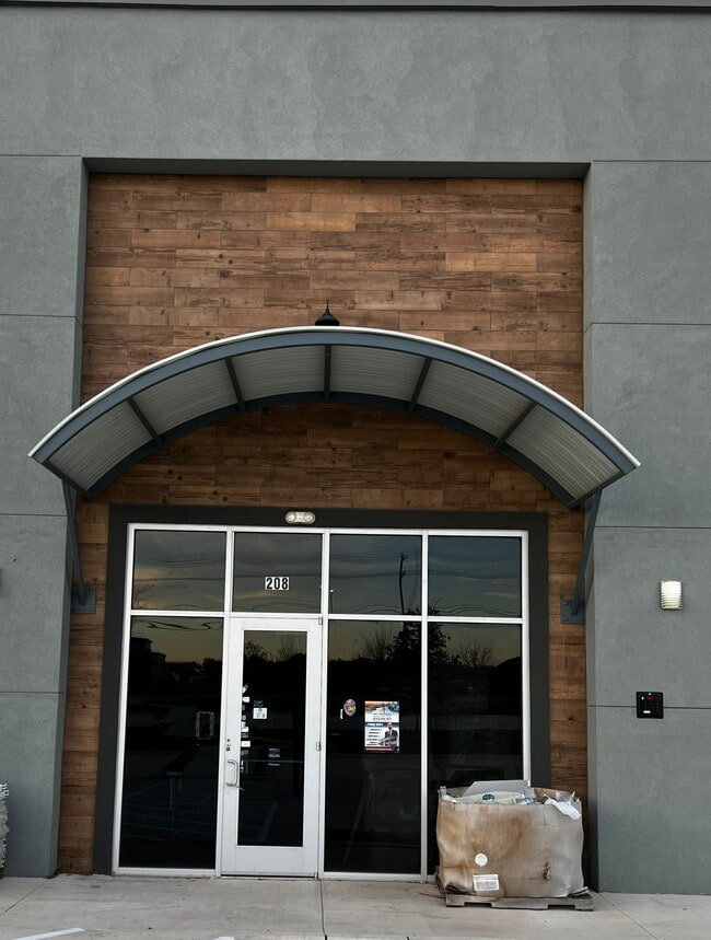
821 W New Hope Dr
Austin-Round Rock-San Marcos, TX
C798 - NEW HOPE CROSSING CONDO, BUILDING 2, UNIT 203, 7.70% COMMON AREA INTEREST
R648694
WILLIAMSON
Commercialnec
Texas
2024
2.29 AC
2025
Cedar Park
020325
Austin
1,508 SF
NEARBY LISTINGS FOR SALE OR LEASE
DEMOGRAPHICS near 821 W New Hope Dr
1 mile
3 mile
5 mile
2025 Total Population
11,857
88,900
187,506
2030 Population
13,308
100,440
212,218
Pop Growth 2025-2030
+ 12.24%
+ 12.98%
+ 13.18%
Average Age
37
37
37
2025 Total Households
4,409
31,374
67,542
HH Growth 2025-2030
+ 12.86%
+ 13.53%
+ 13.77%
Median Household Inc
$87,340
$122,709
$129,467
Avg Household Size
2.60
2.80
2.70
2025 Avg HH Vehicles
2.00
2.00
2.00
Median Home Value
$382,764
$475,584
$517,178
Median Year Built
1999
2005
2008
Nearby Places
Map Layers
Map Styles
 Street
 Aerial
Transit
 Traffic
 Biking
Places
Listings with unknown addresses are not visible on the map
- Restaurants
- Banks
- Shops
- Fitness
- Groceries
PUBLIC TRANSPORTATION
AIRPORT
Austin-Bergstrom International
Drive
Walk
Distance
Austin-Bergstrom International
47 min
34.0 mi
Freight Ports
Calhoun Port
Drive
Walk
Distance
Calhoun Port
212 min
177.5 mi
SALE & LEASE HISTORY
LISTING DATE
SALE/LEASE

Sep 15, 2023
For Lease
Sep 09, 2024
For Lease
Nov 04, 2024
For Lease
Mar 12, 2024
For Sale
Jul 03, 2025
For Sale
Feb 15, 2023
For Lease
Nearby Properties
Address
Land Use
TOTAL SIZE
Lot Size
Zoning
Address
Land Use
TOTAL SIZE
Lot Size
Zoning
338,919 SF
42.88 AC
Address
Land Use
TOTAL SIZE
Lot Size
Zoning
277,152 SF
45.29 AC
Address
Land Use
TOTAL SIZE
Lot Size
Zoning
313,727 SF
6.64 AC
Address
Land Use
TOTAL SIZE
Lot Size
Zoning
324,508 SF
24.08 AC
Address
Land Use
TOTAL SIZE
Lot Size
Zoning
181,000 SF
30.14 AC
Address
Land Use
TOTAL SIZE
Lot Size
Zoning
325,045 SF
22.75 AC
Address
Land Use
TOTAL SIZE
Lot Size
Zoning
335,765 SF
4.10 AC
Address
Land Use
TOTAL SIZE
Lot Size
Zoning
223,681 SF
7.78 AC
Address
Land Use
TOTAL SIZE
Lot Size
Zoning
250,556 SF
17.51 AC
Address
Land Use
TOTAL SIZE
Lot Size
Zoning
205,563 SF
18.24 AC
4-GR
Address
Land Use
TOTAL SIZE
Lot Size
Zoning
180,799 SF
22.90 AC
Address
Land Use
TOTAL SIZE
Lot Size
Zoning
117,076 SF
15.51 AC
Address
Land Use
TOTAL SIZE
Lot Size
Zoning
195,426 SF
12.11 AC
Address
Land Use
TOTAL SIZE
Lot Size
Zoning
316,408 SF
15 AC
Address
Land Use
TOTAL SIZE
Lot Size
Zoning
149,429 SF
16.98 AC
Address
Land Use
TOTAL SIZE
Lot Size
Zoning
94,861 SF
12.72 AC
Address
Land Use
TOTAL SIZE
Lot Size
Zoning
151,181 SF
6 AC
Address
Land Use
TOTAL SIZE
Lot Size
Zoning
89,872 SF
45.29 AC
Address
Land Use
TOTAL SIZE
Lot Size
Zoning
240,800 SF
17.16 AC
Address
Land Use
TOTAL SIZE
Lot Size
Zoning
264,140 SF
21.37 AC
Address
Land Use
TOTAL SIZE
Lot Size
Zoning
173,199 SF
7.66 AC
Address
Land Use
TOTAL SIZE
Lot Size
Zoning
47,009 SF
1.59 AC
Address
Land Use
TOTAL SIZE
Lot Size
Zoning
86,764 SF
Address
Land Use
TOTAL SIZE
Lot Size
Zoning
251,691 SF
14.73 AC
Address
Land Use
TOTAL SIZE
Lot Size
Zoning
72,489 SF
8.99 AC
Address
Land Use
TOTAL SIZE
Lot Size
Zoning
166,265 SF
15.29 AC
3-PD
Address
Land Use
TOTAL SIZE
Lot Size
Zoning
201,900 SF
33.81 AC
Address
Land Use
TOTAL SIZE
Lot Size
Zoning
119,523 SF
5.95 AC
Address
Land Use
TOTAL SIZE
Lot Size
Zoning
41,891 SF
10.42 AC
Address
Land Use
TOTAL SIZE
Lot Size
Zoning
123,858 SF
6.06 AC
The World's #1 Commercial Real Estate Marketplace
Connect with us
© 2026 CoStar Group
The information above has been obtained from sources believed reliable. While we do not doubt its accuracy we have not verified it and make no guarantee, warranty or representation about it. It is your responsibility to independently confirm its accuracy and completeness. Any projections, opinions, assumptions, or estimates used are for example only and do not represent the current or future performance of the property. The value of this transaction to you depends on tax and other factors which should be evaluated by your tax, financial, and legal advisors. You and your advisors should conduct a careful, independent investigation of the property to determine to your satisfaction the suitability of the property for your needs.