Property Record
8210 Fm 1960 Rd W, Humble, TX 77338
NEARBY LISTINGS FOR SALE OR LEASE
Property Detail
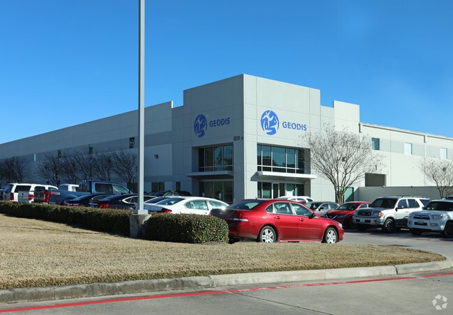
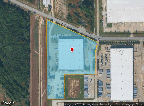
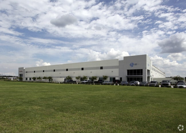
8210 Fm 1960 Rd W
1164130080002
Houston International Trade Center 7Th R
Warehouse
RES B BLK 1 HOUSTON INTERNATIONAL TRADE CENTER 7TH R/P
X
Harris
48339C0725G
Texas
2024
12.23 AC
2025
North Hardy Toll Road
241501
Houston
159,480 SF
Houston-The Woodlands-Sugar Land, TX
DEMOGRAPHICS near 8210 Fm 1960 Rd W
1 Mile
3 Mile
5 Mile
2024 Total Population
6,842
38,015
99,985
2029 Population
7,030
38,695
102,340
Pop Growth 2024-2029
+ 2.75%
+ 1.79%
+ 2.36%
Average Age
36
35
35
2024 Total Households
2,293
12,674
32,994
HH Growth 2024-2029
+ 2.75%
+ 1.74%
+ 2.49%
Median Household Inc
$76,394
$64,071
$59,761
Avg Household Size
2.90
2.90
2.90
2024 Avg HH Vehicles
2.00
2.00
2.00
Median Home Value
$160,944
$167,634
$170,166
Median Year Built
2000
1998
1993
Nearby Places
Map Layers
Map Styles
 Street
 Aerial
- Restaurants
- Banks
- Shops
- Fitness
- Groceries
PUBLIC TRANSPORTATION
AIRPORT
George Bush Intcntl/Houston
DRIVE
WALK
Distance
George Bush Intcntl/Houston
12 min
6.2 mi
William P Hobby
DRIVE
WALK
Distance
William P Hobby
49 min
32.1 mi
Freight Ports
Port of Houston
DRIVE
WALK
Distance
Port of Houston
38 min
25.8 mi
Nearby Properties
Address
Land Use
TOTAL SIZE
Lot Size
Zoning
Address
Land Use
TOTAL SIZE
Lot Size
Zoning
687,195 SF
33.75 AC
Address
Land Use
TOTAL SIZE
Lot Size
Zoning
685,400 SF
38.82 AC
Address
Land Use
TOTAL SIZE
Lot Size
Zoning
514,500 SF
40.85 AC
Address
Land Use
TOTAL SIZE
Lot Size
Zoning
429,750 SF
24.74 AC
Address
Land Use
TOTAL SIZE
Lot Size
Zoning
391,060 SF
32.42 AC
Address
Land Use
TOTAL SIZE
Lot Size
Zoning
355,622 SF
15.78 AC
Address
Land Use
TOTAL SIZE
Lot Size
Zoning
432,617 SF
19.41 AC
Address
Land Use
TOTAL SIZE
Lot Size
Zoning
334,510 SF
23.54 AC
Address
Land Use
TOTAL SIZE
Lot Size
Zoning
320,200 SF
19.56 AC
Address
Land Use
TOTAL SIZE
Lot Size
Zoning
449,858 SF
22.20 AC
Address
Land Use
TOTAL SIZE
Lot Size
Zoning
235,236 SF
15.14 AC
Address
Land Use
TOTAL SIZE
Lot Size
Zoning
309,744 SF
21.50 AC
Address
Land Use
TOTAL SIZE
Lot Size
Zoning
216,978 SF
10.99 AC
Address
Land Use
TOTAL SIZE
Lot Size
Zoning
276,464 SF
18.79 AC
Address
Land Use
TOTAL SIZE
Lot Size
Zoning
252,320 SF
22.14 AC
Address
Land Use
TOTAL SIZE
Lot Size
Zoning
205,040 SF
10.51 AC
Address
Land Use
TOTAL SIZE
Lot Size
Zoning
242,788 SF
14.72 AC
Address
Land Use
TOTAL SIZE
Lot Size
Zoning
304,671 SF
14.77 AC
Address
Land Use
TOTAL SIZE
Lot Size
Zoning
196,468 SF
9.51 AC
Address
Land Use
TOTAL SIZE
Lot Size
Zoning
199,368 SF
8.16 AC
Address
Land Use
TOTAL SIZE
Lot Size
Zoning
207,432 SF
15.12 AC
Address
Land Use
TOTAL SIZE
Lot Size
Zoning
208,230 SF
14.79 AC
Address
Land Use
TOTAL SIZE
Lot Size
Zoning
165,737 SF
14 AC
Address
Land Use
TOTAL SIZE
Lot Size
Zoning
102,374 SF
13.48 AC
Address
Land Use
TOTAL SIZE
Lot Size
Zoning
156,756 SF
17.05 AC
Address
Land Use
TOTAL SIZE
Lot Size
Zoning
64,980 SF
4.19 AC
Address
Land Use
TOTAL SIZE
Lot Size
Zoning
56,344 SF
3.25 AC
Address
Land Use
TOTAL SIZE
Lot Size
Zoning
206,600 SF
23.09 AC
Address
Land Use
TOTAL SIZE
Lot Size
Zoning
168,400 SF
11.57 AC
Address
Land Use
TOTAL SIZE
Lot Size
Zoning
196,200 SF
16.86 AC
The World's #1 Commercial Real Estate Marketplace
Connect with us
© 2026 CoStar Group
The information above has been obtained from sources believed reliable. While we do not doubt its accuracy we have not verified it and make no guarantee, warranty or representation about it. It is your responsibility to independently confirm its accuracy and completeness. Any projections, opinions, assumptions, or estimates used are for example only and do not represent the current or future performance of the property. The value of this transaction to you depends on tax and other factors which should be evaluated by your tax, financial, and legal advisors. You and your advisors should conduct a careful, independent investigation of the property to determine to your satisfaction the suitability of the property for your needs.