Property Record
8210 Pinellas Dr, Bluffton, SC 29910
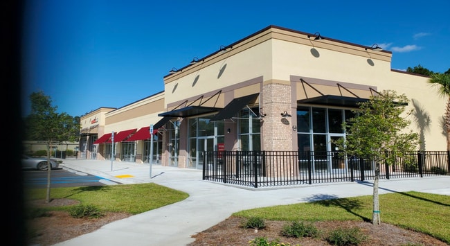

Property Detail
8210 Pinellas Dr
Hilton Head Island-Bluffton-Port Royal, SC
PARCEL C2-E PORT OF BUCKWALTER PUD PB143 PG107 PB145 PG182 PB159 PG140
R610-022-000-1106-0000
BEAUFORT
Stripcommercialcenter
South Carolina
2025
2.09 AC
2025
Hilton Head/Beaufort
002105
Other Market Areas
10,095 SF
NEARBY LISTINGS FOR SALE OR LEASE
DEMOGRAPHICS near 8210 Pinellas Dr
1 mile
3 mile
5 mile
2025 Total Population
2,519
26,464
62,066
2030 Population
2,640
27,623
65,385
Pop Growth 2025-2030
+ 4.80%
+ 4.38%
+ 5.35%
Average Age
43
46
47
2025 Total Households
972
10,680
25,795
HH Growth 2025-2030
+ 5.14%
+ 4.87%
+ 5.87%
Median Household Inc
$89,198
$93,701
$90,645
Avg Household Size
2.50
2.40
2.30
2025 Avg HH Vehicles
2.00
2.00
2.00
Median Home Value
$453,235
$469,078
$454,068
Median Year Built
2008
2005
2005
Nearby Places
Map Layers
Map Styles
 Street
 Aerial
Layers
 Traffic
 Biking
Places
Listings with unknown addresses are not visible on the map
- Restaurants
- Banks
- Shops
- Fitness
- Groceries
PUBLIC TRANSPORTATION
AIRPORT
Savannah/Hilton Head International
Drive
Walk
Distance
Savannah/Hilton Head International
37 min
30.6 mi
Freight Ports
Georgia Ports - Savannah
Drive
Walk
Distance
Georgia Ports - Savannah
1 min
17.8 mi
SALE & LEASE HISTORY
LISTING DATE
SALE/LEASE

Jun 03, 2024
For Lease
Nearby Properties
Address
Land Use
TOTAL SIZE
Lot Size
Zoning
Address
Land Use
TOTAL SIZE
Lot Size
Zoning
359,002 SF
29.31 AC
6106
Address
Land Use
TOTAL SIZE
Lot Size
Zoning
2.61 AC
RC
Address
Land Use
TOTAL SIZE
Lot Size
Zoning
239,640 SF
17.73 AC
6606
Address
Land Use
TOTAL SIZE
Lot Size
Zoning
132,657 SF
45.07 AC
6106
Address
Land Use
TOTAL SIZE
Lot Size
Zoning
188,132 SF
10.59 AC
Address
Land Use
TOTAL SIZE
Lot Size
Zoning
72,932 SF
17.22 AC
Address
Land Use
TOTAL SIZE
Lot Size
Zoning
52,320 SF
17.88 AC
6106
Address
Land Use
TOTAL SIZE
Lot Size
Zoning
90,696 SF
62.80 AC
6616
Address
Land Use
TOTAL SIZE
Lot Size
Zoning
111,303 SF
9.56 AC
Address
Land Use
TOTAL SIZE
Lot Size
Zoning
61,102 SF
12.20 AC
6606
Address
Land Use
TOTAL SIZE
Lot Size
Zoning
696 SF
41.71 AC
6116
Address
Land Use
TOTAL SIZE
Lot Size
Zoning
139,215 SF
13.63 AC
6106
Address
Land Use
TOTAL SIZE
Lot Size
Zoning
65,304 SF
27.78 AC
6606
Address
Land Use
TOTAL SIZE
Lot Size
Zoning
67,941 SF
15.45 AC
Address
Land Use
TOTAL SIZE
Lot Size
Zoning
119,800 SF
9.37 AC
Address
Land Use
TOTAL SIZE
Lot Size
Zoning
2,300 SF
6.85 AC
Address
Land Use
TOTAL SIZE
Lot Size
Zoning
119,902 SF
4.16 AC
6606
Address
Land Use
TOTAL SIZE
Lot Size
Zoning
Address
Land Use
TOTAL SIZE
Lot Size
Zoning
7.22 AC
Address
Land Use
TOTAL SIZE
Lot Size
Zoning
40,847 SF
3.79 AC
Address
Land Use
TOTAL SIZE
Lot Size
Zoning
81,625 SF
5.43 AC
Address
Land Use
TOTAL SIZE
Lot Size
Zoning
30,305 SF
0.93 AC
Address
Land Use
TOTAL SIZE
Lot Size
Zoning
54,614 SF
142.72 AC
6616
Address
Land Use
TOTAL SIZE
Lot Size
Zoning
84,844 SF
5.31 AC
Address
Land Use
TOTAL SIZE
Lot Size
Zoning
89,537 SF
12.29 AC
Address
Land Use
TOTAL SIZE
Lot Size
Zoning
51,163 SF
7.54 AC
Address
Land Use
TOTAL SIZE
Lot Size
Zoning
79,616 SF
23.51 AC
6616
Address
Land Use
TOTAL SIZE
Lot Size
Zoning
76,410 SF
27.89 AC
6616
Address
Land Use
TOTAL SIZE
Lot Size
Zoning
65,592 SF
3.33 AC
6606
The World's #1 Commercial Real Estate Marketplace
Connect with us
© 2026 CoStar Group
The information above has been obtained from sources believed reliable. While we do not doubt its accuracy we have not verified it and make no guarantee, warranty or representation about it. It is your responsibility to independently confirm its accuracy and completeness. Any projections, opinions, assumptions, or estimates used are for example only and do not represent the current or future performance of the property. The value of this transaction to you depends on tax and other factors which should be evaluated by your tax, financial, and legal advisors. You and your advisors should conduct a careful, independent investigation of the property to determine to your satisfaction the suitability of the property for your needs.