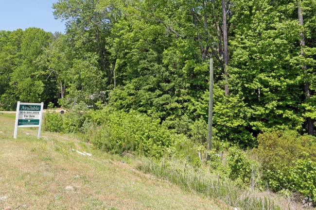
Property Record
8211 Louisburg Rd, Wake Forest, NC 27587

NEARBY LISTINGS FOR SALE OR LEASE
Property Detail
8211 Louisburg Rd
Raleigh, NC
Property/Mae P Reames
1747.01-29-5817-000
PROP OF MAE P. REAMS BM1981-00065
Vacantlandnec
Wake
X
North Carolina
3720174700K
1,2
2025
3.99 AC
2025
Route 1
054218
Raleigh/Durham
DEMOGRAPHICS near 8211 Louisburg Rd
1 Mile
3 Mile
5 Mile
2024 Total Population
8,562
50,355
143,851
2029 Population
9,248
54,894
156,619
Pop Growth 2024-2029
+ 8.01%
+ 9.01%
+ 8.88%
Average Age
37
37
38
2024 Total Households
3,082
17,729
53,924
HH Growth 2024-2029
+ 7.92%
+ 9.08%
+ 8.91%
Median Household Inc
$91,380
$84,744
$89,455
Avg Household Size
2.80
2.80
2.60
2024 Avg HH Vehicles
2.00
2.00
2.00
Median Home Value
$260,781
$289,764
$333,474
Median Year Built
2008
2005
2003
Nearby Places
Map Layers
Map Styles
 Street
 Aerial
- Restaurants
- Banks
- Shops
- Fitness
- Groceries
PUBLIC TRANSPORTATION
AIRPORT
Raleigh-Durham International
DRIVE
WALK
Distance
Raleigh-Durham International
27 min
19.8 mi
SALE & LEASE HISTORY
LISTING DATE
SALE/LEASE

Sep 24, 2016
For Sale
May 14, 2018
For Sale
Nearby Properties
Address
Land Use
TOTAL SIZE
Lot Size
Zoning
Address
Land Use
TOTAL SIZE
Lot Size
Zoning
817,723 SF
64.40 AC
OX-5
Address
Land Use
TOTAL SIZE
Lot Size
Zoning
401,268 SF
23.93 AC
CX-5
Address
Land Use
TOTAL SIZE
Lot Size
Zoning
342,900 SF
19.15 AC
RX-3
Address
Land Use
TOTAL SIZE
Lot Size
Zoning
298,512 SF
20.16 AC
RX-3
Address
Land Use
TOTAL SIZE
Lot Size
Zoning
217,961 SF
11.77 AC
CX-3
Address
Land Use
TOTAL SIZE
Lot Size
Zoning
196,198 SF
29.21 AC
PD
Address
Land Use
TOTAL SIZE
Lot Size
Zoning
211,372 SF
38.26 AC
R-4
Address
Land Use
TOTAL SIZE
Lot Size
Zoning
245,352 SF
28.53 AC
R-10
Address
Land Use
TOTAL SIZE
Lot Size
Zoning
77,921 SF
33 AC
IX-3
Address
Land Use
TOTAL SIZE
Lot Size
Zoning
155,079 SF
5.87 AC
PD
Address
Land Use
TOTAL SIZE
Lot Size
Zoning
208,072 SF
24.35 AC
RX-3
Address
Land Use
TOTAL SIZE
Lot Size
Zoning
179,100 SF
6.80 AC
PD
Address
Land Use
TOTAL SIZE
Lot Size
Zoning
196,091 SF
37.21 AC
RL
Address
Land Use
TOTAL SIZE
Lot Size
Zoning
94,751 SF
66.71 AC
IX-3
Address
Land Use
TOTAL SIZE
Lot Size
Zoning
145,944 SF
45.22 AC
OX-5
Address
Land Use
TOTAL SIZE
Lot Size
Zoning
93,494 SF
10.40 AC
R-10
Address
Land Use
TOTAL SIZE
Lot Size
Zoning
11,577 SF
114.41 AC
R-6
Address
Land Use
TOTAL SIZE
Lot Size
Zoning
139,600 SF
23.64 AC
LI
Address
Land Use
TOTAL SIZE
Lot Size
Zoning
104,919 SF
29.07 AC
GR3
Address
Land Use
TOTAL SIZE
Lot Size
Zoning
105,035 SF
20.68 AC
PD
Address
Land Use
TOTAL SIZE
Lot Size
Zoning
85,312 SF
21.37 AC
HB
Address
Land Use
TOTAL SIZE
Lot Size
Zoning
103,584 SF
7.81 AC
PD
Address
Land Use
TOTAL SIZE
Lot Size
Zoning
101,316 SF
25.68 AC
R-4
Address
Land Use
TOTAL SIZE
Lot Size
Zoning
270,754 SF
168 AC
IH
Address
Land Use
TOTAL SIZE
Lot Size
Zoning
66,609 SF
6.92 AC
IX-3
Address
Land Use
TOTAL SIZE
Lot Size
Zoning
64,149 SF
9.66 AC
IX-3
Address
Land Use
TOTAL SIZE
Lot Size
Zoning
129,612 SF
42.06 AC
ICD
Address
Land Use
TOTAL SIZE
Lot Size
Zoning
81,988 SF
26 AC
R-6
Address
Land Use
TOTAL SIZE
Lot Size
Zoning
341,726 SF
35.16 AC
HB
Address
Land Use
TOTAL SIZE
Lot Size
Zoning
115,872 SF
17.25 AC
CX-3
The World's #1 Commercial Real Estate Marketplace
Connect with us
© 2025 CoStar Group
The information above has been obtained from sources believed reliable. While we do not doubt its accuracy we have not verified it and make no guarantee, warranty or representation about it. It is your responsibility to independently confirm its accuracy and completeness. Any projections, opinions, assumptions, or estimates used are for example only and do not represent the current or future performance of the property. The value of this transaction to you depends on tax and other factors which should be evaluated by your tax, financial, and legal advisors. You and your advisors should conduct a careful, independent investigation of the property to determine to your satisfaction the suitability of the property for your needs.