Property Record
8217 S I 35 Service Rd, Oklahoma City, OK 73149
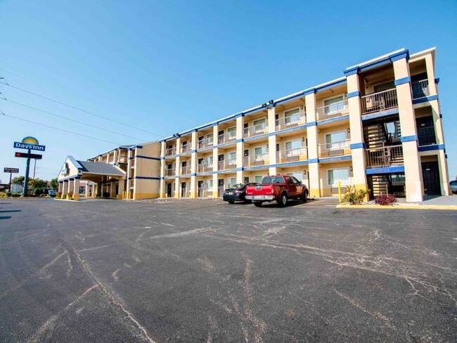

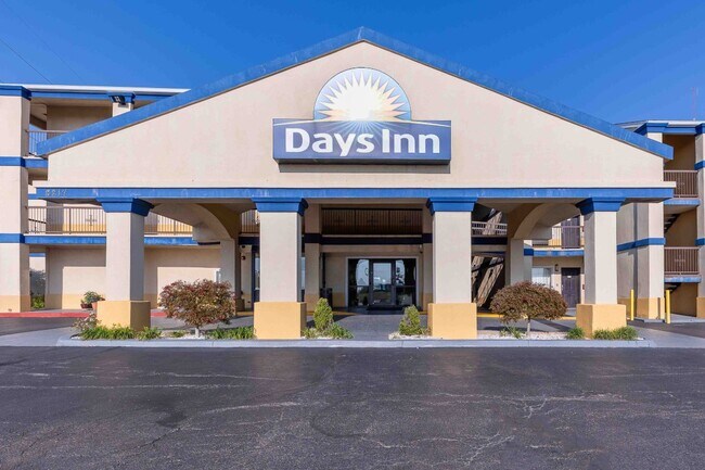
This Property Is For Sale
NEARBY LISTINGS FOR SALE OR LEASE
Property Detail
8217 S I 35 Service Rd
Oklahoma City, OK
Unpltd Pt Sec 34 11N 3W
132303885
UNPLTD PT SEC 34 11N 3W 000 000 PT NE4 SEC 34 11N 3W BEG 30FT N & 299.39FT W OF SE/C NE4 TH ALONG HWY R/W N2.60FT NELY ON A CURVE TO THE LEFT 42.92FT NELY ALONG R/W 262.04FT W235FT S295.37FT E179.27FT TO BEG CONT 64002.9647SQ FT MORE OR LESS PT OF TR
Motel
Oklahoma
X
Oklahoma
40109C0315H
3,2
2023
1.47 AC
2024
Oklahoma City South
107303
Oklahoma City
34,008 SF
DEMOGRAPHICS near 8217 S I 35 Service Rd
1 Mile
3 Mile
5 Mile
2024 Total Population
3,700
79,232
238,040
2029 Population
3,798
81,753
245,437
Pop Growth 2024-2029
+ 2.65%
+ 3.18%
+ 3.11%
Average Age
36
36
36
2024 Total Households
1,539
30,118
88,501
HH Growth 2024-2029
+ 2.73%
+ 3.31%
+ 3.24%
Median Household Inc
$41,639
$49,527
$53,861
Avg Household Size
2.20
2.50
2.60
2024 Avg HH Vehicles
1.00
2.00
2.00
Median Home Value
$88,087
$136,115
$140,960
Median Year Built
1984
1976
1976
Nearby Places
Map Layers
Map Styles
 Street
 Aerial
- Restaurants
- Banks
- Shops
- Fitness
- Groceries
PUBLIC TRANSPORTATION
COMMUTER RAIL
Oklahoma City (Heartland Flyer - Amtrak)
DRIVE
WALK
Distance
Oklahoma City (Heartland Flyer - Amtrak)
11 min
6.2 mi
AIRPORT
Will Rogers World
DRIVE
WALK
Distance
Will Rogers World
18 min
8.6 mi
Freight Ports
Tulsa Port Of Catoosa
DRIVE
WALK
Distance
Tulsa Port Of Catoosa
141 min
128.3 mi
Nearby Properties
Address
Land Use
TOTAL SIZE
Lot Size
Zoning
Address
Land Use
TOTAL SIZE
Lot Size
Zoning
1,600 SF
25 AC
Address
Land Use
TOTAL SIZE
Lot Size
Zoning
50.08 AC
Address
Land Use
TOTAL SIZE
Lot Size
Zoning
29.38 AC
Address
Land Use
TOTAL SIZE
Lot Size
Zoning
2,123 SF
53.41 AC
C3
Address
Land Use
TOTAL SIZE
Lot Size
Zoning
155.94 AC
Address
Land Use
TOTAL SIZE
Lot Size
Zoning
57,536 SF
66.21 AC
R4
Address
Land Use
TOTAL SIZE
Lot Size
Zoning
15.61 AC
C1
Address
Land Use
TOTAL SIZE
Lot Size
Zoning
Address
Land Use
TOTAL SIZE
Lot Size
Zoning
10 AC
R2
Address
Land Use
TOTAL SIZE
Lot Size
Zoning
Address
Land Use
TOTAL SIZE
Lot Size
Zoning
Address
Land Use
TOTAL SIZE
Lot Size
Zoning
347,050 SF
18.56 AC
Address
Land Use
TOTAL SIZE
Lot Size
Zoning
40.90 AC
Address
Land Use
TOTAL SIZE
Lot Size
Zoning
998,813 SF
167.96 AC
I-2
Address
Land Use
TOTAL SIZE
Lot Size
Zoning
14,714 SF
14.41 AC
Address
Land Use
TOTAL SIZE
Lot Size
Zoning
70.01 AC
Address
Land Use
TOTAL SIZE
Lot Size
Zoning
104.87 AC
Address
Land Use
TOTAL SIZE
Lot Size
Zoning
232,037 SF
18.80 AC
C-3
Address
Land Use
TOTAL SIZE
Lot Size
Zoning
403,745 SF
26.03 AC
I-3
Address
Land Use
TOTAL SIZE
Lot Size
Zoning
191,355 SF
13.41 AC
Address
Land Use
TOTAL SIZE
Lot Size
Zoning
1.34 AC
Address
Land Use
TOTAL SIZE
Lot Size
Zoning
2.55 AC
Address
Land Use
TOTAL SIZE
Lot Size
Zoning
Address
Land Use
TOTAL SIZE
Lot Size
Zoning
4.83 AC
AA
Address
Land Use
TOTAL SIZE
Lot Size
Zoning
35.11 AC
Address
Land Use
TOTAL SIZE
Lot Size
Zoning
296,429 SF
33.05 AC
I-2
Address
Land Use
TOTAL SIZE
Lot Size
Zoning
Address
Land Use
TOTAL SIZE
Lot Size
Zoning
303,996 SF
14.90 AC
Address
Land Use
TOTAL SIZE
Lot Size
Zoning
10,110 SF
10 AC
Address
Land Use
TOTAL SIZE
Lot Size
Zoning
3.58 AC
AA
The World's #1 Commercial Real Estate Marketplace
Connect with us
© 2026 CoStar Group
The information above has been obtained from sources believed reliable. While we do not doubt its accuracy we have not verified it and make no guarantee, warranty or representation about it. It is your responsibility to independently confirm its accuracy and completeness. Any projections, opinions, assumptions, or estimates used are for example only and do not represent the current or future performance of the property. The value of this transaction to you depends on tax and other factors which should be evaluated by your tax, financial, and legal advisors. You and your advisors should conduct a careful, independent investigation of the property to determine to your satisfaction the suitability of the property for your needs.