Property Record
8220 N Fm Rd 973, , TX

Property Detail
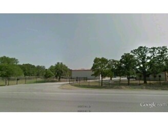
8220 N Fm Rd 973
Austin-Round Rock-San Marcos, TX
ABS 60 SUR 40 BUCKMAN O ACR 4.6760
214247
TRAVIS
Farms
Texas
B and X Area of moderate flood hazard, usually the area between the limits of the 100-year and 500-year floods.
19
2025
1.41 AC
2025
East
002213
Austin
NEARBY LISTINGS FOR SALE OR LEASE
DEMOGRAPHICS near 8220 N Fm Rd 973
1 mile
3 mile
5 mile
2025 Total Population
124
12,685
61,967
2030 Population
142
13,675
66,026
Pop Growth 2025-2030
+ 14.52%
+ 7.80%
+ 6.55%
Average Age
40
34
35
2025 Total Households
42
3,748
19,069
HH Growth 2025-2030
+ 14.29%
+ 8.67%
+ 7.24%
Median Household Inc
$112,500
$84,216
$88,487
Avg Household Size
3.00
3.30
3.20
2025 Avg HH Vehicles
2.00
2.00
2.00
Median Home Value
$526,316
$364,763
$366,446
Median Year Built
2010
2010
2009
Nearby Places
Map Layers
Map Styles
 Street
 Aerial
Transit
 Traffic
 Biking
Places
Listings with unknown addresses are not visible on the map
- Restaurants
- Banks
- Shops
- Fitness
- Groceries
PUBLIC TRANSPORTATION
AIRPORT
Austin-Bergstrom International
Drive
Walk
Distance
Austin-Bergstrom International
21 min
13.6 mi
Freight Ports
Calhoun Port
Drive
Walk
Distance
Calhoun Port
182 min
156.6 mi
SALE & LEASE HISTORY
LISTING DATE
SALE/LEASE

Sep 24, 2016
For Sale
Nearby Properties
Address
Land Use
TOTAL SIZE
Lot Size
Zoning
Address
Land Use
TOTAL SIZE
Lot Size
Zoning
367,756 SF
10.66 AC
Address
Land Use
TOTAL SIZE
Lot Size
Zoning
292,050 SF
15.65 AC
Address
Land Use
TOTAL SIZE
Lot Size
Zoning
358,683 SF
17.54 AC
Address
Land Use
TOTAL SIZE
Lot Size
Zoning
255,750 SF
13.38 AC
Address
Land Use
TOTAL SIZE
Lot Size
Zoning
257,744 SF
49.12 AC
Address
Land Use
TOTAL SIZE
Lot Size
Zoning
187,597 SF
296.76 AC
Address
Land Use
TOTAL SIZE
Lot Size
Zoning
75,000 SF
97.48 AC
Address
Land Use
TOTAL SIZE
Lot Size
Zoning
65,930 SF
128.88 AC
Address
Land Use
TOTAL SIZE
Lot Size
Zoning
89,100 SF
57.27 AC
Address
Land Use
TOTAL SIZE
Lot Size
Zoning
99,800 SF
7.02 AC
Address
Land Use
TOTAL SIZE
Lot Size
Zoning
81,000 SF
5.20 AC
Address
Land Use
TOTAL SIZE
Lot Size
Zoning
80,872 SF
14.75 AC
Address
Land Use
TOTAL SIZE
Lot Size
Zoning
137.27 AC
Address
Land Use
TOTAL SIZE
Lot Size
Zoning
74,954 SF
15.91 AC
Address
Land Use
TOTAL SIZE
Lot Size
Zoning
381.61 AC
Address
Land Use
TOTAL SIZE
Lot Size
Zoning
32,676 SF
26.72 AC
Address
Land Use
TOTAL SIZE
Lot Size
Zoning
52,430 SF
7.79 AC
Address
Land Use
TOTAL SIZE
Lot Size
Zoning
180.98 AC
Address
Land Use
TOTAL SIZE
Lot Size
Zoning
702.73 AC
Address
Land Use
TOTAL SIZE
Lot Size
Zoning
133.36 AC
Address
Land Use
TOTAL SIZE
Lot Size
Zoning
1 SF
124.14 AC
Address
Land Use
TOTAL SIZE
Lot Size
Zoning
238,000 SF
29.39 AC
Address
Land Use
TOTAL SIZE
Lot Size
Zoning
123.08 AC
Address
Land Use
TOTAL SIZE
Lot Size
Zoning
78.15 AC
Address
Land Use
TOTAL SIZE
Lot Size
Zoning
270,000 SF
16.97 AC
Address
Land Use
TOTAL SIZE
Lot Size
Zoning
72.29 AC
Address
Land Use
TOTAL SIZE
Lot Size
Zoning
71.09 AC
Address
Land Use
TOTAL SIZE
Lot Size
Zoning
67.77 AC
Address
Land Use
TOTAL SIZE
Lot Size
Zoning
2,888 SF
65.23 AC
Address
Land Use
TOTAL SIZE
Lot Size
Zoning
3,554 SF
11.64 AC
The World's #1 Commercial Real Estate Marketplace
Connect with us
© 2026 CoStar Group
The information above has been obtained from sources believed reliable. While we do not doubt its accuracy we have not verified it and make no guarantee, warranty or representation about it. It is your responsibility to independently confirm its accuracy and completeness. Any projections, opinions, assumptions, or estimates used are for example only and do not represent the current or future performance of the property. The value of this transaction to you depends on tax and other factors which should be evaluated by your tax, financial, and legal advisors. You and your advisors should conduct a careful, independent investigation of the property to determine to your satisfaction the suitability of the property for your needs.