Property Record
8220 Ohio River Rd, Wheelersburg, OH 45694

NEARBY LISTINGS FOR SALE OR LEASE
-
-
View all Wheelersburg listings for sale on LoopNet.com
Property Detail
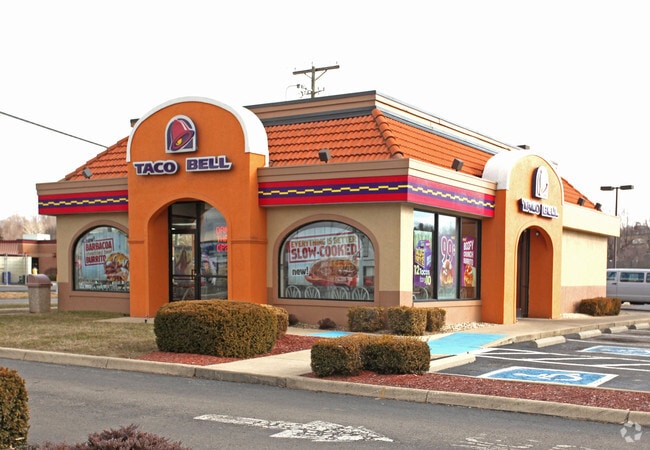
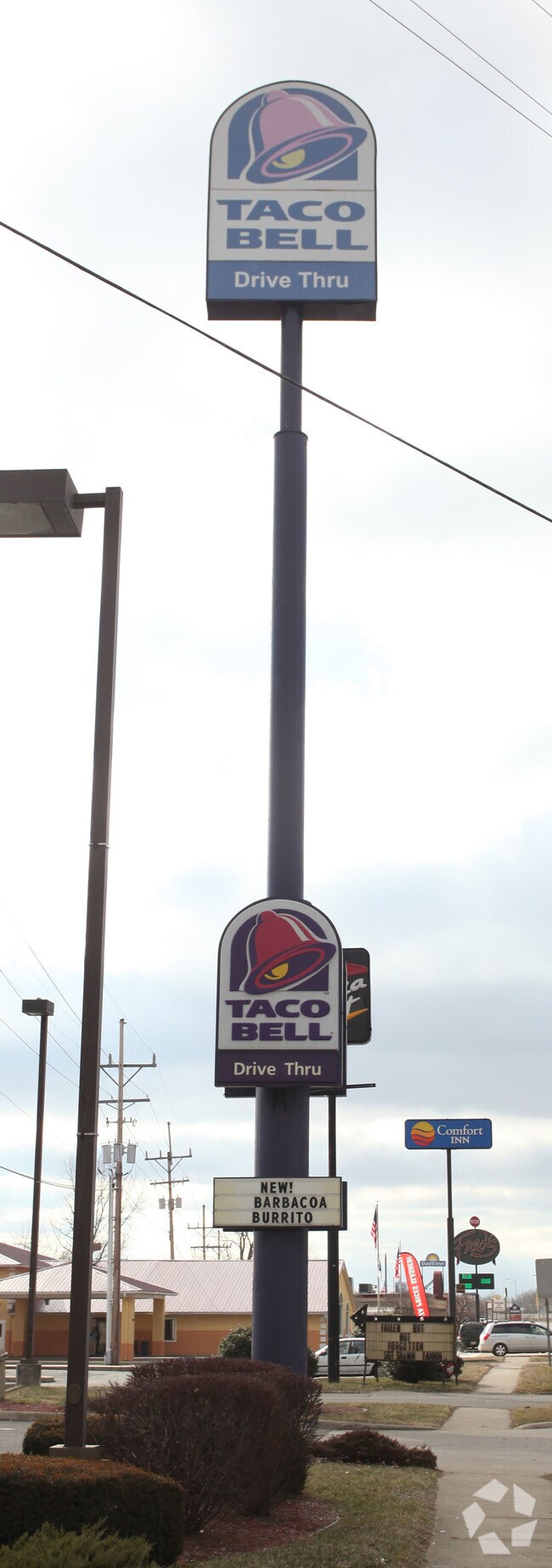
8220 Ohio River Rd
Portsmouth, OH
The Following Described Real Estate Situ
17-0616.002
.711AC RTS 20-2-16 MAP 4-001 OHIO RIVER RD
Restaurantdrivein
Scioto
X
Ohio
39087C0100E
0.71 AC
2024
Ohio South Area
2024
Other Market Areas
002902
DEMOGRAPHICS near 8220 Ohio River Rd
1 Mile
3 Mile
5 Mile
2024 Total Population
2,562
10,362
19,768
2029 Population
2,500
10,104
19,278
Pop Growth 2024-2029
(2.42%)
(2.49%)
(2.48%)
Average Age
43
42
42
2024 Total Households
1,114
4,297
8,185
HH Growth 2024-2029
(2.42%)
(2.51%)
(2.50%)
Median Household Inc
$63,306
$53,727
$46,805
Avg Household Size
2.20
2.30
2.40
2024 Avg HH Vehicles
2.00
2.00
2.00
Median Home Value
$204,036
$164,916
$140,201
Median Year Built
1975
1972
1969
Nearby Places
Map Layers
Map Styles
 Street
 Aerial
- Restaurants
- Banks
- Shops
- Fitness
- Groceries
PUBLIC TRANSPORTATION
AIRPORT
Tri-State/Milton J Ferguson Field
DRIVE
WALK
Distance
Tri-State/Milton J Ferguson Field
46 min
35.8 mi
Nearby Properties
Address
Land Use
TOTAL SIZE
Lot Size
Zoning
Address
Land Use
TOTAL SIZE
Lot Size
Zoning
20.62 AC
Address
Land Use
TOTAL SIZE
Lot Size
Zoning
Address
Land Use
TOTAL SIZE
Lot Size
Zoning
21.17 AC
Address
Land Use
TOTAL SIZE
Lot Size
Zoning
40,000 SF
9.93 AC
Address
Land Use
TOTAL SIZE
Lot Size
Zoning
Address
Land Use
TOTAL SIZE
Lot Size
Zoning
Address
Land Use
TOTAL SIZE
Lot Size
Zoning
Address
Land Use
TOTAL SIZE
Lot Size
Zoning
5,578 SF
3.27 AC
Address
Land Use
TOTAL SIZE
Lot Size
Zoning
1.09 AC
Address
Land Use
TOTAL SIZE
Lot Size
Zoning
2.85 AC
Address
Land Use
TOTAL SIZE
Lot Size
Zoning
Address
Land Use
TOTAL SIZE
Lot Size
Zoning
Address
Land Use
TOTAL SIZE
Lot Size
Zoning
3.44 AC
Address
Land Use
TOTAL SIZE
Lot Size
Zoning
28.26 AC
Address
Land Use
TOTAL SIZE
Lot Size
Zoning
Address
Land Use
TOTAL SIZE
Lot Size
Zoning
Address
Land Use
TOTAL SIZE
Lot Size
Zoning
Address
Land Use
TOTAL SIZE
Lot Size
Zoning
Address
Land Use
TOTAL SIZE
Lot Size
Zoning
4.01 AC
Address
Land Use
TOTAL SIZE
Lot Size
Zoning
Address
Land Use
TOTAL SIZE
Lot Size
Zoning
4.18 AC
Address
Land Use
TOTAL SIZE
Lot Size
Zoning
Address
Land Use
TOTAL SIZE
Lot Size
Zoning
Address
Land Use
TOTAL SIZE
Lot Size
Zoning
Address
Land Use
TOTAL SIZE
Lot Size
Zoning
Address
Land Use
TOTAL SIZE
Lot Size
Zoning
Address
Land Use
TOTAL SIZE
Lot Size
Zoning
2.31 AC
Address
Land Use
TOTAL SIZE
Lot Size
Zoning
Address
Land Use
TOTAL SIZE
Lot Size
Zoning
Address
Land Use
TOTAL SIZE
Lot Size
Zoning
The World's #1 Commercial Real Estate Marketplace
Connect with us
© 2025 CoStar Group
The information above has been obtained from sources believed reliable. While we do not doubt its accuracy we have not verified it and make no guarantee, warranty or representation about it. It is your responsibility to independently confirm its accuracy and completeness. Any projections, opinions, assumptions, or estimates used are for example only and do not represent the current or future performance of the property. The value of this transaction to you depends on tax and other factors which should be evaluated by your tax, financial, and legal advisors. You and your advisors should conduct a careful, independent investigation of the property to determine to your satisfaction the suitability of the property for your needs.