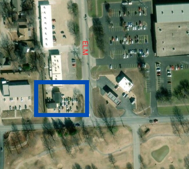
Property Record
8220 S Elm Pl, Broken Arrow, OK 74011

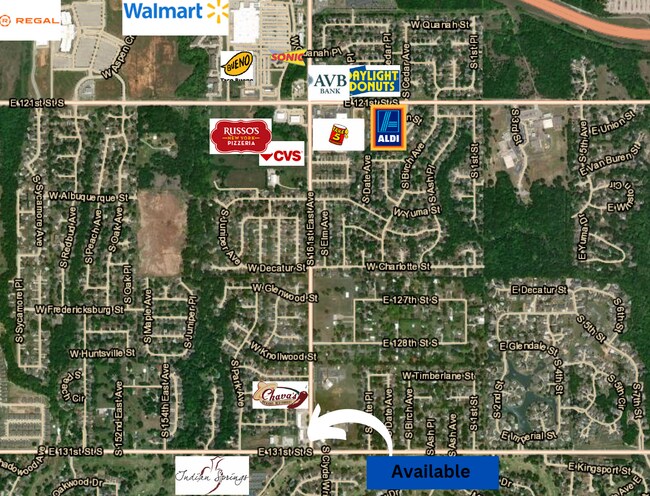
NEARBY LISTINGS FOR SALE OR LEASE
Property Detail
8220 S Elm Pl
Tulsa, OK
Ken-Moore Center Addn Resub B1 Kenmoore
79940-74-03-65420
LT 1 BLK 1
Autorepair
Tulsa
X
Oklahoma
40143C0456M
1
2025
0.51 AC
2025
Southeast Tulsa
007523
Tulsa
1,932 SF
DEMOGRAPHICS near 8220 S Elm Pl
1 Mile
3 Mile
5 Mile
2024 Total Population
6,853
28,494
74,249
2029 Population
7,099
29,643
77,209
Pop Growth 2024-2029
+ 3.59%
+ 4.03%
+ 3.99%
Average Age
41
39
39
2024 Total Households
2,554
10,701
27,526
HH Growth 2024-2029
+ 3.64%
+ 4.01%
+ 3.96%
Median Household Inc
$92,222
$85,514
$83,986
Avg Household Size
2.60
2.60
2.70
2024 Avg HH Vehicles
2.00
2.00
2.00
Median Home Value
$236,455
$222,977
$224,642
Median Year Built
1981
1987
1988
Nearby Places
Map Layers
Map Styles
 Street
 Aerial
- Restaurants
- Banks
- Shops
- Fitness
- Groceries
PUBLIC TRANSPORTATION
AIRPORT
Tulsa International
DRIVE
WALK
Distance
Tulsa International
32 min
22.1 mi
Freight Ports
DRIVE
WALK
Distance
31 min
24.0 mi
SALE & LEASE HISTORY
LISTING DATE
SALE/LEASE

May 20, 2024
For Lease
Nearby Properties
Address
Land Use
TOTAL SIZE
Lot Size
Zoning
Address
Land Use
TOTAL SIZE
Lot Size
Zoning
37.23 AC
A1
Address
Land Use
TOTAL SIZE
Lot Size
Zoning
35,954 SF
27.97 AC
CN
Address
Land Use
TOTAL SIZE
Lot Size
Zoning
67,490 SF
5.40 AC
RM
Address
Land Use
TOTAL SIZE
Lot Size
Zoning
Address
Land Use
TOTAL SIZE
Lot Size
Zoning
245,436 SF
12.21 AC
RM
Address
Land Use
TOTAL SIZE
Lot Size
Zoning
28,303 SF
16.76 AC
CN
Address
Land Use
TOTAL SIZE
Lot Size
Zoning
3,300 SF
40 AC
A1
Address
Land Use
TOTAL SIZE
Lot Size
Zoning
11,800 SF
2.45 AC
A1
Address
Land Use
TOTAL SIZE
Lot Size
Zoning
222,536 SF
11.31 AC
CN
Address
Land Use
TOTAL SIZE
Lot Size
Zoning
28,226 SF
8.26 AC
CN
Address
Land Use
TOTAL SIZE
Lot Size
Zoning
136,434 SF
19.20 AC
Address
Land Use
TOTAL SIZE
Lot Size
Zoning
27,531 SF
4.46 AC
R2
Address
Land Use
TOTAL SIZE
Lot Size
Zoning
11,261 SF
2.85 AC
CN
Address
Land Use
TOTAL SIZE
Lot Size
Zoning
Address
Land Use
TOTAL SIZE
Lot Size
Zoning
279,632 SF
14.54 AC
RM
Address
Land Use
TOTAL SIZE
Lot Size
Zoning
33,181 SF
4.54 AC
R1
Address
Land Use
TOTAL SIZE
Lot Size
Zoning
9,689 SF
101.01 AC
R2
Address
Land Use
TOTAL SIZE
Lot Size
Zoning
11,923 SF
6.11 AC
A1
Address
Land Use
TOTAL SIZE
Lot Size
Zoning
210,976 SF
22.52 AC
CG
Address
Land Use
TOTAL SIZE
Lot Size
Zoning
25,615 SF
4.62 AC
A1
Address
Land Use
TOTAL SIZE
Lot Size
Zoning
24,830 SF
5.15 AC
R2
Address
Land Use
TOTAL SIZE
Lot Size
Zoning
103,411 SF
24.39 AC
CN
Address
Land Use
TOTAL SIZE
Lot Size
Zoning
540 SF
54.39 AC
A1
Address
Land Use
TOTAL SIZE
Lot Size
Zoning
63,686 SF
4.98 AC
Address
Land Use
TOTAL SIZE
Lot Size
Zoning
18,488 SF
4.43 AC
A1
Address
Land Use
TOTAL SIZE
Lot Size
Zoning
14,170 SF
10 AC
Address
Land Use
TOTAL SIZE
Lot Size
Zoning
112,420 SF
4.07 AC
IL
Address
Land Use
TOTAL SIZE
Lot Size
Zoning
60,575 SF
2.77 AC
CH
Address
Land Use
TOTAL SIZE
Lot Size
Zoning
11,148 SF
7.22 AC
A1
Address
Land Use
TOTAL SIZE
Lot Size
Zoning
11,919 SF
16.77 AC
R2
The World's #1 Commercial Real Estate Marketplace
Connect with us
© 2025 CoStar Group
The information above has been obtained from sources believed reliable. While we do not doubt its accuracy we have not verified it and make no guarantee, warranty or representation about it. It is your responsibility to independently confirm its accuracy and completeness. Any projections, opinions, assumptions, or estimates used are for example only and do not represent the current or future performance of the property. The value of this transaction to you depends on tax and other factors which should be evaluated by your tax, financial, and legal advisors. You and your advisors should conduct a careful, independent investigation of the property to determine to your satisfaction the suitability of the property for your needs.