Property Record
8220 Spruce St, Manassas, VA 20111


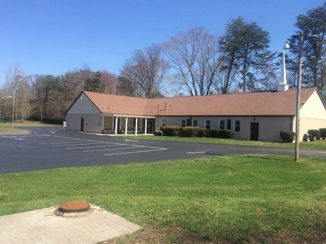
Property Detail
8220 Spruce St
7896-29-5493
L 75 SEC 2
Religious
Prince William
R4
Virginia
B and X Area of moderate flood hazard, usually the area between the limits of the 100-year and 500-year floods.
75
0
1.38 AC
2025
Manassas
901900
Washington, DC
5,616 SF
Washington-Arlington-Alexandria, DC-VA-MD-WV
NEARBY LISTINGS FOR SALE OR LEASE
DEMOGRAPHICS near 8220 Spruce St
1 mile
3 mile
5 mile
2025 Total Population
14,384
92,007
207,173
2030 Population
14,438
93,247
210,596
Pop Growth 2025-2030
+ 0.38%
+ 1.35%
+ 1.65%
Average Age
35
37
37
2025 Total Households
4,055
28,316
67,184
HH Growth 2025-2030
+ 0.32%
+ 1.32%
+ 1.65%
Median Household Inc
$98,391
$116,814
$120,305
Avg Household Size
3.50
3.20
3.00
2025 Avg HH Vehicles
2.00
2.00
2.00
Median Home Value
$408,181
$474,142
$497,268
Median Year Built
1978
1984
1988
Nearby Places
Map Layers
Map Styles
 Street
 Aerial
Layers
 Traffic
 Biking
Places
Listings with unknown addresses are not visible on the map
- Restaurants
- Banks
- Shops
- Fitness
- Groceries
PUBLIC TRANSPORTATION
COMMUTER RAIL
Manassas Amtrak Station (Cardinal - Amtrak, Crescent - Amtrak, Manassas Line - Amtrak, Northeast Regional - Amtrak)
Drive
Walk
Distance
Manassas Amtrak Station (Cardinal - Amtrak, Crescent - Amtrak, Manassas Line - Amtrak, Northeast Regional - Amtrak)
7 min
2.8 mi
Lead (Manassas Line - Virginia Railway Express)
Drive
Walk
Distance
Lead (Manassas Line - Virginia Railway Express)
17 min
6.8 mi
AIRPORT
Washington Dulles International
Drive
Walk
Distance
Washington Dulles International
28 min
15.9 mi
Ronald Reagan Washington Ntl
Drive
Walk
Distance
Ronald Reagan Washington Ntl
44 min
30.5 mi
Freight Ports
Port of Baltimore
Drive
Walk
Distance
Port of Baltimore
89 min
66.4 mi
SALE & LEASE HISTORY
LISTING DATE
SALE/LEASE

Oct 14, 2016
For Sale
Oct 14, 2016
For Sale
Nov 14, 2016
For Sale
Nearby Properties
Address
Land Use
TOTAL SIZE
Lot Size
Zoning
Address
Land Use
TOTAL SIZE
Lot Size
Zoning
328,915 SF
117.39 AC
030
Address
Land Use
TOTAL SIZE
Lot Size
Zoning
382,368 SF
18.40 AC
PMR
Address
Land Use
TOTAL SIZE
Lot Size
Zoning
402,295 SF
8.50 AC
A1
Address
Land Use
TOTAL SIZE
Lot Size
Zoning
23.93 AC
PUD
Address
Land Use
TOTAL SIZE
Lot Size
Zoning
203,544 SF
20.90 AC
GENERAL CO
Address
Land Use
TOTAL SIZE
Lot Size
Zoning
529,436 SF
24.63 AC
MIXED
Address
Land Use
TOTAL SIZE
Lot Size
Zoning
10.62 AC
PUD
Address
Land Use
TOTAL SIZE
Lot Size
Zoning
18,128 SF
MULTI-FAMI
Address
Land Use
TOTAL SIZE
Lot Size
Zoning
69,276 SF
18.15 AC
R16
Address
Land Use
TOTAL SIZE
Lot Size
Zoning
349,608 SF
60.83 AC
A1
Address
Land Use
TOTAL SIZE
Lot Size
Zoning
49,528 SF
15.34 AC
R16
Address
Land Use
TOTAL SIZE
Lot Size
Zoning
31,032 SF
15.29 AC
MULTI-FAMI
Address
Land Use
TOTAL SIZE
Lot Size
Zoning
3.49 AC
MU-D
Address
Land Use
TOTAL SIZE
Lot Size
Zoning
205,000 SF
37.08 AC
LOW DENSIT
Address
Land Use
TOTAL SIZE
Lot Size
Zoning
3.41 AC
MU-D
Address
Land Use
TOTAL SIZE
Lot Size
Zoning
140,188 SF
12.76 AC
CITY CENTE
Address
Land Use
TOTAL SIZE
Lot Size
Zoning
325,000 SF
27.97 AC
SMALL LOTS
Address
Land Use
TOTAL SIZE
Lot Size
Zoning
45,585 SF
17.95 AC
GENERAL CO
Address
Land Use
TOTAL SIZE
Lot Size
Zoning
74,450 SF
2.91 AC
CITY CENTE
Address
Land Use
TOTAL SIZE
Lot Size
Zoning
159,940 SF
30 AC
R4
Address
Land Use
TOTAL SIZE
Lot Size
Zoning
71,303 SF
0.54 AC
GENERAL CO
Address
Land Use
TOTAL SIZE
Lot Size
Zoning
8,562 SF
13.50 AC
MULTI-FAMI
Address
Land Use
TOTAL SIZE
Lot Size
Zoning
149,911 SF
13.15 AC
MULTI-FAMI
Address
Land Use
TOTAL SIZE
Lot Size
Zoning
54,401 SF
8.56 AC
PLANNED MI
Address
Land Use
TOTAL SIZE
Lot Size
Zoning
89,844 SF
3.53 AC
GENERAL CO
Address
Land Use
TOTAL SIZE
Lot Size
Zoning
178,423 SF
81.57 AC
030
Address
Land Use
TOTAL SIZE
Lot Size
Zoning
150,000 SF
3.50 AC
CITY CENTE
Address
Land Use
TOTAL SIZE
Lot Size
Zoning
3.43 AC
MU-D
Address
Land Use
TOTAL SIZE
Lot Size
Zoning
106,768 SF
13.28 AC
R4
Address
Land Use
TOTAL SIZE
Lot Size
Zoning
157,394 SF
32.22 AC
R4
The World's #1 Commercial Real Estate Marketplace
Connect with us
© 2026 CoStar Group
The information above has been obtained from sources believed reliable. While we do not doubt its accuracy we have not verified it and make no guarantee, warranty or representation about it. It is your responsibility to independently confirm its accuracy and completeness. Any projections, opinions, assumptions, or estimates used are for example only and do not represent the current or future performance of the property. The value of this transaction to you depends on tax and other factors which should be evaluated by your tax, financial, and legal advisors. You and your advisors should conduct a careful, independent investigation of the property to determine to your satisfaction the suitability of the property for your needs.