Property Record
8221 W 20Th St, Greeley, CO 80634
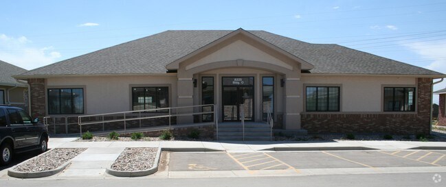

Property Detail
8221 W 20Th St
Greeley, CO
GR 1MVOP L3C MOUNTAIN VISTA OFFICE PARK 1ST RPLT
R3304505
WELD
Charitableorganization
Colorado
B and X Area of moderate flood hazard, usually the area between the limits of the 100-year and 500-year floods.
3c
0
0.55 AC
2025
Weld County
001412
Denver
4,052 SF
NEARBY LISTINGS FOR SALE OR LEASE
DEMOGRAPHICS near 8221 W 20Th St
1 mile
3 mile
5 mile
2024 Total Population
8,420
34,273
85,616
2029 Population
9,460
38,088
94,465
Pop Growth 2024-2029
+ 12.35%
+ 11.13%
+ 10.34%
Average Age
34
39
39
2024 Total Households
2,665
12,750
31,519
HH Growth 2024-2029
+ 12.38%
+ 11.41%
+ 10.67%
Median Household Inc
$110,429
$99,011
$84,451
Avg Household Size
3.10
2.70
2.70
2024 Avg HH Vehicles
2.00
2.00
2.00
Median Home Value
$465,624
$479,877
$425,967
Median Year Built
2010
2006
1999
Nearby Places
Map Layers
Map Styles
 Street
 Aerial
Transit
 Traffic
 Biking
Places
Listings with unknown addresses are not visible on the map
- Restaurants
- Banks
- Shops
- Fitness
- Groceries
Nearby Properties
Address
Land Use
TOTAL SIZE
Lot Size
Zoning
Address
Land Use
TOTAL SIZE
Lot Size
Zoning
315,937 SF
22.73 AC
Address
Land Use
TOTAL SIZE
Lot Size
Zoning
669,727 SF
180.71 AC
Address
Land Use
TOTAL SIZE
Lot Size
Zoning
270,965 SF
99.08 AC
Address
Land Use
TOTAL SIZE
Lot Size
Zoning
46,025 SF
5.32 AC
Address
Land Use
TOTAL SIZE
Lot Size
Zoning
142,317 SF
34.34 AC
Address
Land Use
TOTAL SIZE
Lot Size
Zoning
67,456 SF
40.89 AC
Address
Land Use
TOTAL SIZE
Lot Size
Zoning
475,750 SF
55.48 AC
Address
Land Use
TOTAL SIZE
Lot Size
Zoning
611,456 SF
29.25 AC
Address
Land Use
TOTAL SIZE
Lot Size
Zoning
146,843 SF
12.80 AC
Address
Land Use
TOTAL SIZE
Lot Size
Zoning
145,625 SF
22.93 AC
Address
Land Use
TOTAL SIZE
Lot Size
Zoning
101,963 SF
45.74 AC
Address
Land Use
TOTAL SIZE
Lot Size
Zoning
88,284 SF
5.80 AC
Address
Land Use
TOTAL SIZE
Lot Size
Zoning
437,527 SF
17.54 AC
Address
Land Use
TOTAL SIZE
Lot Size
Zoning
105,705 SF
9.24 AC
Address
Land Use
TOTAL SIZE
Lot Size
Zoning
125,372 SF
11.40 AC
Address
Land Use
TOTAL SIZE
Lot Size
Zoning
252,025 SF
10.15 AC
Address
Land Use
TOTAL SIZE
Lot Size
Zoning
80,202 SF
6 AC
Address
Land Use
TOTAL SIZE
Lot Size
Zoning
71,614 SF
5.99 AC
Address
Land Use
TOTAL SIZE
Lot Size
Zoning
68,145 SF
13.76 AC
Address
Land Use
TOTAL SIZE
Lot Size
Zoning
312,355 SF
14.44 AC
Address
Land Use
TOTAL SIZE
Lot Size
Zoning
45,141 SF
12.15 AC
Address
Land Use
TOTAL SIZE
Lot Size
Zoning
102,289 SF
20.34 AC
Address
Land Use
TOTAL SIZE
Lot Size
Zoning
240,821 SF
14.53 AC
Address
Land Use
TOTAL SIZE
Lot Size
Zoning
58,754 SF
5.77 AC
Address
Land Use
TOTAL SIZE
Lot Size
Zoning
22,012 SF
3.30 AC
Address
Land Use
TOTAL SIZE
Lot Size
Zoning
184,724 SF
7.21 AC
Address
Land Use
TOTAL SIZE
Lot Size
Zoning
196,796 SF
12.24 AC
Address
Land Use
TOTAL SIZE
Lot Size
Zoning
5,731 SF
77 AC
Address
Land Use
TOTAL SIZE
Lot Size
Zoning
51,306 SF
9.29 AC
Address
Land Use
TOTAL SIZE
Lot Size
Zoning
62,550 SF
12.52 AC
The World's #1 Commercial Real Estate Marketplace
Connect with us
© 2026 CoStar Group
The information above has been obtained from sources believed reliable. While we do not doubt its accuracy we have not verified it and make no guarantee, warranty or representation about it. It is your responsibility to independently confirm its accuracy and completeness. Any projections, opinions, assumptions, or estimates used are for example only and do not represent the current or future performance of the property. The value of this transaction to you depends on tax and other factors which should be evaluated by your tax, financial, and legal advisors. You and your advisors should conduct a careful, independent investigation of the property to determine to your satisfaction the suitability of the property for your needs.