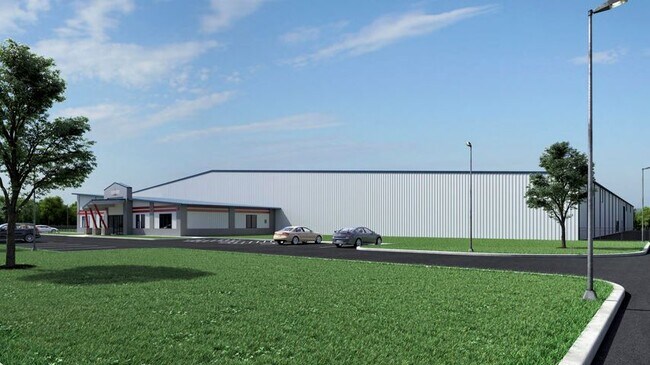
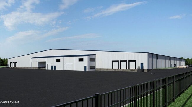
Property Record
County Road 190 & Alliance Way, Joplin, MO 64804

NEARBY LISTINGS FOR SALE OR LEASE
Property Detail
County Road 190 & Alliance Way
Other Market Areas
Jop
Joplin, MO-KS
JOP MISC COM W 1/4 COR SEC 14 N 1064.48 S 88 DEG E 1249.04 TO POB N 609.80 S 88 DEG E 613.07 S 343.31 N 88 DEG W 531.98 S 261.72 N 88 DEG W 80.65 TO POB
20-6.0-14-00-000-004.010
Jasper
Agriculturalland
Missouri
2024
5.39 AC
2025
Missouri South Area
020502
DEMOGRAPHICS near County Road 190 & Alliance Way
1 Mile
3 Mile
5 Mile
2024 Total Population
420
5,326
21,486
2029 Population
436
5,539
22,034
Pop Growth 2024-2029
+ 3.81%
+ 4.00%
+ 2.55%
Average Age
40
42
40
2024 Total Households
178
2,087
8,944
HH Growth 2024-2029
+ 3.93%
+ 4.22%
+ 2.59%
Median Household Inc
$63,261
$70,562
$56,249
Avg Household Size
2.30
2.50
2.30
2024 Avg HH Vehicles
2.00
2.00
2.00
Median Home Value
$135,416
$195,213
$195,976
Median Year Built
1982
1987
1991
Nearby Places
Map Layers
Map Styles
 Street
 Aerial
- Restaurants
- Banks
- Shops
- Fitness
- Groceries
SALE & LEASE HISTORY
LISTING DATE
SALE/LEASE

May 12, 2021
For Sale
Nearby Properties
Address
Land Use
TOTAL SIZE
Lot Size
Zoning
Address
Land Use
TOTAL SIZE
Lot Size
Zoning
274,885 SF
40.60 AC
Address
Land Use
TOTAL SIZE
Lot Size
Zoning
151,572 SF
27.05 AC
Address
Land Use
TOTAL SIZE
Lot Size
Zoning
31,046 SF
4.77 AC
Address
Land Use
TOTAL SIZE
Lot Size
Zoning
236,532 SF
205.82 AC
Address
Land Use
TOTAL SIZE
Lot Size
Zoning
383,660 SF
19.88 AC
Address
Land Use
TOTAL SIZE
Lot Size
Zoning
100,000 SF
46.33 AC
Address
Land Use
TOTAL SIZE
Lot Size
Zoning
475,819 SF
17.84 AC
Address
Land Use
TOTAL SIZE
Lot Size
Zoning
199,498 SF
9.85 AC
Address
Land Use
TOTAL SIZE
Lot Size
Zoning
97,936 SF
9.93 AC
Address
Land Use
TOTAL SIZE
Lot Size
Zoning
16,944 SF
10 AC
Address
Land Use
TOTAL SIZE
Lot Size
Zoning
110,000 SF
5.40 AC
Address
Land Use
TOTAL SIZE
Lot Size
Zoning
213,125 SF
15.17 AC
Address
Land Use
TOTAL SIZE
Lot Size
Zoning
103,197 SF
11.88 AC
Address
Land Use
TOTAL SIZE
Lot Size
Zoning
29,274 SF
5.05 AC
Address
Land Use
TOTAL SIZE
Lot Size
Zoning
26,756 SF
8.04 AC
Address
Land Use
TOTAL SIZE
Lot Size
Zoning
29,692 SF
13.46 AC
Address
Land Use
TOTAL SIZE
Lot Size
Zoning
55,429 SF
9.51 AC
Address
Land Use
TOTAL SIZE
Lot Size
Zoning
42,244 SF
21.74 AC
Address
Land Use
TOTAL SIZE
Lot Size
Zoning
12,856 SF
24.91 AC
Address
Land Use
TOTAL SIZE
Lot Size
Zoning
213,420 SF
17.48 AC
Address
Land Use
TOTAL SIZE
Lot Size
Zoning
63,000 SF
4.32 AC
Address
Land Use
TOTAL SIZE
Lot Size
Zoning
232,180 SF
8.98 AC
Address
Land Use
TOTAL SIZE
Lot Size
Zoning
14,352 SF
11.02 AC
Address
Land Use
TOTAL SIZE
Lot Size
Zoning
107,068 SF
148.57 AC
Address
Land Use
TOTAL SIZE
Lot Size
Zoning
22,136 SF
5 AC
Address
Land Use
TOTAL SIZE
Lot Size
Zoning
8,374 SF
5.08 AC
Address
Land Use
TOTAL SIZE
Lot Size
Zoning
30,432 SF
4.11 AC
Address
Land Use
TOTAL SIZE
Lot Size
Zoning
55,872 SF
18.20 AC
The World's #1 Commercial Real Estate Marketplace
Connect with us
© 2026 CoStar Group
The information above has been obtained from sources believed reliable. While we do not doubt its accuracy we have not verified it and make no guarantee, warranty or representation about it. It is your responsibility to independently confirm its accuracy and completeness. Any projections, opinions, assumptions, or estimates used are for example only and do not represent the current or future performance of the property. The value of this transaction to you depends on tax and other factors which should be evaluated by your tax, financial, and legal advisors. You and your advisors should conduct a careful, independent investigation of the property to determine to your satisfaction the suitability of the property for your needs.