Property Record
82275 Indio Blvd, Indio, CA 92201


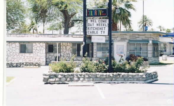

Property Detail
82275 Indio Blvd
611-023-035
1.35 ACRES M/L IN POR NW 1/4 OF SEC 23 T5S R7E FOR TOTAL DESCRIPTION SEE ASSESSORS MAPS
Hotel
Riverside
C2
California
B and X Area of moderate flood hazard, usually the area between the limits of the 100-year and 500-year floods.
1.35 AC
2024
Palm Springs
2025
Inland Empire (California)
045502
Riverside-San Bernardino-Ontario, CA
13,717 SF
NEARBY LISTINGS FOR SALE OR LEASE
-
-
View all Indio listings for sale on LoopNet.com
DEMOGRAPHICS near 82275 Indio Blvd
1 mile
3 mile
5 mile
2025 Total Population
19,003
103,040
174,995
2030 Population
19,229
106,962
183,010
Pop Growth 2025-2030
+ 1.19%
+ 3.81%
+ 4.58%
Average Age
35
39
41
2025 Total Households
5,290
32,761
59,329
HH Growth 2025-2030
+ 0.59%
+ 4.02%
+ 5.04%
Median Household Inc
$66,021
$80,409
$83,087
Avg Household Size
3.40
3.00
2.80
2025 Avg HH Vehicles
2.00
2.00
2.00
Median Home Value
$360,541
$493,493
$569,655
Median Year Built
1975
1997
1997
Nearby Places
Map Layers
Map Styles
 Street
 Aerial
Layers
 Traffic
 Biking
Places
Listings with unknown addresses are not visible on the map
- Restaurants
- Banks
- Shops
- Fitness
- Groceries
PUBLIC TRANSPORTATION
AIRPORT
Palm Springs International
Drive
Walk
Distance
Palm Springs International
29 min
21.2 mi
Nearby Properties
Address
Land Use
TOTAL SIZE
Lot Size
Zoning
Address
Land Use
TOTAL SIZE
Lot Size
Zoning
73,832 SF
7.71 AC
Address
Land Use
TOTAL SIZE
Lot Size
Zoning
128,503 SF
6.25 AC
R3
Address
Land Use
TOTAL SIZE
Lot Size
Zoning
189,101 SF
8.98 AC
C1
Address
Land Use
TOTAL SIZE
Lot Size
Zoning
55,072 SF
6.88 AC
C2
Address
Land Use
TOTAL SIZE
Lot Size
Zoning
170,272 SF
16.28 AC
Address
Land Use
TOTAL SIZE
Lot Size
Zoning
171,910 SF
14.89 AC
C1
Address
Land Use
TOTAL SIZE
Lot Size
Zoning
144,647 SF
16.60 AC
Address
Land Use
TOTAL SIZE
Lot Size
Zoning
197,244 SF
20.44 AC
Address
Land Use
TOTAL SIZE
Lot Size
Zoning
55,695 SF
10.60 AC
C1
Address
Land Use
TOTAL SIZE
Lot Size
Zoning
58,560 SF
3.01 AC
Address
Land Use
TOTAL SIZE
Lot Size
Zoning
81,004 SF
2.99 AC
Address
Land Use
TOTAL SIZE
Lot Size
Zoning
52,971 SF
7.29 AC
Address
Land Use
TOTAL SIZE
Lot Size
Zoning
2,841 SF
7.51 AC
A1
Address
Land Use
TOTAL SIZE
Lot Size
Zoning
103,618 SF
10.51 AC
Address
Land Use
TOTAL SIZE
Lot Size
Zoning
102,400 SF
6.98 AC
Address
Land Use
TOTAL SIZE
Lot Size
Zoning
Address
Land Use
TOTAL SIZE
Lot Size
Zoning
39,776 SF
4.46 AC
C2
Address
Land Use
TOTAL SIZE
Lot Size
Zoning
102,867 SF
11.10 AC
Address
Land Use
TOTAL SIZE
Lot Size
Zoning
35,760 SF
3.74 AC
Address
Land Use
TOTAL SIZE
Lot Size
Zoning
94,642 SF
10 AC
Address
Land Use
TOTAL SIZE
Lot Size
Zoning
59,420 SF
5.57 AC
Address
Land Use
TOTAL SIZE
Lot Size
Zoning
104,741 SF
5.80 AC
R1
Address
Land Use
TOTAL SIZE
Lot Size
Zoning
48,578 SF
7.88 AC
Address
Land Use
TOTAL SIZE
Lot Size
Zoning
67,787 SF
3.93 AC
R3
Address
Land Use
TOTAL SIZE
Lot Size
Zoning
86,063 SF
4.11 AC
Address
Land Use
TOTAL SIZE
Lot Size
Zoning
114,716 SF
6.38 AC
Address
Land Use
TOTAL SIZE
Lot Size
Zoning
42,414 SF
1.43 AC
NC
Address
Land Use
TOTAL SIZE
Lot Size
Zoning
44,511 SF
9.40 AC
CM
Address
Land Use
TOTAL SIZE
Lot Size
Zoning
34,312 SF
3.15 AC
The World's #1 Commercial Real Estate Marketplace
Connect with us
© 2026 CoStar Group
The information above has been obtained from sources believed reliable. While we do not doubt its accuracy we have not verified it and make no guarantee, warranty or representation about it. It is your responsibility to independently confirm its accuracy and completeness. Any projections, opinions, assumptions, or estimates used are for example only and do not represent the current or future performance of the property. The value of this transaction to you depends on tax and other factors which should be evaluated by your tax, financial, and legal advisors. You and your advisors should conduct a careful, independent investigation of the property to determine to your satisfaction the suitability of the property for your needs.