Property Record
8223 Us Highway 183 S, Austin, TX 78747


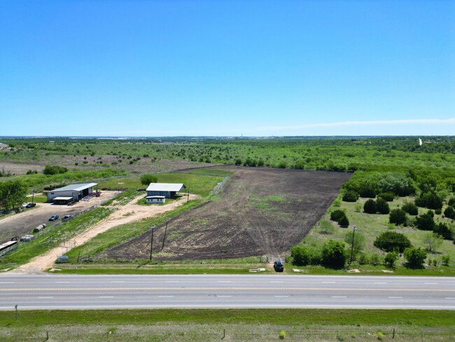
Property Detail
8223 Us Highway 183 S
Austin-Round Rock-San Marcos, TX
ABS 531 SUR 503 MIRALES B L Y ACR 5.651
300035
TRAVIS
Warehouse
Texas
B and X Area of moderate flood hazard, usually the area between the limits of the 100-year and 500-year floods.
y
2025
5.65 AC
2025
Southeast
002436
Austin
4,800 SF
NEARBY LISTINGS FOR SALE OR LEASE
DEMOGRAPHICS near 8223 Us Highway 183 S
1 mile
3 mile
5 mile
2025 Total Population
639
14,494
61,806
2030 Population
708
15,971
65,886
Pop Growth 2025-2030
+ 10.80%
+ 10.19%
+ 6.60%
Average Age
37
36
35
2025 Total Households
211
4,967
19,823
HH Growth 2025-2030
+ 11.85%
+ 11.33%
+ 7.57%
Median Household Inc
$111,029
$116,044
$93,955
Avg Household Size
2.90
2.90
3.00
2025 Avg HH Vehicles
2.00
2.00
2.00
Median Home Value
$542,683
$493,893
$411,369
Median Year Built
2010
2011
2010
Nearby Places
Map Layers
Map Styles
 Street
 Aerial
Transit
 Traffic
 Biking
Places
Listings with unknown addresses are not visible on the map
- Restaurants
- Banks
- Shops
- Fitness
- Groceries
PUBLIC TRANSPORTATION
AIRPORT
Austin-Bergstrom International
Drive
Walk
Distance
Austin-Bergstrom International
14 min
6.5 mi
Freight Ports
Calhoun Port
Drive
Walk
Distance
Calhoun Port
171 min
143.5 mi
SALE & LEASE HISTORY
LISTING DATE
SALE/LEASE

Sep 03, 2024
For Sale
May 31, 2024
For Sale
Nearby Properties
Address
Land Use
TOTAL SIZE
Lot Size
Zoning
Address
Land Use
TOTAL SIZE
Lot Size
Zoning
287,925 SF
9.92 AC
Address
Land Use
TOTAL SIZE
Lot Size
Zoning
288,174 SF
18.91 AC
Address
Land Use
TOTAL SIZE
Lot Size
Zoning
241,920 SF
23.37 AC
Address
Land Use
TOTAL SIZE
Lot Size
Zoning
562,830 SF
213.88 AC
Address
Land Use
TOTAL SIZE
Lot Size
Zoning
351,255 SF
12.45 AC
Address
Land Use
TOTAL SIZE
Lot Size
Zoning
237,600 SF
17.79 AC
Address
Land Use
TOTAL SIZE
Lot Size
Zoning
249,216 SF
20.19 AC
Address
Land Use
TOTAL SIZE
Lot Size
Zoning
356,800 SF
40.79 AC
Address
Land Use
TOTAL SIZE
Lot Size
Zoning
181,115 SF
13.81 AC
Address
Land Use
TOTAL SIZE
Lot Size
Zoning
121,950 SF
11.92 AC
Address
Land Use
TOTAL SIZE
Lot Size
Zoning
407,700 SF
34.50 AC
Address
Land Use
TOTAL SIZE
Lot Size
Zoning
168,000 SF
11.79 AC
Address
Land Use
TOTAL SIZE
Lot Size
Zoning
72,159 SF
Address
Land Use
TOTAL SIZE
Lot Size
Zoning
99,000 SF
7.07 AC
Address
Land Use
TOTAL SIZE
Lot Size
Zoning
237,600 SF
14.17 AC
Address
Land Use
TOTAL SIZE
Lot Size
Zoning
57,100 SF
Address
Land Use
TOTAL SIZE
Lot Size
Zoning
4,060 SF
154.80 AC
Address
Land Use
TOTAL SIZE
Lot Size
Zoning
14,320 SF
3.15 AC
Address
Land Use
TOTAL SIZE
Lot Size
Zoning
73,938 SF
26.60 AC
Address
Land Use
TOTAL SIZE
Lot Size
Zoning
90,000 SF
7.75 AC
Address
Land Use
TOTAL SIZE
Lot Size
Zoning
44,402 SF
Address
Land Use
TOTAL SIZE
Lot Size
Zoning
4,256 SF
293.94 AC
Address
Land Use
TOTAL SIZE
Lot Size
Zoning
43,828 SF
20.18 AC
Address
Land Use
TOTAL SIZE
Lot Size
Zoning
18,000 SF
10.87 AC
Address
Land Use
TOTAL SIZE
Lot Size
Zoning
24,400 SF
5.56 AC
Address
Land Use
TOTAL SIZE
Lot Size
Zoning
12,840 SF
3.20 AC
Address
Land Use
TOTAL SIZE
Lot Size
Zoning
1,216 SF
132.90 AC
Address
Land Use
TOTAL SIZE
Lot Size
Zoning
22,400 SF
25.25 AC
Address
Land Use
TOTAL SIZE
Lot Size
Zoning
10,341 SF
99.49 AC
Address
Land Use
TOTAL SIZE
Lot Size
Zoning
598,920 SF
49.90 AC
The World's #1 Commercial Real Estate Marketplace
Connect with us
© 2026 CoStar Group
The information above has been obtained from sources believed reliable. While we do not doubt its accuracy we have not verified it and make no guarantee, warranty or representation about it. It is your responsibility to independently confirm its accuracy and completeness. Any projections, opinions, assumptions, or estimates used are for example only and do not represent the current or future performance of the property. The value of this transaction to you depends on tax and other factors which should be evaluated by your tax, financial, and legal advisors. You and your advisors should conduct a careful, independent investigation of the property to determine to your satisfaction the suitability of the property for your needs.