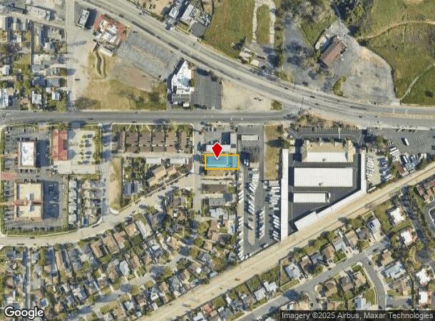
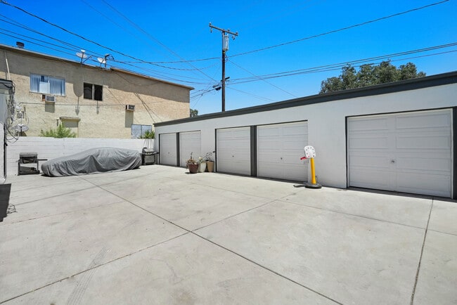
Property Record
8231 Tapia Via Dr, Rancho Cucamonga, CA 91730
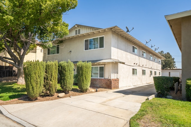

This Property Is For Sale
NEARBY LISTINGS FOR SALE OR LEASE
Property Detail
8231 Tapia Via Dr
Riverside-San Bernardino-Ontario, CA
Tract No. 2952
0207-123-13
TRACT 2952 LOT 74
Apartment
San Bernardino
X
California
06037C1750F
74
2024
0.21 AC
2025
Rancho Cucamonga
002101
Inland Empire (California)
5,508 SF
DEMOGRAPHICS near 8231 Tapia Via Dr
1 Mile
3 Mile
5 Mile
2024 Total Population
23,056
180,416
361,856
2029 Population
23,448
183,151
367,076
Pop Growth 2024-2029
+ 1.70%
+ 1.52%
+ 1.44%
Average Age
38
38
38
2024 Total Households
7,990
59,501
118,156
HH Growth 2024-2029
+ 1.90%
+ 1.56%
+ 1.52%
Median Household Inc
$75,259
$81,709
$86,473
Avg Household Size
2.80
2.90
3.00
2024 Avg HH Vehicles
2.00
2.00
2.00
Median Home Value
$480,943
$585,643
$617,337
Median Year Built
1982
1976
1979
Nearby Places
Map Layers
Map Styles
 Street
 Aerial
- Restaurants
- Banks
- Shops
- Fitness
- Groceries
PUBLIC TRANSPORTATION
COMMUTER RAIL
Upland (San Bernardino Line - Southern California Regional Rail Authority (Metrolink))
DRIVE
WALK
Distance
Upland (San Bernardino Line - Southern California Regional Rail Authority (Metrolink))
4 min
1.7 mi
Ontario Amtrak (Sunset Limited - Amtrak, Texas Eagle - Amtrak)
DRIVE
WALK
Distance
Ontario Amtrak (Sunset Limited - Amtrak, Texas Eagle - Amtrak)
8 min
4.4 mi
AIRPORT
Ontario International
DRIVE
WALK
Distance
Ontario International
9 min
4.8 mi
Freight Ports
Port of Long Beach
DRIVE
WALK
Distance
Port of Long Beach
67 min
52.5 mi
Nearby Properties
Address
Land Use
TOTAL SIZE
Lot Size
Zoning
Address
Land Use
TOTAL SIZE
Lot Size
Zoning
376,610 SF
25.22 AC
Address
Land Use
TOTAL SIZE
Lot Size
Zoning
539,128 SF
10.24 AC
Address
Land Use
TOTAL SIZE
Lot Size
Zoning
293,860 SF
16.10 AC
Address
Land Use
TOTAL SIZE
Lot Size
Zoning
545,161 SF
11.10 AC
Address
Land Use
TOTAL SIZE
Lot Size
Zoning
1,052,840 SF
41.85 AC
Address
Land Use
TOTAL SIZE
Lot Size
Zoning
531,988 SF
9.83 AC
Address
Land Use
TOTAL SIZE
Lot Size
Zoning
440,209 SF
10.34 AC
Address
Land Use
TOTAL SIZE
Lot Size
Zoning
830,300 SF
39.99 AC
Address
Land Use
TOTAL SIZE
Lot Size
Zoning
190,724 SF
10.69 AC
Address
Land Use
TOTAL SIZE
Lot Size
Zoning
468,682 SF
19.40 AC
Address
Land Use
TOTAL SIZE
Lot Size
Zoning
167,512 SF
8.35 AC
Address
Land Use
TOTAL SIZE
Lot Size
Zoning
174,092 SF
4.42 AC
Address
Land Use
TOTAL SIZE
Lot Size
Zoning
251,645 SF
4.50 AC
Address
Land Use
TOTAL SIZE
Lot Size
Zoning
573,220 SF
32.33 AC
Address
Land Use
TOTAL SIZE
Lot Size
Zoning
780,648 SF
13.59 AC
Address
Land Use
TOTAL SIZE
Lot Size
Zoning
553,882 SF
24.59 AC
Address
Land Use
TOTAL SIZE
Lot Size
Zoning
401,226 SF
17.62 AC
Address
Land Use
TOTAL SIZE
Lot Size
Zoning
502,917 SF
35.94 AC
Address
Land Use
TOTAL SIZE
Lot Size
Zoning
340,104 SF
8.95 AC
Address
Land Use
TOTAL SIZE
Lot Size
Zoning
250,200 SF
15.06 AC
Address
Land Use
TOTAL SIZE
Lot Size
Zoning
249,672 SF
13.80 AC
Address
Land Use
TOTAL SIZE
Lot Size
Zoning
405,970 SF
19.23 AC
Address
Land Use
TOTAL SIZE
Lot Size
Zoning
397,875 SF
14.13 AC
Address
Land Use
TOTAL SIZE
Lot Size
Zoning
120,939 SF
3.87 AC
Address
Land Use
TOTAL SIZE
Lot Size
Zoning
Address
Land Use
TOTAL SIZE
Lot Size
Zoning
161,555 SF
8.25 AC
Address
Land Use
TOTAL SIZE
Lot Size
Zoning
95,240 SF
8.42 AC
Address
Land Use
TOTAL SIZE
Lot Size
Zoning
81,786 SF
4.05 AC
Address
Land Use
TOTAL SIZE
Lot Size
Zoning
573,000 SF
22.83 AC
Address
Land Use
TOTAL SIZE
Lot Size
Zoning
99,345 SF
5.15 AC
The World's #1 Commercial Real Estate Marketplace
Connect with us
© 2026 CoStar Group
The information above has been obtained from sources believed reliable. While we do not doubt its accuracy we have not verified it and make no guarantee, warranty or representation about it. It is your responsibility to independently confirm its accuracy and completeness. Any projections, opinions, assumptions, or estimates used are for example only and do not represent the current or future performance of the property. The value of this transaction to you depends on tax and other factors which should be evaluated by your tax, financial, and legal advisors. You and your advisors should conduct a careful, independent investigation of the property to determine to your satisfaction the suitability of the property for your needs.