Property Record
8235 Highway 178, Olive Branch, MS 38654


Save to a Folder
{{folder.Name}}
{{folder.ListingIds.length}} Properties
{{folder.ListingIds.length}} Property
Create a New Folder
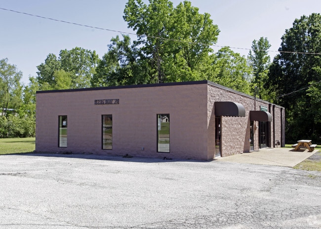
Property Detail
8235 Highway 178
1068280000002600
PT MID PT NW 1/4
Communitycenter
Desoto
C-2
Mississippi
B and X Area of moderate flood hazard, usually the area between the limits of the 100-year and 500-year floods.
26
2025
0.73 AC
2025
Olive Branch
070811
Memphis
2,736 SF
Memphis, TN-MS-AR
NEARBY LISTINGS FOR SALE OR LEASE
DEMOGRAPHICS near 8235 Highway 178
1 mile
3 mile
5 mile
2025 Total Population
2,529
41,124
103,238
2030 Population
2,643
41,717
103,236
Pop Growth 2025-2030
+ 4.51%
+ 1.44%
0.00%
Average Age
42
38
38
2025 Total Households
933
15,225
37,068
HH Growth 2025-2030
+ 4.61%
+ 1.50%
+ 0.01%
Median Household Inc
$91,885
$84,629
$83,823
Avg Household Size
2.70
2.70
2.70
2025 Avg HH Vehicles
2.00
2.00
2.00
Median Home Value
$338,073
$258,746
$263,750
Median Year Built
1998
1995
1992
Nearby Places
Map Layers
Map Styles
 Street
 Aerial
Layers
 Traffic
 Biking
Places
Listings with unknown addresses are not visible on the map
- Restaurants
- Banks
- Shops
- Fitness
- Groceries
PUBLIC TRANSPORTATION
AIRPORT
Memphis International
Drive
Walk
Distance
Memphis International
17 min
11.4 mi
Freight Ports
Port of Shreveport
Drive
Walk
Distance
Port of Shreveport
422 min
385.2 mi
SALE & LEASE HISTORY
LISTING DATE
SALE/LEASE

May 27, 2022
For Sale
Nearby Properties
Address
Land Use
TOTAL SIZE
Lot Size
Zoning
Address
Land Use
TOTAL SIZE
Lot Size
Zoning
1,059,729 SF
74.33 AC
M-2
Address
Land Use
TOTAL SIZE
Lot Size
Zoning
863,591 SF
35.66 AC
EMP
Address
Land Use
TOTAL SIZE
Lot Size
Zoning
834,463 SF
37.46 AC
EMP
Address
Land Use
TOTAL SIZE
Lot Size
Zoning
434,122 SF
23.97 AC
R-6
Address
Land Use
TOTAL SIZE
Lot Size
Zoning
158,366 SF
24.31 AC
R-6
Address
Land Use
TOTAL SIZE
Lot Size
Zoning
326,743 SF
22.91 AC
R-8
Address
Land Use
TOTAL SIZE
Lot Size
Zoning
345,770 SF
18.13 AC
EMP
Address
Land Use
TOTAL SIZE
Lot Size
Zoning
903,083 SF
45.12 AC
EMP
Address
Land Use
TOTAL SIZE
Lot Size
Zoning
350,298 SF
12.68 AC
EMP
Address
Land Use
TOTAL SIZE
Lot Size
Zoning
330,758 SF
12.09 AC
EMP
Address
Land Use
TOTAL SIZE
Lot Size
Zoning
554,282 SF
67.63 AC
IH
Address
Land Use
TOTAL SIZE
Lot Size
Zoning
689,307 SF
22.68 AC
EMP
Address
Land Use
TOTAL SIZE
Lot Size
Zoning
642,900 SF
29.71 AC
EMP
Address
Land Use
TOTAL SIZE
Lot Size
Zoning
573,825 SF
32.39 AC
EMP
Address
Land Use
TOTAL SIZE
Lot Size
Zoning
466,532 SF
21.76 AC
EMP
Address
Land Use
TOTAL SIZE
Lot Size
Zoning
414,374 SF
19.74 AC
EMP
Address
Land Use
TOTAL SIZE
Lot Size
Zoning
864,054 SF
72.19 AC
M-1
Address
Land Use
TOTAL SIZE
Lot Size
Zoning
421,766 SF
26.26 AC
IH
Address
Land Use
TOTAL SIZE
Lot Size
Zoning
379,348 SF
23.82 AC
IH
Address
Land Use
TOTAL SIZE
Lot Size
Zoning
364,578 SF
19.76 AC
IH
Address
Land Use
TOTAL SIZE
Lot Size
Zoning
307,100 SF
18.95 AC
CA
Address
Land Use
TOTAL SIZE
Lot Size
Zoning
277,936 SF
15.92 AC
EMP
Address
Land Use
TOTAL SIZE
Lot Size
Zoning
309,885 SF
17.49 AC
R-8
Address
Land Use
TOTAL SIZE
Lot Size
Zoning
860,464 SF
54.55 AC
M-1
Address
Land Use
TOTAL SIZE
Lot Size
Zoning
88,090 SF
6.05 AC
CA
Address
Land Use
TOTAL SIZE
Lot Size
Zoning
291,941 SF
15.38 AC
EMP
Address
Land Use
TOTAL SIZE
Lot Size
Zoning
693,680 SF
47.15 AC
M-1
Address
Land Use
TOTAL SIZE
Lot Size
Zoning
198,224 SF
9.64 AC
EMP
Address
Land Use
TOTAL SIZE
Lot Size
Zoning
814,054 SF
51.14 AC
M-1
Address
Land Use
TOTAL SIZE
Lot Size
Zoning
217,172 SF
12.32 AC
R-6
The World's #1 Commercial Real Estate Marketplace
Connect with us
© 2026 CoStar Group
The information above has been obtained from sources believed reliable. While we do not doubt its accuracy we have not verified it and make no guarantee, warranty or representation about it. It is your responsibility to independently confirm its accuracy and completeness. Any projections, opinions, assumptions, or estimates used are for example only and do not represent the current or future performance of the property. The value of this transaction to you depends on tax and other factors which should be evaluated by your tax, financial, and legal advisors. You and your advisors should conduct a careful, independent investigation of the property to determine to your satisfaction the suitability of the property for your needs.