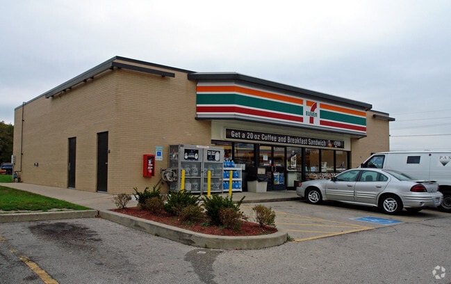
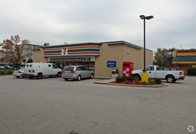
Property Record
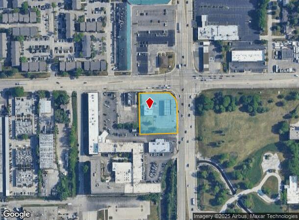
824 W Oakton St, Des Plaines, IL 60018
NEARBY LISTINGS FOR SALE OR LEASE
Property Detail
824 W Oakton St
Servicestation
Cook
X
Illinois
17031C0214J
1.31 AC
2023
O'Hare
2024
Chicago
770602
Chicago-Naperville-Elgin, IL-IN-WI
2,940 SF
08-26-201-024-0000
DEMOGRAPHICS near 824 W Oakton St
1 Mile
3 Mile
5 Mile
2024 Total Population
12,230
92,842
241,865
2029 Population
11,885
89,890
234,851
Pop Growth 2024-2029
(2.82%)
(3.18%)
(2.90%)
Average Age
38
41
42
2024 Total Households
4,501
35,367
93,768
HH Growth 2024-2029
(2.75%)
(3.47%)
(3.19%)
Median Household Inc
$58,369
$77,644
$83,991
Avg Household Size
2.70
2.50
2.50
2024 Avg HH Vehicles
2.00
2.00
2.00
Median Home Value
$214,325
$300,259
$316,481
Median Year Built
1976
1968
1969
Nearby Places
Map Layers
Map Styles
 Street
 Aerial
- Restaurants
- Banks
- Shops
- Fitness
- Groceries
PUBLIC TRANSPORTATION
COMMUTER RAIL
Mount Prospect Station (Union Pacific Northwest Line - Northeast Illinois Regional Commuter Railroad (Metra))
DRIVE
WALK
Distance
Mount Prospect Station (Union Pacific Northwest Line - Northeast Illinois Regional Commuter Railroad (Metra))
8 min
3.1 mi
Cumberland Station (Union Pacific Northwest Line - Northeast Illinois Regional Commuter Railroad (Metra))
DRIVE
WALK
Distance
Cumberland Station (Union Pacific Northwest Line - Northeast Illinois Regional Commuter Railroad (Metra))
9 min
3.6 mi
AIRPORT
Chicago O'Hare International
DRIVE
WALK
Distance
Chicago O'Hare International
12 min
7.1 mi
Chicago Midway International
DRIVE
WALK
Distance
Chicago Midway International
41 min
25.4 mi
Nearby Properties
Address
Land Use
TOTAL SIZE
Lot Size
Zoning
Address
Land Use
TOTAL SIZE
Lot Size
Zoning
108,216 SF
7.87 AC
Address
Land Use
TOTAL SIZE
Lot Size
Zoning
Address
Land Use
TOTAL SIZE
Lot Size
Zoning
310,751 SF
15.04 AC
Address
Land Use
TOTAL SIZE
Lot Size
Zoning
333,258 SF
9.48 AC
Address
Land Use
TOTAL SIZE
Lot Size
Zoning
179,780 SF
8.12 AC
I
Address
Land Use
TOTAL SIZE
Lot Size
Zoning
58,373 SF
11.22 AC
Address
Land Use
TOTAL SIZE
Lot Size
Zoning
17.67 AC
Address
Land Use
TOTAL SIZE
Lot Size
Zoning
74,664 SF
3.19 AC
Address
Land Use
TOTAL SIZE
Lot Size
Zoning
14.76 AC
Address
Land Use
TOTAL SIZE
Lot Size
Zoning
15.32 AC
Address
Land Use
TOTAL SIZE
Lot Size
Zoning
15.29 AC
Address
Land Use
TOTAL SIZE
Lot Size
Zoning
Address
Land Use
TOTAL SIZE
Lot Size
Zoning
410,822 SF
14.26 AC
Address
Land Use
TOTAL SIZE
Lot Size
Zoning
208,000 SF
10.35 AC
Address
Land Use
TOTAL SIZE
Lot Size
Zoning
132,699 SF
6.74 AC
Address
Land Use
TOTAL SIZE
Lot Size
Zoning
193,020 SF
8.94 AC
I
Address
Land Use
TOTAL SIZE
Lot Size
Zoning
413,338 SF
23.92 AC
Address
Land Use
TOTAL SIZE
Lot Size
Zoning
165,128 SF
Address
Land Use
TOTAL SIZE
Lot Size
Zoning
688,900 SF
20.91 AC
Address
Land Use
TOTAL SIZE
Lot Size
Zoning
533,629 SF
24.19 AC
Address
Land Use
TOTAL SIZE
Lot Size
Zoning
508,246 SF
32.81 AC
Address
Land Use
TOTAL SIZE
Lot Size
Zoning
189,290 SF
9.51 AC
Address
Land Use
TOTAL SIZE
Lot Size
Zoning
256,686 SF
10.60 AC
I
Address
Land Use
TOTAL SIZE
Lot Size
Zoning
160,000 SF
2.14 AC
Address
Land Use
TOTAL SIZE
Lot Size
Zoning
284,440 SF
17.35 AC
I
Address
Land Use
TOTAL SIZE
Lot Size
Zoning
67,564 SF
12.11 AC
I
Address
Land Use
TOTAL SIZE
Lot Size
Zoning
378,525 SF
0.11 AC
Address
Land Use
TOTAL SIZE
Lot Size
Zoning
255,638 SF
9.69 AC
Address
Land Use
TOTAL SIZE
Lot Size
Zoning
206,400 SF
9.73 AC
I
Address
Land Use
TOTAL SIZE
Lot Size
Zoning
132,844 SF
5.42 AC
I
The World's #1 Commercial Real Estate Marketplace
Connect with us
© 2025 CoStar Group
The information above has been obtained from sources believed reliable. While we do not doubt its accuracy we have not verified it and make no guarantee, warranty or representation about it. It is your responsibility to independently confirm its accuracy and completeness. Any projections, opinions, assumptions, or estimates used are for example only and do not represent the current or future performance of the property. The value of this transaction to you depends on tax and other factors which should be evaluated by your tax, financial, and legal advisors. You and your advisors should conduct a careful, independent investigation of the property to determine to your satisfaction the suitability of the property for your needs.