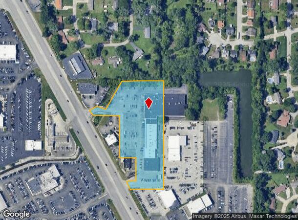
Property Record
8251 Us 31 S, Indianapolis, IN 46227
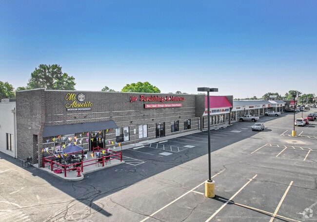
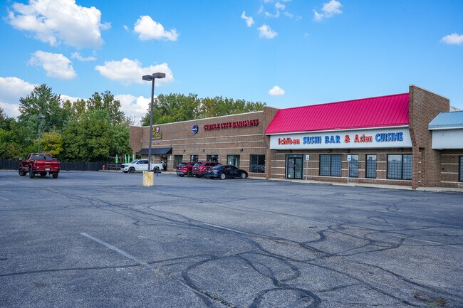

This Property Is For Sale
NEARBY LISTINGS FOR SALE OR LEASE
Property Detail
8251 Us 31 S
49-15-19-113-005.000-500
4.081AC W/ EXCEPTIONS
Regionalshoppingcenterormallwithanchorstore
Marion
AE
Indiana
18081C0019E
4.08 AC
2023
Edgewood/South County
2024
Indianapolis
381203
Indianapolis-Carmel-Anderson, IN
56,148 SF
DEMOGRAPHICS near 8251 Us 31 S
1 Mile
3 Mile
5 Mile
2024 Total Population
15,570
84,874
209,275
2029 Population
15,440
85,481
212,211
Pop Growth 2024-2029
(0.83%)
+ 0.72%
+ 1.40%
Average Age
36
39
38
2024 Total Households
6,593
33,821
80,737
HH Growth 2024-2029
(0.65%)
+ 0.86%
+ 1.46%
Median Household Inc
$45,814
$66,528
$70,771
Avg Household Size
2.30
2.40
2.50
2024 Avg HH Vehicles
1.00
2.00
2.00
Median Home Value
$187,133
$196,087
$206,008
Median Year Built
1973
1978
1986
Nearby Places
- Restaurants
- Banks
- Shops
- Fitness
- Groceries
PUBLIC TRANSPORTATION
COMMUTER RAIL
Indianapolis (Cardinal - Amtrak)
DRIVE
WALK
Distance
Indianapolis (Cardinal - Amtrak)
14 min
8.6 mi
AIRPORT
Indianapolis International
DRIVE
WALK
Distance
Indianapolis International
31 min
18.2 mi
Freight Ports
Port of Toledo
DRIVE
WALK
Distance
Port of Toledo
282 min
236.0 mi
Nearby Properties
Address
Land Use
TOTAL SIZE
Lot Size
Zoning
Address
Land Use
TOTAL SIZE
Lot Size
Zoning
295,161 SF
70.54 AC
Address
Land Use
TOTAL SIZE
Lot Size
Zoning
31,217 SF
105.06 AC
ZO01
Address
Land Use
TOTAL SIZE
Lot Size
Zoning
56,520 SF
35.65 AC
Address
Land Use
TOTAL SIZE
Lot Size
Zoning
5,576 SF
14.15 AC
ZO01
Address
Land Use
TOTAL SIZE
Lot Size
Zoning
3,286 SF
26.39 AC
Address
Land Use
TOTAL SIZE
Lot Size
Zoning
81,996 SF
8.56 AC
Address
Land Use
TOTAL SIZE
Lot Size
Zoning
6,786 SF
45.81 AC
Address
Land Use
TOTAL SIZE
Lot Size
Zoning
3,782 SF
44.43 AC
ZO01
Address
Land Use
TOTAL SIZE
Lot Size
Zoning
21,784 SF
30.75 AC
ZO01
Address
Land Use
TOTAL SIZE
Lot Size
Zoning
2,911 SF
24.62 AC
ZO01
Address
Land Use
TOTAL SIZE
Lot Size
Zoning
23,040 SF
9.28 AC
ZO01
Address
Land Use
TOTAL SIZE
Lot Size
Zoning
4,478 SF
12.05 AC
Address
Land Use
TOTAL SIZE
Lot Size
Zoning
226,129 SF
18.69 AC
ZO01
Address
Land Use
TOTAL SIZE
Lot Size
Zoning
1,102 SF
9.98 AC
Address
Land Use
TOTAL SIZE
Lot Size
Zoning
11,546 SF
14.18 AC
Address
Land Use
TOTAL SIZE
Lot Size
Zoning
155,088 SF
20.85 AC
ZO01
Address
Land Use
TOTAL SIZE
Lot Size
Zoning
3,935 SF
36.09 AC
ZO01
Address
Land Use
TOTAL SIZE
Lot Size
Zoning
3,793 SF
23.47 AC
ZO01
Address
Land Use
TOTAL SIZE
Lot Size
Zoning
176,228 SF
1.57 AC
Address
Land Use
TOTAL SIZE
Lot Size
Zoning
2,320 SF
7.92 AC
ZO01
Address
Land Use
TOTAL SIZE
Lot Size
Zoning
4,476 SF
12.18 AC
Address
Land Use
TOTAL SIZE
Lot Size
Zoning
1,925 SF
29.98 AC
Address
Land Use
TOTAL SIZE
Lot Size
Zoning
3,296 SF
21 AC
Address
Land Use
TOTAL SIZE
Lot Size
Zoning
3,202 SF
18.62 AC
ZO01
Address
Land Use
TOTAL SIZE
Lot Size
Zoning
3,701 SF
26 AC
ZO01
Address
Land Use
TOTAL SIZE
Lot Size
Zoning
69,444 SF
2.99 AC
Address
Land Use
TOTAL SIZE
Lot Size
Zoning
108,092 SF
23.62 AC
ZO01
Address
Land Use
TOTAL SIZE
Lot Size
Zoning
73,680 SF
5.62 AC
ZO01
Address
Land Use
TOTAL SIZE
Lot Size
Zoning
3,168 SF
8.62 AC
Address
Land Use
TOTAL SIZE
Lot Size
Zoning
1,960 SF
23.76 AC
The World's #1 Commercial Real Estate Marketplace
Connect with us
© 2025 CoStar Group
The information above has been obtained from sources believed reliable. While we do not doubt its accuracy we have not verified it and make no guarantee, warranty or representation about it. It is your responsibility to independently confirm its accuracy and completeness. Any projections, opinions, assumptions, or estimates used are for example only and do not represent the current or future performance of the property. The value of this transaction to you depends on tax and other factors which should be evaluated by your tax, financial, and legal advisors. You and your advisors should conduct a careful, independent investigation of the property to determine to your satisfaction the suitability of the property for your needs.