Property Record
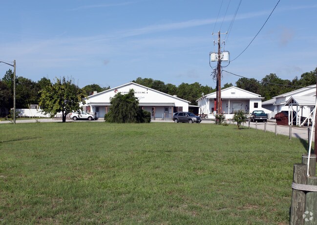
8249 River Rd Se, Southport, NC 28461


NEARBY LISTINGS FOR SALE OR LEASE
Property Detail
8249 River Rd Se
20500018
5.40AC HWY 133 & 87
Foodprocessing
Brunswick
X
North Carolina
3720209700K
5.40 AC
2024
Southport/St James
2025
Wilmington
020204
Myrtle Beach-Conway-North Myrtle Beach, SC-NC
7,500 SF
DEMOGRAPHICS near 8249 River Rd Se
1 Mile
3 Mile
5 Mile
2024 Total Population
986
9,150
18,761
2029 Population
1,266
11,779
24,542
Pop Growth 2024-2029
+ 28.40%
+ 28.73%
+ 30.81%
Average Age
46
51
55
2024 Total Households
437
4,308
9,000
HH Growth 2024-2029
+ 28.38%
+ 28.51%
+ 30.72%
Median Household Inc
$49,264
$61,654
$69,658
Avg Household Size
2.20
2.10
2.00
2024 Avg HH Vehicles
2.00
2.00
2.00
Median Home Value
$256,016
$287,564
$366,162
Median Year Built
2008
2002
2002
Nearby Places
Map Layers
Map Styles
 Street
 Aerial
- Restaurants
- Banks
- Shops
- Fitness
- Groceries
PUBLIC TRANSPORTATION
AIRPORT
Wilmington International
DRIVE
WALK
Distance
Wilmington International
51 min
31.6 mi
Freight Ports
Port of Wilmington
DRIVE
WALK
Distance
Port of Wilmington
42 min
27.3 mi
SALE & LEASE HISTORY
LISTING DATE
SALE/LEASE

Mar 17, 2017
For Sale
Jul 13, 2018
For Sale
Nearby Properties
Address
Land Use
TOTAL SIZE
Lot Size
Zoning
Address
Land Use
TOTAL SIZE
Lot Size
Zoning
2,757.07 AC
IG
Address
Land Use
TOTAL SIZE
Lot Size
Zoning
8,539.91 AC
MI
Address
Land Use
TOTAL SIZE
Lot Size
Zoning
16,463 SF
456.73 AC
IG
Address
Land Use
TOTAL SIZE
Lot Size
Zoning
44,200 SF
41.54 AC
OS
Address
Land Use
TOTAL SIZE
Lot Size
Zoning
109,644 SF
3.21 AC
BD
Address
Land Use
TOTAL SIZE
Lot Size
Zoning
11,024 SF
25 AC
R10
Address
Land Use
TOTAL SIZE
Lot Size
Zoning
25,926 SF
5.70 AC
CLD
Address
Land Use
TOTAL SIZE
Lot Size
Zoning
57,128 SF
4.70 AC
CLD
Address
Land Use
TOTAL SIZE
Lot Size
Zoning
52,178 SF
17.21 AC
HC
Address
Land Use
TOTAL SIZE
Lot Size
Zoning
9,697 SF
52.60 AC
BD
Address
Land Use
TOTAL SIZE
Lot Size
Zoning
119,126 SF
22.91 AC
HC
Address
Land Use
TOTAL SIZE
Lot Size
Zoning
41,664 SF
2.07 AC
CLD
Address
Land Use
TOTAL SIZE
Lot Size
Zoning
39,060 SF
1.85 AC
CLD
Address
Land Use
TOTAL SIZE
Lot Size
Zoning
3,696 SF
9.99 AC
SBR6
Address
Land Use
TOTAL SIZE
Lot Size
Zoning
134,680 SF
10.65 AC
CLD
Address
Land Use
TOTAL SIZE
Lot Size
Zoning
34,893 SF
4.48 AC
R10
Address
Land Use
TOTAL SIZE
Lot Size
Zoning
12,635 SF
8.50 AC
CLD
Address
Land Use
TOTAL SIZE
Lot Size
Zoning
55,956 SF
1.10 AC
HC
Address
Land Use
TOTAL SIZE
Lot Size
Zoning
32,956 SF
6.54 AC
R60
Address
Land Use
TOTAL SIZE
Lot Size
Zoning
10,812 SF
4.11 AC
R10
Address
Land Use
TOTAL SIZE
Lot Size
Zoning
964 SF
18.93 AC
BD
Address
Land Use
TOTAL SIZE
Lot Size
Zoning
10,750 SF
14.19 AC
CLD
Address
Land Use
TOTAL SIZE
Lot Size
Zoning
35,885 SF
6.75 AC
CLD
Address
Land Use
TOTAL SIZE
Lot Size
Zoning
4,080 SF
2.20 AC
R10
Address
Land Use
TOTAL SIZE
Lot Size
Zoning
4,722 SF
0.74 AC
R10
Address
Land Use
TOTAL SIZE
Lot Size
Zoning
7,550 SF
3.88 AC
CLD
Address
Land Use
TOTAL SIZE
Lot Size
Zoning
3,450 SF
3.06 AC
R10
Address
Land Use
TOTAL SIZE
Lot Size
Zoning
20,650 SF
7.65 AC
CLD
The World's #1 Commercial Real Estate Marketplace
Connect with us
© 2025 CoStar Group
The information above has been obtained from sources believed reliable. While we do not doubt its accuracy we have not verified it and make no guarantee, warranty or representation about it. It is your responsibility to independently confirm its accuracy and completeness. Any projections, opinions, assumptions, or estimates used are for example only and do not represent the current or future performance of the property. The value of this transaction to you depends on tax and other factors which should be evaluated by your tax, financial, and legal advisors. You and your advisors should conduct a careful, independent investigation of the property to determine to your satisfaction the suitability of the property for your needs.