Property Record
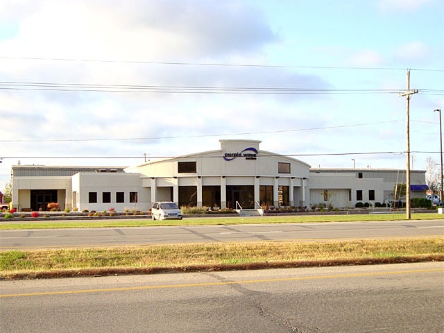
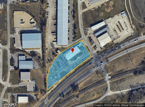
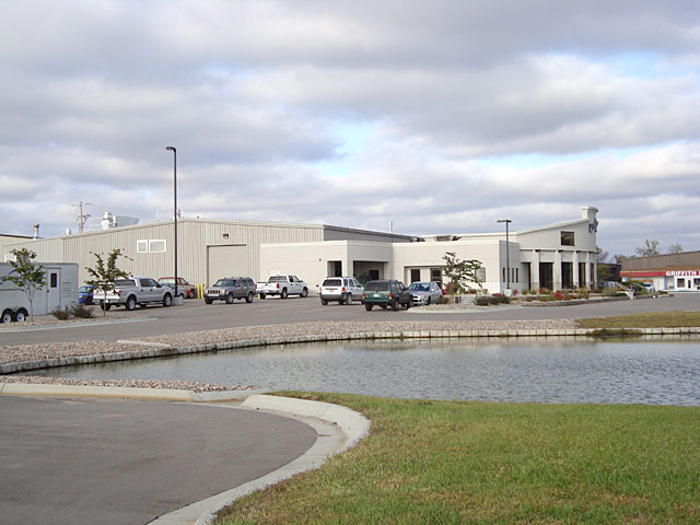
825 Levee Dr, Manhattan, KS 66502
NEARBY LISTINGS FOR SALE OR LEASE
Property Detail
825 Levee Dr
313-08-0-40-03-007.00-0
Manhattan Industrial Park
Officebuilding
S08, T10, R08, ACRES 3.58, BEG NW COR INTER LEVEE DR & HWY 24 TH SW725.93' N138.18' NLY471.95' NE237.27' SE235' TO POB
ARE
Pottawatomie
20149C0460F
Kansas
2024
3.58 AC
2025
Kansas Area
000102
Other Market Areas
16,000 SF
Manhattan, KS
DEMOGRAPHICS near 825 Levee Dr
1 Mile
3 Mile
5 Mile
2024 Total Population
441
36,050
57,503
2029 Population
436
36,624
58,095
Pop Growth 2024-2029
(1.13%)
+ 1.59%
+ 1.03%
Average Age
35
30
33
2024 Total Households
179
13,513
22,480
HH Growth 2024-2029
(1.12%)
+ 1.57%
+ 0.83%
Median Household Inc
$59,761
$39,897
$55,768
Avg Household Size
2.40
2.20
2.20
2024 Avg HH Vehicles
2.00
2.00
2.00
Median Home Value
$109,155
$184,702
$225,057
Median Year Built
1979
1979
1981
Nearby Places
Map Layers
Map Styles
 Street
 Aerial
- Restaurants
- Banks
- Shops
- Fitness
- Groceries
PUBLIC TRANSPORTATION
AIRPORT
Manhattan Regional
DRIVE
WALK
Distance
Manhattan Regional
20 min
10.4 mi
Nearby Properties
Address
Land Use
TOTAL SIZE
Lot Size
Zoning
Address
Land Use
TOTAL SIZE
Lot Size
Zoning
45.61 AC
U
Address
Land Use
TOTAL SIZE
Lot Size
Zoning
4,748,887 SF
261.83 AC
U
Address
Land Use
TOTAL SIZE
Lot Size
Zoning
125.53 AC
U
Address
Land Use
TOTAL SIZE
Lot Size
Zoning
1,084,753 SF
69.85 AC
U
Address
Land Use
TOTAL SIZE
Lot Size
Zoning
518,756 SF
11.88 AC
U
Address
Land Use
TOTAL SIZE
Lot Size
Zoning
69,440 SF
27.76 AC
U
Address
Land Use
TOTAL SIZE
Lot Size
Zoning
41,664 SF
22.69 AC
U
Address
Land Use
TOTAL SIZE
Lot Size
Zoning
132.41 AC
U
Address
Land Use
TOTAL SIZE
Lot Size
Zoning
347,291 SF
21.20 AC
R
Address
Land Use
TOTAL SIZE
Lot Size
Zoning
114,793 SF
9.46 AC
U
Address
Land Use
TOTAL SIZE
Lot Size
Zoning
13,351 SF
23.80 AC
R1
Address
Land Use
TOTAL SIZE
Lot Size
Zoning
10,315 SF
128.74 AC
U
Address
Land Use
TOTAL SIZE
Lot Size
Zoning
77,295 SF
4.30 AC
U
Address
Land Use
TOTAL SIZE
Lot Size
Zoning
95,188 SF
6.34 AC
R1
Address
Land Use
TOTAL SIZE
Lot Size
Zoning
29,816 SF
2.09 AC
C4
Address
Land Use
TOTAL SIZE
Lot Size
Zoning
126,616 SF
28.60 AC
R1
Address
Land Use
TOTAL SIZE
Lot Size
Zoning
1,920 SF
4.47 AC
Address
Land Use
TOTAL SIZE
Lot Size
Zoning
66,076 SF
19.64 AC
Address
Land Use
TOTAL SIZE
Lot Size
Zoning
40,076 SF
1.27 AC
PUD
Address
Land Use
TOTAL SIZE
Lot Size
Zoning
89,898 SF
5.48 AC
R3
Address
Land Use
TOTAL SIZE
Lot Size
Zoning
46,653 SF
0.85 AC
U
Address
Land Use
TOTAL SIZE
Lot Size
Zoning
71,899 SF
5.50 AC
R
Address
Land Use
TOTAL SIZE
Lot Size
Zoning
34,319 SF
1.77 AC
C1
Address
Land Use
TOTAL SIZE
Lot Size
Zoning
72,326 SF
4.83 AC
R
Address
Land Use
TOTAL SIZE
Lot Size
Zoning
44,800 SF
4.49 AC
Address
Land Use
TOTAL SIZE
Lot Size
Zoning
9,754 SF
2 AC
PUD
Address
Land Use
TOTAL SIZE
Lot Size
Zoning
25,505 SF
2.46 AC
U
Address
Land Use
TOTAL SIZE
Lot Size
Zoning
50,784 SF
2.66 AC
U
Address
Land Use
TOTAL SIZE
Lot Size
Zoning
33,829 SF
2.80 AC
R1
Address
Land Use
TOTAL SIZE
Lot Size
Zoning
46,655 SF
3.46 AC
The World's #1 Commercial Real Estate Marketplace
Connect with us
© 2025 CoStar Group
The information above has been obtained from sources believed reliable. While we do not doubt its accuracy we have not verified it and make no guarantee, warranty or representation about it. It is your responsibility to independently confirm its accuracy and completeness. Any projections, opinions, assumptions, or estimates used are for example only and do not represent the current or future performance of the property. The value of this transaction to you depends on tax and other factors which should be evaluated by your tax, financial, and legal advisors. You and your advisors should conduct a careful, independent investigation of the property to determine to your satisfaction the suitability of the property for your needs.