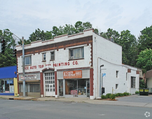
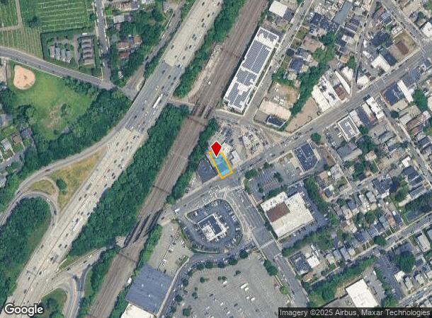
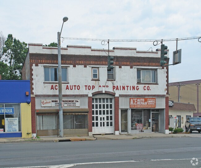
Property Record
825 Main St, New Rochelle, NY 10801
NEARBY LISTINGS FOR SALE OR LEASE
Property Detail
825 Main St
1000-000-002-00530-000-0007
Westchester
Autorepair
New York
X
0.007
36119C0343F
0.12 AC
2025
Southeast
2024
Westchester/So Connecticut
006100
New York-Jersey City-White Plains, NY-NJ
DEMOGRAPHICS near 825 Main St
1 Mile
3 Mile
5 Mile
2024 Total Population
43,557
217,177
594,338
2029 Population
43,442
207,605
556,633
Pop Growth 2024-2029
(0.26%)
(4.41%)
(6.34%)
Average Age
41
41
41
2024 Total Households
16,820
81,660
222,084
HH Growth 2024-2029
+ 0.05%
(4.59%)
(6.64%)
Median Household Inc
$81,170
$77,679
$73,284
Avg Household Size
2.40
2.50
2.50
2024 Avg HH Vehicles
1.00
1.00
1.00
Median Home Value
$528,721
$527,780
$584,034
Median Year Built
1957
1953
1952
Nearby Places
- Restaurants
- Banks
- Shops
- Fitness
- Groceries
PUBLIC TRANSPORTATION
COMMUTER RAIL
New Rochelle Station (New Haven Line - Metro-North Commuter Railroad Company (Metro-North))
DRIVE
WALK
Distance
New Rochelle Station (New Haven Line - Metro-North Commuter Railroad Company (Metro-North))
3 min
17 min
0.9 mi
Pelham Station (New Haven Line - Metro-North Commuter Railroad Company (Metro-North))
DRIVE
WALK
Distance
Pelham Station (New Haven Line - Metro-North Commuter Railroad Company (Metro-North))
4 min
1.4 mi
AIRPORT
LaGuardia
DRIVE
WALK
Distance
LaGuardia
25 min
13.8 mi
Westchester County
DRIVE
WALK
Distance
Westchester County
26 min
16.7 mi
John F Kennedy International
DRIVE
WALK
Distance
John F Kennedy International
33 min
21.4 mi
Freight Ports
NY - Red Hook Container Terminal
DRIVE
WALK
Distance
NY - Red Hook Container Terminal
40 min
24.3 mi
Nearby Properties
Address
Land Use
TOTAL SIZE
Lot Size
Zoning
Address
Land Use
TOTAL SIZE
Lot Size
Zoning
1,132,500 SF
62.44 AC
R6
Address
Land Use
TOTAL SIZE
Lot Size
Zoning
119,980 SF
1,704.55 AC
PARK
Address
Land Use
TOTAL SIZE
Lot Size
Zoning
Address
Land Use
TOTAL SIZE
Lot Size
Zoning
4,000 SF
19.83 AC
BUS
Address
Land Use
TOTAL SIZE
Lot Size
Zoning
545,388 SF
29.07 AC
C4-3
Address
Land Use
TOTAL SIZE
Lot Size
Zoning
Address
Land Use
TOTAL SIZE
Lot Size
Zoning
Address
Land Use
TOTAL SIZE
Lot Size
Zoning
Address
Land Use
TOTAL SIZE
Lot Size
Zoning
165,529 SF
7.05 AC
RA3
Address
Land Use
TOTAL SIZE
Lot Size
Zoning
1,028,976 SF
23.03 AC
R5
Address
Land Use
TOTAL SIZE
Lot Size
Zoning
191,800 SF
13.39 AC
C4-3
Address
Land Use
TOTAL SIZE
Lot Size
Zoning
12,150 SF
482.09 AC
PARK
Address
Land Use
TOTAL SIZE
Lot Size
Zoning
240,000 SF
6.49 AC
C4-3
Address
Land Use
TOTAL SIZE
Lot Size
Zoning
306,540 SF
11.67 AC
R5
Address
Land Use
TOTAL SIZE
Lot Size
Zoning
336,240 SF
8.45 AC
R5
Address
Land Use
TOTAL SIZE
Lot Size
Zoning
138,305 SF
3.18 AC
R6
Address
Land Use
TOTAL SIZE
Lot Size
Zoning
125,143 SF
2.21 AC
R4
Address
Land Use
TOTAL SIZE
Lot Size
Zoning
219,285 SF
15.51 AC
R4
Address
Land Use
TOTAL SIZE
Lot Size
Zoning
Address
Land Use
TOTAL SIZE
Lot Size
Zoning
74,147 SF
2.76 AC
Address
Land Use
TOTAL SIZE
Lot Size
Zoning
181,092 SF
3.47 AC
R4
Address
Land Use
TOTAL SIZE
Lot Size
Zoning
103,158 SF
1.82 AC
R4
Address
Land Use
TOTAL SIZE
Lot Size
Zoning
141,156 SF
9.37 AC
C4-1
Address
Land Use
TOTAL SIZE
Lot Size
Zoning
Address
Land Use
TOTAL SIZE
Lot Size
Zoning
38,912 SF
19.25 AC
R4
Address
Land Use
TOTAL SIZE
Lot Size
Zoning
92,960 SF
11.39 AC
Address
Land Use
TOTAL SIZE
Lot Size
Zoning
143,260 SF
1.79 AC
R5
Address
Land Use
TOTAL SIZE
Lot Size
Zoning
117,954 SF
3.27 AC
R4
Address
Land Use
TOTAL SIZE
Lot Size
Zoning
185,595 SF
1.40 AC
C4-1
Address
Land Use
TOTAL SIZE
Lot Size
Zoning
24,668 SF
11.17 AC
The World's #1 Commercial Real Estate Marketplace
Connect with us
© 2025 CoStar Group
The information above has been obtained from sources believed reliable. While we do not doubt its accuracy we have not verified it and make no guarantee, warranty or representation about it. It is your responsibility to independently confirm its accuracy and completeness. Any projections, opinions, assumptions, or estimates used are for example only and do not represent the current or future performance of the property. The value of this transaction to you depends on tax and other factors which should be evaluated by your tax, financial, and legal advisors. You and your advisors should conduct a careful, independent investigation of the property to determine to your satisfaction the suitability of the property for your needs.