Property Record
825 N Us Highway 287 St, Lafayette, CO 80026


Property Detail
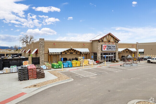
825 N Us Highway 287 St
Boulder, CO
LOT 7 WEST RIDGE FILING 1 REPLAT B
1465340-72-007
Boulder
Commercialnec
Colorado
B and X Area of moderate flood hazard, usually the area between the limits of the 100-year and 500-year floods.
7
2024
3.33 AC
2025
Boulder
012903
Denver
23,130 SF
NEARBY LISTINGS FOR SALE OR LEASE
DEMOGRAPHICS near 825 N Us Highway 287 St
1 mile
3 mile
5 mile
2024 Total Population
7,832
53,459
107,896
2029 Population
7,943
53,815
110,729
Pop Growth 2024-2029
+ 1.42%
+ 0.67%
+ 2.63%
Average Age
42
41
41
2024 Total Households
3,086
20,824
41,236
HH Growth 2024-2029
+ 1.33%
+ 0.58%
+ 2.53%
Median Household Inc
$128,030
$119,109
$136,314
Avg Household Size
2.50
2.50
2.60
2024 Avg HH Vehicles
2.00
2.00
2.00
Median Home Value
$791,843
$770,211
$793,350
Median Year Built
1991
1994
1999
Nearby Places
Map Layers
Map Styles
 Street
 Aerial
Transit
 Traffic
 Biking
Places
Listings with unknown addresses are not visible on the map
- Restaurants
- Banks
- Shops
- Fitness
- Groceries
PUBLIC TRANSPORTATION
AIRPORT
Denver International
Drive
Walk
Distance
Denver International
41 min
34.3 mi
Freight Ports
Tulsa Port Of Catoosa
Drive
Walk
Distance
Tulsa Port Of Catoosa
747 min
728.4 mi
SALE & LEASE HISTORY
LISTING DATE
SALE/LEASE

Sep 06, 2019
For Sale
Sep 04, 2019
For Sale
Nov 02, 2021
For Sale
Nearby Properties
Address
Land Use
TOTAL SIZE
Lot Size
Zoning
Address
Land Use
TOTAL SIZE
Lot Size
Zoning
62.60 AC
Address
Land Use
TOTAL SIZE
Lot Size
Zoning
576 SF
175.05 AC
A
Address
Land Use
TOTAL SIZE
Lot Size
Zoning
188,092 SF
2.01 AC
Address
Land Use
TOTAL SIZE
Lot Size
Zoning
57.98 AC
A
Address
Land Use
TOTAL SIZE
Lot Size
Zoning
120,510 SF
11.02 AC
Address
Land Use
TOTAL SIZE
Lot Size
Zoning
102 AC
A
Address
Land Use
TOTAL SIZE
Lot Size
Zoning
109,056 SF
7.76 AC
Address
Land Use
TOTAL SIZE
Lot Size
Zoning
Address
Land Use
TOTAL SIZE
Lot Size
Zoning
76,658 SF
6.40 AC
Address
Land Use
TOTAL SIZE
Lot Size
Zoning
67,551 SF
4.27 AC
Address
Land Use
TOTAL SIZE
Lot Size
Zoning
91,570 SF
6.09 AC
Address
Land Use
TOTAL SIZE
Lot Size
Zoning
136,448 SF
10.86 AC
Address
Land Use
TOTAL SIZE
Lot Size
Zoning
247,609 SF
14.53 AC
Address
Land Use
TOTAL SIZE
Lot Size
Zoning
132.98 AC
Address
Land Use
TOTAL SIZE
Lot Size
Zoning
109,547 SF
7.91 AC
Address
Land Use
TOTAL SIZE
Lot Size
Zoning
273,678 SF
10.79 AC
Address
Land Use
TOTAL SIZE
Lot Size
Zoning
83,615 SF
6.81 AC
Address
Land Use
TOTAL SIZE
Lot Size
Zoning
217,874 SF
10.49 AC
Address
Land Use
TOTAL SIZE
Lot Size
Zoning
200,885 SF
17.84 AC
Address
Land Use
TOTAL SIZE
Lot Size
Zoning
64,231 SF
5.91 AC
Address
Land Use
TOTAL SIZE
Lot Size
Zoning
106,869 SF
7.46 AC
Address
Land Use
TOTAL SIZE
Lot Size
Zoning
36.81 AC
RR
Address
Land Use
TOTAL SIZE
Lot Size
Zoning
65.53 AC
Address
Land Use
TOTAL SIZE
Lot Size
Zoning
51.39 AC
Address
Land Use
TOTAL SIZE
Lot Size
Zoning
141,896 SF
9.08 AC
Address
Land Use
TOTAL SIZE
Lot Size
Zoning
Address
Land Use
TOTAL SIZE
Lot Size
Zoning
171,317 SF
4.68 AC
Address
Land Use
TOTAL SIZE
Lot Size
Zoning
13.99 AC
Address
Land Use
TOTAL SIZE
Lot Size
Zoning
103,151 SF
6.96 AC
Address
Land Use
TOTAL SIZE
Lot Size
Zoning
77,724 SF
5.78 AC
The World's #1 Commercial Real Estate Marketplace
Connect with us
© 2026 CoStar Group
The information above has been obtained from sources believed reliable. While we do not doubt its accuracy we have not verified it and make no guarantee, warranty or representation about it. It is your responsibility to independently confirm its accuracy and completeness. Any projections, opinions, assumptions, or estimates used are for example only and do not represent the current or future performance of the property. The value of this transaction to you depends on tax and other factors which should be evaluated by your tax, financial, and legal advisors. You and your advisors should conduct a careful, independent investigation of the property to determine to your satisfaction the suitability of the property for your needs.