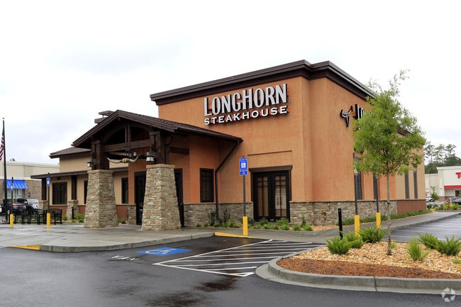
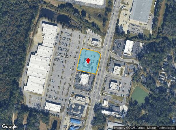
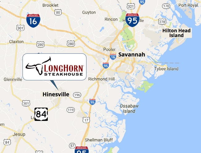
Property Record
825 W Oglethorpe Hwy, Hinesville, GA 31313
NEARBY LISTINGS FOR SALE OR LEASE
Property Detail
825 W Oglethorpe Hwy
Hinesville, GA
Gmass Commercial
058C-158
LOT 5 OGLETHORPE SQUARE (LONGHORNS)
Commercialnec
Liberty
X
Georgia
13179C0228E
5
2024
1.34 AC
2024
Liberty County
010402
Savannah
5,771 SF
DEMOGRAPHICS near 825 W Oglethorpe Hwy
1 Mile
3 Mile
5 Mile
2024 Total Population
5,698
30,848
54,348
2029 Population
5,926
32,011
57,499
Pop Growth 2024-2029
+ 4.00%
+ 3.77%
+ 5.80%
Average Age
35
34
32
2024 Total Households
2,230
11,945
18,881
HH Growth 2024-2029
+ 4.22%
+ 4.09%
+ 6.09%
Median Household Inc
$41,842
$45,747
$47,691
Avg Household Size
2.50
2.60
2.60
2024 Avg HH Vehicles
2.00
2.00
2.00
Median Home Value
$140,609
$148,987
$150,380
Median Year Built
1986
1989
1991
Nearby Places
Map Layers
Map Styles
 Street
 Aerial
- Restaurants
- Banks
- Shops
- Fitness
- Groceries
SALE & LEASE HISTORY
LISTING DATE
SALE/LEASE

Apr 17, 2017
For Sale
Nearby Properties
Address
Land Use
TOTAL SIZE
Lot Size
Zoning
Address
Land Use
TOTAL SIZE
Lot Size
Zoning
3,354 SF
58.90 AC
C3/R20
Address
Land Use
TOTAL SIZE
Lot Size
Zoning
2,352 SF
22.31 AC
ATR/MFR
Address
Land Use
TOTAL SIZE
Lot Size
Zoning
102,939 SF
2.53 AC
C1
Address
Land Use
TOTAL SIZE
Lot Size
Zoning
148,364 SF
18.53 AC
PUD
Address
Land Use
TOTAL SIZE
Lot Size
Zoning
41,670 SF
1.89 AC
C1
Address
Land Use
TOTAL SIZE
Lot Size
Zoning
60,432 SF
23.64 AC
R20
Address
Land Use
TOTAL SIZE
Lot Size
Zoning
100,765 SF
33.20 AC
C2
Address
Land Use
TOTAL SIZE
Lot Size
Zoning
90,886 SF
10.78 AC
C2
Address
Land Use
TOTAL SIZE
Lot Size
Zoning
1,884 SF
9.25 AC
C2
Address
Land Use
TOTAL SIZE
Lot Size
Zoning
81,366 SF
35.17 AC
R8
Address
Land Use
TOTAL SIZE
Lot Size
Zoning
81,366 SF
16.50 AC
R20
Address
Land Use
TOTAL SIZE
Lot Size
Zoning
205,730 SF
21.03 AC
C3
Address
Land Use
TOTAL SIZE
Lot Size
Zoning
10.58 AC
PUD
Address
Land Use
TOTAL SIZE
Lot Size
Zoning
57,980 SF
10.72 AC
C2
Address
Land Use
TOTAL SIZE
Lot Size
Zoning
155,001 SF
10.56 AC
MFR
Address
Land Use
TOTAL SIZE
Lot Size
Zoning
105,967 SF
11.18 AC
C2
Address
Land Use
TOTAL SIZE
Lot Size
Zoning
110,150 SF
14.83 AC
C3
Address
Land Use
TOTAL SIZE
Lot Size
Zoning
133,379 SF
15.59 AC
C2
Address
Land Use
TOTAL SIZE
Lot Size
Zoning
27,627 SF
4.97 AC
C2
Address
Land Use
TOTAL SIZE
Lot Size
Zoning
52,416 SF
3.70 AC
C2
Address
Land Use
TOTAL SIZE
Lot Size
Zoning
42,572 SF
5.87 AC
C2
Address
Land Use
TOTAL SIZE
Lot Size
Zoning
42,572 SF
5.27 AC
C2
Address
Land Use
TOTAL SIZE
Lot Size
Zoning
34,334 SF
7.10 AC
C2
Address
Land Use
TOTAL SIZE
Lot Size
Zoning
39,252 SF
4.93 AC
MFR
Address
Land Use
TOTAL SIZE
Lot Size
Zoning
42,110 SF
5.86 AC
C3
Address
Land Use
TOTAL SIZE
Lot Size
Zoning
14,274 SF
6.34 AC
MFR
Address
Land Use
TOTAL SIZE
Lot Size
Zoning
24,144 SF
9.24 AC
C3
Address
Land Use
TOTAL SIZE
Lot Size
Zoning
2,969 SF
24.68 AC
MFR
Address
Land Use
TOTAL SIZE
Lot Size
Zoning
34,484 SF
1.92 AC
C2
Address
Land Use
TOTAL SIZE
Lot Size
Zoning
21,685 SF
1.15 AC
C2
The World's #1 Commercial Real Estate Marketplace
Connect with us
© 2025 CoStar Group
The information above has been obtained from sources believed reliable. While we do not doubt its accuracy we have not verified it and make no guarantee, warranty or representation about it. It is your responsibility to independently confirm its accuracy and completeness. Any projections, opinions, assumptions, or estimates used are for example only and do not represent the current or future performance of the property. The value of this transaction to you depends on tax and other factors which should be evaluated by your tax, financial, and legal advisors. You and your advisors should conduct a careful, independent investigation of the property to determine to your satisfaction the suitability of the property for your needs.