Property Record
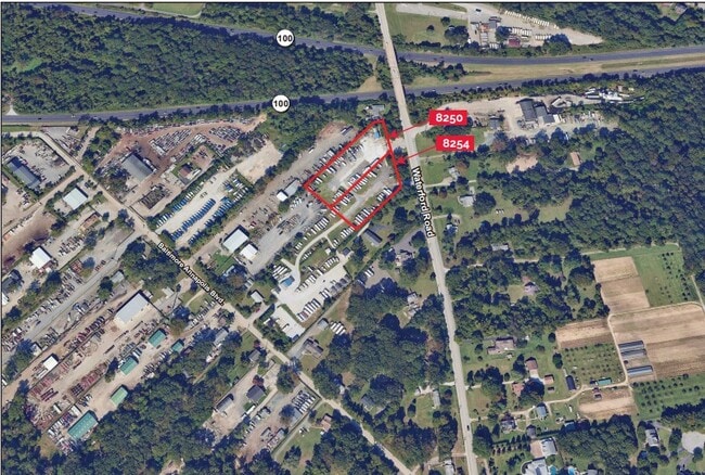
8250 Waterford Rd, Pasadena, MD 21122
This Property Is For Sale
NEARBY LISTINGS FOR SALE OR LEASE
Property Detail
8250 Waterford Rd
Baltimore-Columbia-Towson, MD
Waterford Heights Add
03-896-90212001
PT LT 49 WATERFORD HEIGHTS ADD
Commercialacreage
Anne Arundel
X
Maryland
24003C0156F
49
2024
1.69 AC
2025
Route 2 Corridor South
731209
Baltimore
DEMOGRAPHICS near 8250 Waterford Rd
1 Mile
3 Mile
5 Mile
2024 Total Population
5,377
78,346
186,352
2029 Population
5,568
80,943
191,944
Pop Growth 2024-2029
+ 3.55%
+ 3.31%
+ 3.00%
Average Age
39
40
40
2024 Total Households
1,887
28,118
68,617
HH Growth 2024-2029
+ 3.66%
+ 3.39%
+ 3.02%
Median Household Inc
$135,171
$117,027
$107,771
Avg Household Size
2.70
2.70
2.70
2024 Avg HH Vehicles
2.00
2.00
2.00
Median Home Value
$432,521
$415,251
$399,388
Median Year Built
1992
1983
1979
Nearby Places
- Restaurants
- Banks
- Shops
- Fitness
- Groceries
PUBLIC TRANSPORTATION
AIRPORT
Baltimore/Washington International Thurgood Marshall
DRIVE
WALK
Distance
Baltimore/Washington International Thurgood Marshall
20 min
11.6 mi
Freight Ports
Port of Baltimore
DRIVE
WALK
Distance
Port of Baltimore
26 min
13.3 mi
Nearby Properties
Address
Land Use
TOTAL SIZE
Lot Size
Zoning
Address
Land Use
TOTAL SIZE
Lot Size
Zoning
374,664 SF
22.89 AC
R15
Address
Land Use
TOTAL SIZE
Lot Size
Zoning
32.18 AC
R15
Address
Land Use
TOTAL SIZE
Lot Size
Zoning
176,405 SF
41.81 AC
C3
Address
Land Use
TOTAL SIZE
Lot Size
Zoning
285,360 SF
14.96 AC
Address
Land Use
TOTAL SIZE
Lot Size
Zoning
277,037 SF
10.45 AC
R5
Address
Land Use
TOTAL SIZE
Lot Size
Zoning
16.72 AC
R15
Address
Land Use
TOTAL SIZE
Lot Size
Zoning
7.07 AC
R15
Address
Land Use
TOTAL SIZE
Lot Size
Zoning
154,044 SF
16.89 AC
C3
Address
Land Use
TOTAL SIZE
Lot Size
Zoning
123,376 SF
25.42 AC
C3
Address
Land Use
TOTAL SIZE
Lot Size
Zoning
238,688 SF
35 AC
R5
Address
Land Use
TOTAL SIZE
Lot Size
Zoning
166,646 SF
4.61 AC
R22
Address
Land Use
TOTAL SIZE
Lot Size
Zoning
303,626 SF
20.88 AC
C3
Address
Land Use
TOTAL SIZE
Lot Size
Zoning
106,160 SF
5.11 AC
R-2
Address
Land Use
TOTAL SIZE
Lot Size
Zoning
106,760 SF
5.09 AC
C4
Address
Land Use
TOTAL SIZE
Lot Size
Zoning
139,230 SF
39.22 AC
R2
Address
Land Use
TOTAL SIZE
Lot Size
Zoning
122,175 SF
7.32 AC
R5
Address
Land Use
TOTAL SIZE
Lot Size
Zoning
154,056 SF
19.89 AC
R2
Address
Land Use
TOTAL SIZE
Lot Size
Zoning
209,143 SF
19.29 AC
C3
Address
Land Use
TOTAL SIZE
Lot Size
Zoning
79,311 SF
3.90 AC
C2
Address
Land Use
TOTAL SIZE
Lot Size
Zoning
272,245 SF
40.30 AC
R5
Address
Land Use
TOTAL SIZE
Lot Size
Zoning
191,856 SF
5.61 AC
R15
Address
Land Use
TOTAL SIZE
Lot Size
Zoning
80,512 SF
4.87 AC
R22
Address
Land Use
TOTAL SIZE
Lot Size
Zoning
141,829 SF
29.38 AC
R5
Address
Land Use
TOTAL SIZE
Lot Size
Zoning
121,846 SF
8.10 AC
C4
Address
Land Use
TOTAL SIZE
Lot Size
Zoning
9.97 AC
R15
Address
Land Use
TOTAL SIZE
Lot Size
Zoning
45,570 SF
3.46 AC
C4
Address
Land Use
TOTAL SIZE
Lot Size
Zoning
114,602 SF
10.26 AC
C3
Address
Land Use
TOTAL SIZE
Lot Size
Zoning
99,218 SF
2.96 AC
R22
Address
Land Use
TOTAL SIZE
Lot Size
Zoning
90,488 SF
9.82 AC
C3
Address
Land Use
TOTAL SIZE
Lot Size
Zoning
75,634 SF
17.37 AC
R5
The World's #1 Commercial Real Estate Marketplace
Connect with us
© 2025 CoStar Group
The information above has been obtained from sources believed reliable. While we do not doubt its accuracy we have not verified it and make no guarantee, warranty or representation about it. It is your responsibility to independently confirm its accuracy and completeness. Any projections, opinions, assumptions, or estimates used are for example only and do not represent the current or future performance of the property. The value of this transaction to you depends on tax and other factors which should be evaluated by your tax, financial, and legal advisors. You and your advisors should conduct a careful, independent investigation of the property to determine to your satisfaction the suitability of the property for your needs.