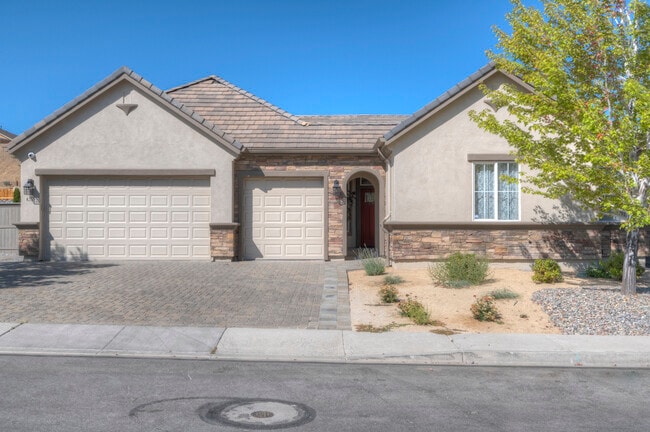
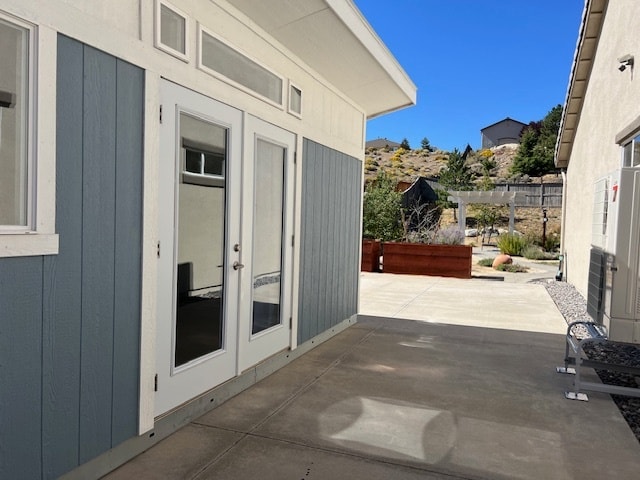
Property Record
8255 Opal Ranch Way, Reno, NV 89506

This Property Is For Sale
NEARBY LISTINGS FOR SALE OR LEASE
Property Detail
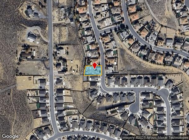
8255 Opal Ranch Way
Reno, NV
Northstar Ranch Phase 3
502-573-12
Washoe
Sfr
Nevada
X
0.35 AC
32031C3027G
North Valleys
2,706 SF
Reno/Sparks
DEMOGRAPHICS near 8255 Opal Ranch Way
1 Mile
3 Mile
5 Mile
2024 Total Population
3,718
43,007
151,394
2029 Population
3,859
45,565
160,070
Pop Growth 2024-2029
+ 3.79%
+ 5.95%
+ 5.73%
Average Age
41
38
37
2024 Total Households
1,265
14,424
54,478
HH Growth 2024-2029
+ 3.95%
+ 6.11%
+ 5.86%
Median Household Inc
$111,881
$69,470
$62,656
Avg Household Size
2.80
2.80
2.60
2024 Avg HH Vehicles
3.00
2.00
2.00
Median Home Value
$445,879
$350,261
$362,597
Median Year Built
2003
1992
1988
Nearby Places
Map Layers
Map Styles
 Street
 Aerial
- Restaurants
- Banks
- Shops
- Fitness
- Groceries
PUBLIC TRANSPORTATION
COMMUTER RAIL
Reno (California Zephyr - Amtrak)
DRIVE
WALK
Distance
Reno (California Zephyr - Amtrak)
15 min
6.7 mi
AIRPORT
Reno/Tahoe International
DRIVE
WALK
Distance
Reno/Tahoe International
34 min
12.8 mi
Freight Ports
Port of Stockton
DRIVE
WALK
Distance
Port of Stockton
219 min
184.2 mi
Nearby Properties
Address
Land Use
TOTAL SIZE
Lot Size
Zoning
Address
Land Use
TOTAL SIZE
Lot Size
Zoning
391,195 SF
53.65 AC
PF
Address
Land Use
TOTAL SIZE
Lot Size
Zoning
371,855 SF
39.61 AC
MF14
Address
Land Use
TOTAL SIZE
Lot Size
Zoning
402,421 SF
45.18 AC
GC
Address
Land Use
TOTAL SIZE
Lot Size
Zoning
902,786 SF
57.98 AC
IC
Address
Land Use
TOTAL SIZE
Lot Size
Zoning
790,500 SF
74.63 AC
I
Address
Land Use
TOTAL SIZE
Lot Size
Zoning
799,980 SF
44.67 AC
IC
Address
Land Use
TOTAL SIZE
Lot Size
Zoning
600 SF
279.66 AC
ME 61% / P
Address
Land Use
TOTAL SIZE
Lot Size
Zoning
624,000 SF
39.35 AC
MS
Address
Land Use
TOTAL SIZE
Lot Size
Zoning
722,512 SF
43.90 AC
IC
Address
Land Use
TOTAL SIZE
Lot Size
Zoning
706,540 SF
35.45 AC
IC
Address
Land Use
TOTAL SIZE
Lot Size
Zoning
285,214 SF
11.46 AC
MS
Address
Land Use
TOTAL SIZE
Lot Size
Zoning
282,355 SF
82.61 AC
LDS 86% /
Address
Land Use
TOTAL SIZE
Lot Size
Zoning
409,829 SF
25.46 AC
IC
Address
Land Use
TOTAL SIZE
Lot Size
Zoning
207,353 SF
11.32 AC
MF30
Address
Land Use
TOTAL SIZE
Lot Size
Zoning
193,295 SF
35.91 AC
MS
Address
Land Use
TOTAL SIZE
Lot Size
Zoning
402,320 SF
28.27 AC
MS
Address
Land Use
TOTAL SIZE
Lot Size
Zoning
352,720 SF
22.25 AC
IC
Address
Land Use
TOTAL SIZE
Lot Size
Zoning
146,255 SF
9.99 AC
MDU
Address
Land Use
TOTAL SIZE
Lot Size
Zoning
79,337 SF
11.98 AC
PF
Address
Land Use
TOTAL SIZE
Lot Size
Zoning
269,982 SF
17.99 AC
IC
Address
Land Use
TOTAL SIZE
Lot Size
Zoning
160,891 SF
16.91 AC
GC
Address
Land Use
TOTAL SIZE
Lot Size
Zoning
247,007 SF
19.92 AC
MU
Address
Land Use
TOTAL SIZE
Lot Size
Zoning
245,385 SF
15.23 AC
IC
Address
Land Use
TOTAL SIZE
Lot Size
Zoning
122,088 SF
10.52 AC
MS
Address
Land Use
TOTAL SIZE
Lot Size
Zoning
138,048 SF
18.71 AC
IC
Address
Land Use
TOTAL SIZE
Lot Size
Zoning
224,640 SF
19.70 AC
MS
Address
Land Use
TOTAL SIZE
Lot Size
Zoning
154,440 SF
14.26 AC
IC
Address
Land Use
TOTAL SIZE
Lot Size
Zoning
297,816 SF
16.80 AC
SPD
Address
Land Use
TOTAL SIZE
Lot Size
Zoning
131,537 SF
16.61 AC
SPD
Address
Land Use
TOTAL SIZE
Lot Size
Zoning
104,747 SF
16.02 AC
GC
The World's #1 Commercial Real Estate Marketplace
Connect with us
© 2025 CoStar Group
The information above has been obtained from sources believed reliable. While we do not doubt its accuracy we have not verified it and make no guarantee, warranty or representation about it. It is your responsibility to independently confirm its accuracy and completeness. Any projections, opinions, assumptions, or estimates used are for example only and do not represent the current or future performance of the property. The value of this transaction to you depends on tax and other factors which should be evaluated by your tax, financial, and legal advisors. You and your advisors should conduct a careful, independent investigation of the property to determine to your satisfaction the suitability of the property for your needs.