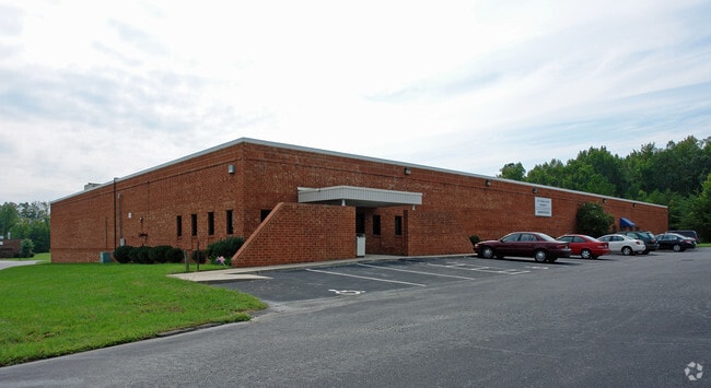
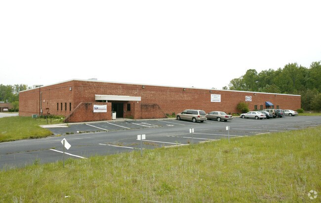
Property Record
827 Herman Ct, High Point, NC 27263


Property Detail
827 Herman Ct
0179764
12-13 PB 55-9 827 HERMAN PL:55-9
Industrialgeneral
Guilford
LI
North Carolina
A Areas with a 1% annual chance of flooding and a 26% chance of flooding over the life of a 30-year mortgage.
12-13
2024
2.47 AC
2025
High Point/SW Guilford Cty
014502
Greensboro/Winston-Salem
26,378 SF
Greensboro-High Point, NC
NEARBY LISTINGS FOR SALE OR LEASE
DEMOGRAPHICS near 827 Herman Ct
1 mile
3 mile
5 mile
2025 Total Population
5,239
40,627
94,206
2030 Population
5,399
42,255
97,584
Pop Growth 2025-2030
+ 3.05%
+ 4.01%
+ 3.59%
Average Age
37
38
39
2025 Total Households
1,965
15,910
36,164
HH Growth 2025-2030
+ 3.21%
+ 4.15%
+ 3.82%
Median Household Inc
$51,485
$44,585
$50,463
Avg Household Size
2.60
2.40
2.40
2025 Avg HH Vehicles
2.00
2.00
2.00
Median Home Value
$123,746
$159,113
$187,706
Median Year Built
1965
1972
1974
Nearby Places
Map Layers
Map Styles
 Street
 Aerial
Transit
 Traffic
 Biking
Places
Listings with unknown addresses are not visible on the map
- Restaurants
- Banks
- Shops
- Fitness
- Groceries
PUBLIC TRANSPORTATION
AIRPORT
Piedmont Triad International
Drive
Walk
Distance
Piedmont Triad International
26 min
19.7 mi
Nearby Properties
Address
Land Use
TOTAL SIZE
Lot Size
Zoning
Address
Land Use
TOTAL SIZE
Lot Size
Zoning
1,277,656 SF
2.47 AC
CB
Address
Land Use
TOTAL SIZE
Lot Size
Zoning
464,134 SF
11.28 AC
PI
Address
Land Use
TOTAL SIZE
Lot Size
Zoning
484,289 SF
6.41 AC
CB
Address
Land Use
TOTAL SIZE
Lot Size
Zoning
796,121 SF
9.36 AC
CB
Address
Land Use
TOTAL SIZE
Lot Size
Zoning
802,214 SF
0.01 AC
CB
Address
Land Use
TOTAL SIZE
Lot Size
Zoning
805,958 SF
61.42 AC
LI
Address
Land Use
TOTAL SIZE
Lot Size
Zoning
136,202 SF
30.02 AC
CZ-I
Address
Land Use
TOTAL SIZE
Lot Size
Zoning
457,534 SF
2.13 AC
CB
Address
Land Use
TOTAL SIZE
Lot Size
Zoning
142,800 SF
1.04 AC
CB
Address
Land Use
TOTAL SIZE
Lot Size
Zoning
285,094 SF
3.23 AC
CB
Address
Land Use
TOTAL SIZE
Lot Size
Zoning
299,349 SF
21.76 AC
RM-16
Address
Land Use
TOTAL SIZE
Lot Size
Zoning
355,633 SF
63.42 AC
HI
Address
Land Use
TOTAL SIZE
Lot Size
Zoning
322,779 SF
0.88 AC
CB
Address
Land Use
TOTAL SIZE
Lot Size
Zoning
204,276 SF
68.51 AC
M-2
Address
Land Use
TOTAL SIZE
Lot Size
Zoning
297,676 SF
0.48 AC
CB
Address
Land Use
TOTAL SIZE
Lot Size
Zoning
319,603 SF
1.34 AC
CB
Address
Land Use
TOTAL SIZE
Lot Size
Zoning
196,353 SF
13.76 AC
RC
Address
Land Use
TOTAL SIZE
Lot Size
Zoning
369,312 SF
0.75 AC
CB
Address
Land Use
TOTAL SIZE
Lot Size
Zoning
156,010 SF
36.21 AC
M-1
Address
Land Use
TOTAL SIZE
Lot Size
Zoning
324,986 SF
24.19 AC
LI
Address
Land Use
TOTAL SIZE
Lot Size
Zoning
351,736 SF
34.77 AC
HI
Address
Land Use
TOTAL SIZE
Lot Size
Zoning
127,800 SF
57.35 AC
M-1
Address
Land Use
TOTAL SIZE
Lot Size
Zoning
174,529 SF
2.87 AC
CB
Address
Land Use
TOTAL SIZE
Lot Size
Zoning
81,450 SF
1.38 AC
CB
Address
Land Use
TOTAL SIZE
Lot Size
Zoning
233,398 SF
0.48 AC
CB
Address
Land Use
TOTAL SIZE
Lot Size
Zoning
200,288 SF
2.58 AC
CB
Address
Land Use
TOTAL SIZE
Lot Size
Zoning
4,500 SF
6.98 AC
MX-D
Address
Land Use
TOTAL SIZE
Lot Size
Zoning
94,632 SF
1.13 AC
MX-D
Address
Land Use
TOTAL SIZE
Lot Size
Zoning
258,695 SF
0.70 AC
CB
Address
Land Use
TOTAL SIZE
Lot Size
Zoning
286,940 SF
1.97 AC
CB
The World's #1 Commercial Real Estate Marketplace
Connect with us
© 2026 CoStar Group
The information above has been obtained from sources believed reliable. While we do not doubt its accuracy we have not verified it and make no guarantee, warranty or representation about it. It is your responsibility to independently confirm its accuracy and completeness. Any projections, opinions, assumptions, or estimates used are for example only and do not represent the current or future performance of the property. The value of this transaction to you depends on tax and other factors which should be evaluated by your tax, financial, and legal advisors. You and your advisors should conduct a careful, independent investigation of the property to determine to your satisfaction the suitability of the property for your needs.