Property Record
8270 Pine Rd, Cincinnati, OH 45236

Property Detail
8270 Pine Rd
600-0202-0600
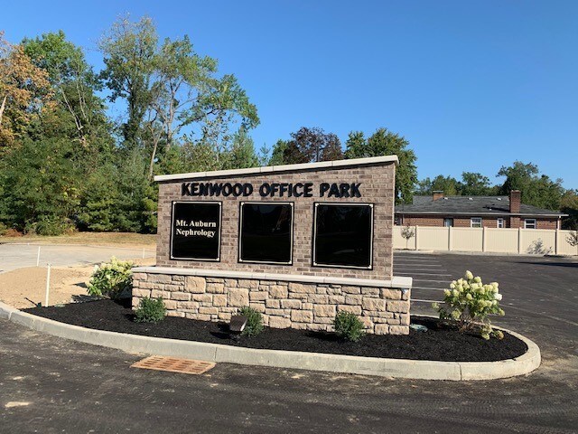
60.21% UNIT BKENWOOD OFFICE PARK CONDOMINIUM PHASE 2
Officecondo
HAMILTON
B and X Area of moderate flood hazard, usually the area between the limits of the 100-year and 500-year floods.
Ohio
2025
Blue Ash
2025
Cincinnati/Dayton
024001
Cincinnati, OH-KY-IN
NEARBY LISTINGS FOR SALE OR LEASE
DEMOGRAPHICS near 8270 Pine Rd
1 mile
3 mile
5 mile
2025 Total Population
11,340
69,621
169,168
2030 Population
11,448
70,232
170,621
Pop Growth 2025-2030
+ 0.95%
+ 0.88%
+ 0.86%
Average Age
42
42
41
2025 Total Households
4,963
29,085
73,612
HH Growth 2025-2030
+ 0.91%
+ 0.85%
+ 0.86%
Median Household Inc
$83,748
$98,700
$79,210
Avg Household Size
2.20
2.30
2.20
2025 Avg HH Vehicles
2.00
2.00
2.00
Median Home Value
$244,751
$323,200
$298,431
Median Year Built
1956
1959
1957
Nearby Places
Map Layers
Map Styles
 Street
 Aerial
Transit
 Traffic
 Biking
Places
Listings with unknown addresses are not visible on the map
- Restaurants
- Banks
- Shops
- Fitness
- Groceries
PUBLIC TRANSPORTATION
AIRPORT
Cincinnati/Northern Kentucky International
Drive
Walk
Distance
Cincinnati/Northern Kentucky International
45 min
26.1 mi
Freight Ports
Port of Toledo
Drive
Walk
Distance
Port of Toledo
237 min
202.0 mi
SALE & LEASE HISTORY
LISTING DATE
SALE/LEASE

Sep 21, 2018
For Sale
Nov 17, 2020
For Lease
Jan 16, 2018
For Sale
Jan 12, 2018
For Sale
Nearby Properties
Address
Land Use
TOTAL SIZE
Lot Size
Zoning
Address
Land Use
TOTAL SIZE
Lot Size
Zoning
31.26 AC
E
Address
Land Use
TOTAL SIZE
Lot Size
Zoning
8.11 AC
E
Address
Land Use
TOTAL SIZE
Lot Size
Zoning
317,592 SF
29.46 AC
E
Address
Land Use
TOTAL SIZE
Lot Size
Zoning
12.43 AC
OO
Address
Land Use
TOTAL SIZE
Lot Size
Zoning
Address
Land Use
TOTAL SIZE
Lot Size
Zoning
6.03 AC
Address
Land Use
TOTAL SIZE
Lot Size
Zoning
Address
Land Use
TOTAL SIZE
Lot Size
Zoning
49.51 AC
Address
Land Use
TOTAL SIZE
Lot Size
Zoning
119.08 AC
R1
Address
Land Use
TOTAL SIZE
Lot Size
Zoning
280,900 SF
11.14 AC
D2
Address
Land Use
TOTAL SIZE
Lot Size
Zoning
15.91 AC
E
Address
Land Use
TOTAL SIZE
Lot Size
Zoning
5.78 AC
Address
Land Use
TOTAL SIZE
Lot Size
Zoning
1,238 SF
14.03 AC
Address
Land Use
TOTAL SIZE
Lot Size
Zoning
Address
Land Use
TOTAL SIZE
Lot Size
Zoning
0.26 AC
RM12
Address
Land Use
TOTAL SIZE
Lot Size
Zoning
35.74 AC
Address
Land Use
TOTAL SIZE
Lot Size
Zoning
5.79 AC
Address
Land Use
TOTAL SIZE
Lot Size
Zoning
124.81 AC
Address
Land Use
TOTAL SIZE
Lot Size
Zoning
Address
Land Use
TOTAL SIZE
Lot Size
Zoning
2.08 AC
Address
Land Use
TOTAL SIZE
Lot Size
Zoning
19.17 AC
ML
Address
Land Use
TOTAL SIZE
Lot Size
Zoning
17,055 SF
6.51 AC
D1
Address
Land Use
TOTAL SIZE
Lot Size
Zoning
0.77 AC
EE
Address
Land Use
TOTAL SIZE
Lot Size
Zoning
Address
Land Use
TOTAL SIZE
Lot Size
Zoning
Address
Land Use
TOTAL SIZE
Lot Size
Zoning
Address
Land Use
TOTAL SIZE
Lot Size
Zoning
15.61 AC
Address
Land Use
TOTAL SIZE
Lot Size
Zoning
4,599 SF
29.03 AC
R4
Address
Land Use
TOTAL SIZE
Lot Size
Zoning
138,040 SF
176.17 AC
Address
Land Use
TOTAL SIZE
Lot Size
Zoning
5.09 AC
The World's #1 Commercial Real Estate Marketplace
Connect with us
© 2026 CoStar Group
The information above has been obtained from sources believed reliable. While we do not doubt its accuracy we have not verified it and make no guarantee, warranty or representation about it. It is your responsibility to independently confirm its accuracy and completeness. Any projections, opinions, assumptions, or estimates used are for example only and do not represent the current or future performance of the property. The value of this transaction to you depends on tax and other factors which should be evaluated by your tax, financial, and legal advisors. You and your advisors should conduct a careful, independent investigation of the property to determine to your satisfaction the suitability of the property for your needs.