Property Record
8276 28Th Ct Ne, Lacey, WA 98516

NEARBY LISTINGS FOR SALE OR LEASE
Property Detail
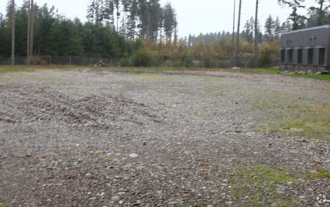
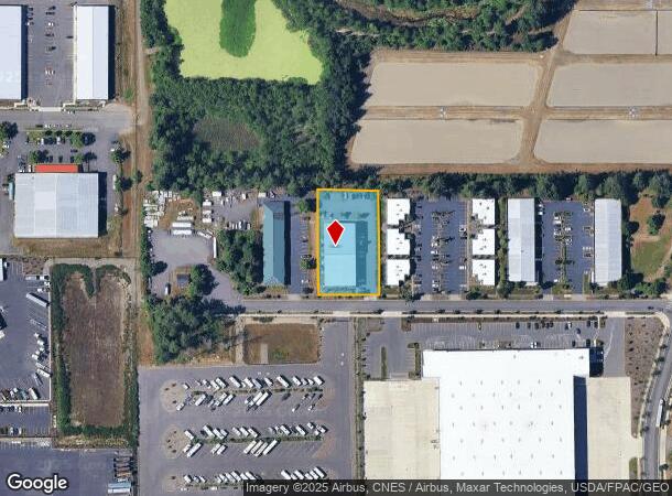
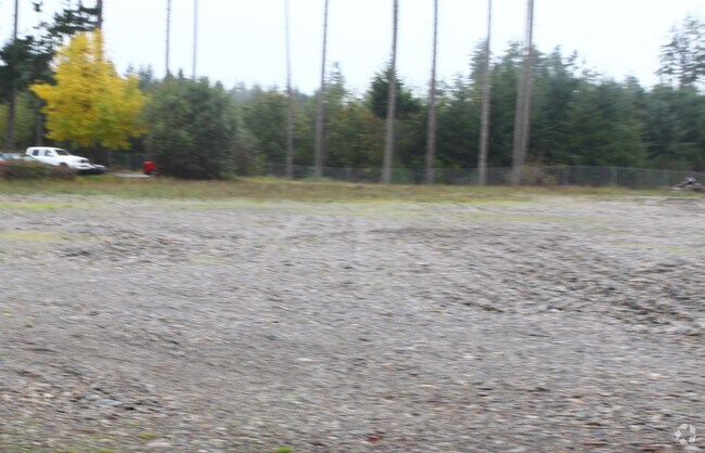
8276 28Th Ct Ne
Olympia-Tumwater, WA
Hogum Bay Industrial Park
54890000500
SECTION 02 TOWNSHIP 18 RANGE 1W QUARTER NW SE & SW SE PLAT HOGUM BAY INDUSTRIAL PARK LT 5 DOCUMENT 2440/579
Commercialnec
Thurston
X
Washington
53067C0185F
5
2024
0.86 AC
2024
Lacey
012226
Olympia
11,250 SF
DEMOGRAPHICS near 8276 28Th Ct Ne
1 Mile
3 Mile
5 Mile
2024 Total Population
5,186
48,835
99,658
2029 Population
5,640
51,990
105,442
Pop Growth 2024-2029
+ 8.75%
+ 6.46%
+ 5.80%
Average Age
36
39
41
2024 Total Households
1,923
18,330
38,354
HH Growth 2024-2029
+ 8.84%
+ 6.57%
+ 5.92%
Median Household Inc
$73,440
$84,690
$81,021
Avg Household Size
2.70
2.60
2.50
2024 Avg HH Vehicles
2.00
2.00
2.00
Median Home Value
$403,251
$409,092
$407,115
Median Year Built
2006
1996
1990
Nearby Places
Map Layers
Map Styles
 Street
 Aerial
- Restaurants
- Banks
- Shops
- Fitness
- Groceries
PUBLIC TRANSPORTATION
COMMUTER RAIL
Olympia-Lacey Amtrak Station (Amtrak Cascades - Amtrak, Coast Starlight - Amtrak)
DRIVE
WALK
Distance
Olympia-Lacey Amtrak Station (Amtrak Cascades - Amtrak, Coast Starlight - Amtrak)
19 min
9.1 mi
Freight Ports
Port of Tacoma
DRIVE
WALK
Distance
Port of Tacoma
35 min
25.4 mi
Nearby Properties
Address
Land Use
TOTAL SIZE
Lot Size
Zoning
Address
Land Use
TOTAL SIZE
Lot Size
Zoning
1,946,991 SF
125.04 AC
LI
Address
Land Use
TOTAL SIZE
Lot Size
Zoning
1,352,178 SF
62.06 AC
LI
Address
Land Use
TOTAL SIZE
Lot Size
Zoning
497,558 SF
28.57 AC
CBD 7
Address
Land Use
TOTAL SIZE
Lot Size
Zoning
1,002,702 SF
42.16 AC
LI
Address
Land Use
TOTAL SIZE
Lot Size
Zoning
709,886 SF
39.25 AC
LI
Address
Land Use
TOTAL SIZE
Lot Size
Zoning
755,671 SF
43.66 AC
LI
Address
Land Use
TOTAL SIZE
Lot Size
Zoning
679,704 SF
38.60 AC
LI
Address
Land Use
TOTAL SIZE
Lot Size
Zoning
580,520 SF
30.25 AC
LI
Address
Land Use
TOTAL SIZE
Lot Size
Zoning
500,000 SF
28.28 AC
LI
Address
Land Use
TOTAL SIZE
Lot Size
Zoning
214,214 SF
12.06 AC
MHDC
Address
Land Use
TOTAL SIZE
Lot Size
Zoning
203,998 SF
9.60 AC
HD
Address
Land Use
TOTAL SIZE
Lot Size
Zoning
160,106 SF
39.73 AC
OSI-S
Address
Land Use
TOTAL SIZE
Lot Size
Zoning
272,388 SF
4.69 AC
HD
Address
Land Use
TOTAL SIZE
Lot Size
Zoning
209,986 SF
11.21 AC
MHDC
Address
Land Use
TOTAL SIZE
Lot Size
Zoning
180,132 SF
6.66 AC
HD
Address
Land Use
TOTAL SIZE
Lot Size
Zoning
173,239 SF
7.66 AC
HD
Address
Land Use
TOTAL SIZE
Lot Size
Zoning
64.18 AC
HPBDBC
Address
Land Use
TOTAL SIZE
Lot Size
Zoning
62.35 AC
HPBDBC
Address
Land Use
TOTAL SIZE
Lot Size
Zoning
208,708 SF
8.46 AC
CO
Address
Land Use
TOTAL SIZE
Lot Size
Zoning
166,022 SF
9.61 AC
MD
Address
Land Use
TOTAL SIZE
Lot Size
Zoning
315,693 SF
14.65 AC
LI
Address
Land Use
TOTAL SIZE
Lot Size
Zoning
159,103 SF
8.44 AC
HD
Address
Land Use
TOTAL SIZE
Lot Size
Zoning
185,054 SF
6.29 AC
HD
Address
Land Use
TOTAL SIZE
Lot Size
Zoning
194,020 SF
9.49 AC
MHDC
Address
Land Use
TOTAL SIZE
Lot Size
Zoning
213,391 SF
9.91 AC
MHDC
Address
Land Use
TOTAL SIZE
Lot Size
Zoning
164,498 SF
8.80 AC
MHDC
Address
Land Use
TOTAL SIZE
Lot Size
Zoning
221,642 SF
4.96 AC
CBD 5
Address
Land Use
TOTAL SIZE
Lot Size
Zoning
158,221 SF
9.55 AC
HD
Address
Land Use
TOTAL SIZE
Lot Size
Zoning
163,167 SF
8.20 AC
CBD 5
Address
Land Use
TOTAL SIZE
Lot Size
Zoning
318,880 SF
18.13 AC
LI
The World's #1 Commercial Real Estate Marketplace
Connect with us
© 2025 CoStar Group
The information above has been obtained from sources believed reliable. While we do not doubt its accuracy we have not verified it and make no guarantee, warranty or representation about it. It is your responsibility to independently confirm its accuracy and completeness. Any projections, opinions, assumptions, or estimates used are for example only and do not represent the current or future performance of the property. The value of this transaction to you depends on tax and other factors which should be evaluated by your tax, financial, and legal advisors. You and your advisors should conduct a careful, independent investigation of the property to determine to your satisfaction the suitability of the property for your needs.