Property Record
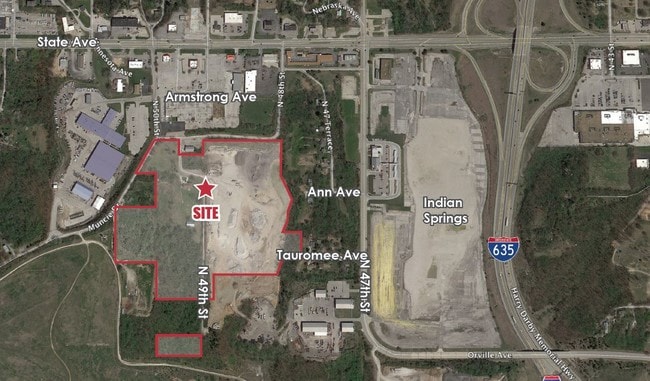
822 N 49Th St, Kansas City, KS 66102

NEARBY LISTINGS FOR SALE OR LEASE
Property Detail
822 N 49Th St
Kansas City, MO-KS
Douglas Highlands
051304
DOUGLAS HIGHLANDS, S12, T11, R24, ACRES 17.75, L1, L2, L5 TO L17; ALSO BEG NW COR L1; S 282.4FT, W 154.59FT, NELY-322FT TO POB; ALSO BEG 179.42FT S OF SW COR L8; W 340FT, N TO MUNCIE DR, NELY-25FT M/L, E 325FT M/L, S 384FT TO POB; CONTG 17.75AC M/L
Governmentalpublicusegeneral
Wyandotte
X
Kansas
20209C0152F
1
2022
17.75 AC
2025
Kansas City KS
043905
Kansas City
1,593 SF
DEMOGRAPHICS near 822 N 49Th St
1 Mile
3 Mile
5 Mile
2024 Total Population
3,385
61,683
127,087
2029 Population
3,299
60,498
124,405
Pop Growth 2024-2029
(2.54%)
(1.92%)
(2.11%)
Average Age
35
35
36
2024 Total Households
1,146
21,049
44,884
HH Growth 2024-2029
(2.62%)
(1.96%)
(2.13%)
Median Household Inc
$61,303
$50,192
$50,989
Avg Household Size
2.80
2.80
2.70
2024 Avg HH Vehicles
2.00
2.00
2.00
Median Home Value
$83,333
$110,398
$127,444
Median Year Built
1957
1955
1957
Nearby Places
Map Layers
Map Styles
 Street
 Aerial
- Restaurants
- Banks
- Shops
- Fitness
- Groceries
PUBLIC TRANSPORTATION
COMMUTER RAIL
DRIVE
WALK
Distance
15 min
8.4 mi
AIRPORT
Kansas City International
DRIVE
WALK
Distance
Kansas City International
27 min
20.0 mi
SALE & LEASE HISTORY
LISTING DATE
SALE/LEASE

Feb 11, 2019
For Sale
Nearby Properties
Address
Land Use
TOTAL SIZE
Lot Size
Zoning
Address
Land Use
TOTAL SIZE
Lot Size
Zoning
872,064 SF
119.39 AC
Address
Land Use
TOTAL SIZE
Lot Size
Zoning
347,991 SF
51.92 AC
1KMC
Address
Land Use
TOTAL SIZE
Lot Size
Zoning
542,696 SF
28.12 AC
Address
Land Use
TOTAL SIZE
Lot Size
Zoning
264,254 SF
56.62 AC
KR1
Address
Land Use
TOTAL SIZE
Lot Size
Zoning
346,224 SF
28.44 AC
Address
Land Use
TOTAL SIZE
Lot Size
Zoning
407,936 SF
37.46 AC
1
Address
Land Use
TOTAL SIZE
Lot Size
Zoning
396,532 SF
31.98 AC
Address
Land Use
TOTAL SIZE
Lot Size
Zoning
241,816 SF
20.03 AC
Address
Land Use
TOTAL SIZE
Lot Size
Zoning
88,396 SF
23.79 AC
Address
Land Use
TOTAL SIZE
Lot Size
Zoning
139,499 SF
20.51 AC
KR1B
Address
Land Use
TOTAL SIZE
Lot Size
Zoning
122,217 SF
23.87 AC
KR2
Address
Land Use
TOTAL SIZE
Lot Size
Zoning
71,326 SF
6.31 AC
KR1
Address
Land Use
TOTAL SIZE
Lot Size
Zoning
100,090 SF
48.47 AC
KR1
Address
Land Use
TOTAL SIZE
Lot Size
Zoning
75,309 SF
19.40 AC
KR1
Address
Land Use
TOTAL SIZE
Lot Size
Zoning
383,232 SF
15.93 AC
LU1
Address
Land Use
TOTAL SIZE
Lot Size
Zoning
54,578 SF
12.01 AC
KR1
Address
Land Use
TOTAL SIZE
Lot Size
Zoning
52,374 SF
2.88 AC
KRP5
Address
Land Use
TOTAL SIZE
Lot Size
Zoning
158,011 SF
26.66 AC
Address
Land Use
TOTAL SIZE
Lot Size
Zoning
132,724 SF
20.84 AC
KC1
Address
Land Use
TOTAL SIZE
Lot Size
Zoning
45,968 SF
2.58 AC
KR2
Address
Land Use
TOTAL SIZE
Lot Size
Zoning
36,576 SF
4.46 AC
Address
Land Use
TOTAL SIZE
Lot Size
Zoning
1,032,141 SF
45.80 AC
LU1
Address
Land Use
TOTAL SIZE
Lot Size
Zoning
10,132 SF
0.75 AC
KE9
Address
Land Use
TOTAL SIZE
Lot Size
Zoning
53,029 SF
6.50 AC
KR1B
Address
Land Use
TOTAL SIZE
Lot Size
Zoning
31,185 SF
4.72 AC
KC1
Address
Land Use
TOTAL SIZE
Lot Size
Zoning
41,904 SF
2.48 AC
Address
Land Use
TOTAL SIZE
Lot Size
Zoning
39,588 SF
16.33 AC
KR1
Address
Land Use
TOTAL SIZE
Lot Size
Zoning
164,462 SF
23.15 AC
Address
Land Use
TOTAL SIZE
Lot Size
Zoning
43,922 SF
5.81 AC
The World's #1 Commercial Real Estate Marketplace
Connect with us
© 2026 CoStar Group
The information above has been obtained from sources believed reliable. While we do not doubt its accuracy we have not verified it and make no guarantee, warranty or representation about it. It is your responsibility to independently confirm its accuracy and completeness. Any projections, opinions, assumptions, or estimates used are for example only and do not represent the current or future performance of the property. The value of this transaction to you depends on tax and other factors which should be evaluated by your tax, financial, and legal advisors. You and your advisors should conduct a careful, independent investigation of the property to determine to your satisfaction the suitability of the property for your needs.