Property Record
8280 Longleaf Dr, Elk Grove, CA 95758


NEARBY LISTINGS FOR SALE OR LEASE
Property Detail
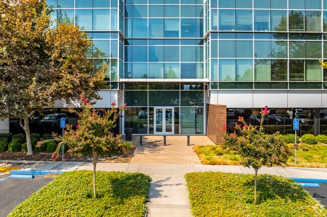
8280 Longleaf Dr
116-1480-016
LOT 11 S335-001 EXC POR DES AS BEG AT A PT LOC S40D1636W FROM NW COR OF SD LOT 11., TH FRM SD POB CURVING LEFT ON RAD 528FT
Officebuilding
Sacramento
X
California
06067C0317H
11
2024
6.67 AC
2025
Elk Grove
009611
Sacramento
105,511 SF
Sacramento-Roseville-Folsom, CA
DEMOGRAPHICS near 8280 Longleaf Dr
1 mile
3 mile
5 mile
2024 Total Population
14,003
154,039
295,006
2029 Population
14,036
155,284
296,967
Pop Growth 2024-2029
+ 0.24%
+ 0.81%
+ 0.66%
Average Age
40
38
38
2024 Total Households
4,744
47,869
89,865
HH Growth 2024-2029
+ 0.21%
+ 0.78%
+ 0.62%
Median Household Inc
$98,680
$101,857
$96,133
Avg Household Size
2.90
3.20
3.20
2024 Avg HH Vehicles
2.00
2.00
2.00
Median Home Value
$474,892
$498,013
$482,010
Median Year Built
1995
1997
1995
Nearby Places
Map Layers
Map Styles
 Street
 Aerial
Transit
 Traffic
 Biking
Places
Listings with unknown addresses are not visible on the map
- Restaurants
- Banks
- Shops
- Fitness
- Groceries
PUBLIC TRANSPORTATION
AIRPORT
Sacramento International
Drive
Walk
Distance
Sacramento International
36 min
25.5 mi
Freight Ports
Port of Stockton
Drive
Walk
Distance
Port of Stockton
50 min
38.4 mi
Nearby Properties
Address
Land Use
TOTAL SIZE
Lot Size
Zoning
Address
Land Use
TOTAL SIZE
Lot Size
Zoning
25,000 SF
13.42 AC
RD-30
Address
Land Use
TOTAL SIZE
Lot Size
Zoning
303,529 SF
10.28 AC
R-3A-PUD R
Address
Land Use
TOTAL SIZE
Lot Size
Zoning
268,881 SF
12.25 AC
RD-20
Address
Land Use
TOTAL SIZE
Lot Size
Zoning
7.65 AC
RD-20
Address
Land Use
TOTAL SIZE
Lot Size
Zoning
10.35 AC
SC
Address
Land Use
TOTAL SIZE
Lot Size
Zoning
Address
Land Use
TOTAL SIZE
Lot Size
Zoning
201,228 SF
8.83 AC
R-2B-PUD
Address
Land Use
TOTAL SIZE
Lot Size
Zoning
433,006 SF
4.55 AC
R-2B C-2-R
Address
Land Use
TOTAL SIZE
Lot Size
Zoning
0.12 AC
SPA
Address
Land Use
TOTAL SIZE
Lot Size
Zoning
4.98 AC
RD-20
Address
Land Use
TOTAL SIZE
Lot Size
Zoning
102,085 SF
10.26 AC
BP
Address
Land Use
TOTAL SIZE
Lot Size
Zoning
147,920 SF
18.20 AC
SC
Address
Land Use
TOTAL SIZE
Lot Size
Zoning
152,217 SF
17.42 AC
SC
Address
Land Use
TOTAL SIZE
Lot Size
Zoning
9.02 AC
SPASEPA
Address
Land Use
TOTAL SIZE
Lot Size
Zoning
433,006 SF
8.70 AC
R-2B C-2-R
Address
Land Use
TOTAL SIZE
Lot Size
Zoning
64,579 SF
5.41 AC
LRSPA
Address
Land Use
TOTAL SIZE
Lot Size
Zoning
179,487 SF
9.83 AC
R-2B-R-PUD
Address
Land Use
TOTAL SIZE
Lot Size
Zoning
242,577 SF
0.10 AC
RD-20
Address
Land Use
TOTAL SIZE
Lot Size
Zoning
105,511 SF
4.79 AC
BP
Address
Land Use
TOTAL SIZE
Lot Size
Zoning
135,197 SF
15.70 AC
LC
Address
Land Use
TOTAL SIZE
Lot Size
Zoning
111,489 SF
4.96 AC
MP
Address
Land Use
TOTAL SIZE
Lot Size
Zoning
195,101 SF
12.21 AC
BP
Address
Land Use
TOTAL SIZE
Lot Size
Zoning
92,120 SF
6.91 AC
GC
Address
Land Use
TOTAL SIZE
Lot Size
Zoning
76,090 SF
3.32 AC
RD-25
Address
Land Use
TOTAL SIZE
Lot Size
Zoning
148,007 SF
9.09 AC
RD-20
Address
Land Use
TOTAL SIZE
Lot Size
Zoning
108,843 SF
4.14 AC
RD-30
Address
Land Use
TOTAL SIZE
Lot Size
Zoning
185,300 SF
11.63 AC
RD-20
Address
Land Use
TOTAL SIZE
Lot Size
Zoning
3.88 AC
RD-20
Address
Land Use
TOTAL SIZE
Lot Size
Zoning
182,916 SF
10.66 AC
RD-20
The World's #1 Commercial Real Estate Marketplace
Connect with us
© 2026 CoStar Group
The information above has been obtained from sources believed reliable. While we do not doubt its accuracy we have not verified it and make no guarantee, warranty or representation about it. It is your responsibility to independently confirm its accuracy and completeness. Any projections, opinions, assumptions, or estimates used are for example only and do not represent the current or future performance of the property. The value of this transaction to you depends on tax and other factors which should be evaluated by your tax, financial, and legal advisors. You and your advisors should conduct a careful, independent investigation of the property to determine to your satisfaction the suitability of the property for your needs.