Property Record
829 Berlin Tpke, Berlin, CT 06037


Property Detail
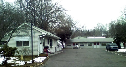
829 Berlin Tpke
BERL-000104-000158-000015-007887
Capitol
Commercialnec
Connecticut
CCD-1
15
B and X Area of moderate flood hazard, usually the area between the limits of the 100-year and 500-year floods.
1.13 AC
2025
Hartford CBD/South
2025
Hartford
400101
Hartford-West Hartford-East Hartford, CT
NEARBY LISTINGS FOR SALE OR LEASE
-
-
View all Berlin listings for sale on LoopNet.com
DEMOGRAPHICS near 829 Berlin Tpke
1 mile
3 mile
5 mile
2025 Total Population
2,377
43,047
143,307
2030 Population
2,425
43,468
144,891
Pop Growth 2025-2030
+ 2.02%
+ 0.98%
+ 1.11%
Average Age
47
42
41
2025 Total Households
1,047
17,786
58,167
HH Growth 2025-2030
+ 2.20%
+ 1.03%
+ 1.14%
Median Household Inc
$83,135
$88,118
$81,735
Avg Household Size
2.30
2.40
2.30
2025 Avg HH Vehicles
2.00
2.00
2.00
Median Home Value
$356,401
$335,859
$320,963
Median Year Built
1973
1973
1968
Nearby Places
Map Layers
Map Styles
 Street
 Aerial
Layers
 Traffic
 Biking
Places
Listings with unknown addresses are not visible on the map
- Restaurants
- Banks
- Shops
- Fitness
- Groceries
PUBLIC TRANSPORTATION
COMMUTER RAIL
Drive
Walk
Distance
5 min
2.1 mi
AIRPORT
Bradley International
Drive
Walk
Distance
Bradley International
46 min
28.2 mi
Tweed/New Haven
Drive
Walk
Distance
Tweed/New Haven
42 min
30.0 mi
Freight Ports
Port of New Haven
Drive
Walk
Distance
Port of New Haven
38 min
27.7 mi
Nearby Properties
Address
Land Use
TOTAL SIZE
Lot Size
Zoning
Address
Land Use
TOTAL SIZE
Lot Size
Zoning
109,079 SF
110.62 AC
OT
Address
Land Use
TOTAL SIZE
Lot Size
Zoning
24.70 AC
R-20
Address
Land Use
TOTAL SIZE
Lot Size
Zoning
43.15 AC
R-20
Address
Land Use
TOTAL SIZE
Lot Size
Zoning
17.38 AC
PRD
Address
Land Use
TOTAL SIZE
Lot Size
Zoning
403,000 SF
33.55 AC
IND
Address
Land Use
TOTAL SIZE
Lot Size
Zoning
241,225 SF
25.64 AC
R-11
Address
Land Use
TOTAL SIZE
Lot Size
Zoning
96,238 SF
6.75 AC
T
Address
Land Use
TOTAL SIZE
Lot Size
Zoning
13.34 AC
PD
Address
Land Use
TOTAL SIZE
Lot Size
Zoning
33.36 AC
T
Address
Land Use
TOTAL SIZE
Lot Size
Zoning
11.81 AC
PRD
Address
Land Use
TOTAL SIZE
Lot Size
Zoning
27,152 SF
8.75 AC
R-25
Address
Land Use
TOTAL SIZE
Lot Size
Zoning
21.35 AC
PD
Address
Land Use
TOTAL SIZE
Lot Size
Zoning
68 AC
R-20
Address
Land Use
TOTAL SIZE
Lot Size
Zoning
18.40 AC
PD
Address
Land Use
TOTAL SIZE
Lot Size
Zoning
129,626 SF
22.36 AC
IT
Address
Land Use
TOTAL SIZE
Lot Size
Zoning
5.20 AC
PD
Address
Land Use
TOTAL SIZE
Lot Size
Zoning
38,860 SF
38.47 AC
PS-B
Address
Land Use
TOTAL SIZE
Lot Size
Zoning
83,464 SF
13.96 AC
T
Address
Land Use
TOTAL SIZE
Lot Size
Zoning
185,902 SF
101.89 AC
GI-2
Address
Land Use
TOTAL SIZE
Lot Size
Zoning
16.29 AC
PD
Address
Land Use
TOTAL SIZE
Lot Size
Zoning
76,510 SF
10 AC
R-11
Address
Land Use
TOTAL SIZE
Lot Size
Zoning
15.50 AC
PRD
Address
Land Use
TOTAL SIZE
Lot Size
Zoning
18.53 AC
BTD
Address
Land Use
TOTAL SIZE
Lot Size
Zoning
91,663 SF
22.20 AC
R-21
Address
Land Use
TOTAL SIZE
Lot Size
Zoning
10.76 AC
PD
Address
Land Use
TOTAL SIZE
Lot Size
Zoning
44,084 SF
1.36 AC
T
Address
Land Use
TOTAL SIZE
Lot Size
Zoning
197,680 SF
26.91 AC
IT
Address
Land Use
TOTAL SIZE
Lot Size
Zoning
25.10 AC
R-15
Address
Land Use
TOTAL SIZE
Lot Size
Zoning
5.65 AC
HB
Address
Land Use
TOTAL SIZE
Lot Size
Zoning
125,492 SF
12.39 AC
PD
The World's #1 Commercial Real Estate Marketplace
Connect with us
© 2026 CoStar Group
The information above has been obtained from sources believed reliable. While we do not doubt its accuracy we have not verified it and make no guarantee, warranty or representation about it. It is your responsibility to independently confirm its accuracy and completeness. Any projections, opinions, assumptions, or estimates used are for example only and do not represent the current or future performance of the property. The value of this transaction to you depends on tax and other factors which should be evaluated by your tax, financial, and legal advisors. You and your advisors should conduct a careful, independent investigation of the property to determine to your satisfaction the suitability of the property for your needs.