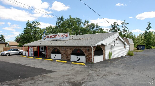
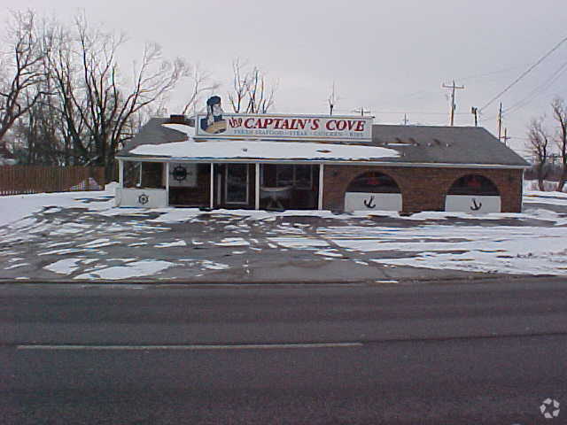
Property Record
829 Dick Rd, Buffalo, NY 14225

NEARBY LISTINGS FOR SALE OR LEASE
Property Detail
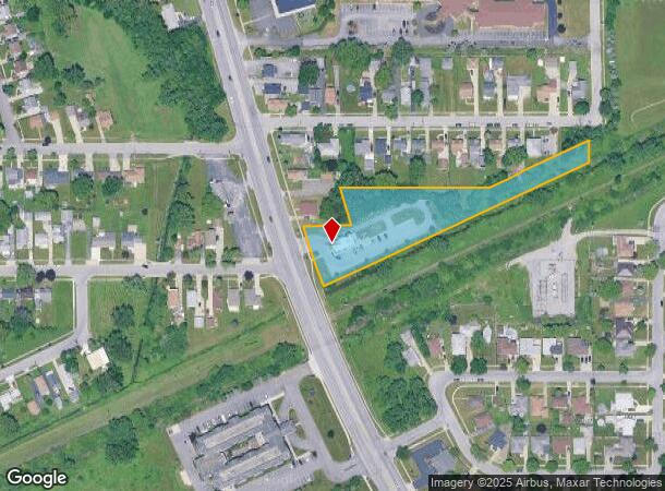
829 Dick Rd
143089 92.17-5-34.1
Holland Land Companys Survey
Restaurantdrivein
Erie
X
New York
36029C0236H
34.100
2025
1.90 AC
2024
East
010002
Buffalo/Niagara Falls
1,979 SF
Buffalo-Cheektowaga, NY
DEMOGRAPHICS near 829 Dick Rd
1 Mile
3 Mile
5 Mile
2024 Total Population
12,160
75,619
267,555
2029 Population
11,991
74,824
264,137
Pop Growth 2024-2029
(1.39%)
(1.05%)
(1.28%)
Average Age
43
43
41
2024 Total Households
5,559
33,899
114,209
HH Growth 2024-2029
(1.42%)
(1.13%)
(1.30%)
Median Household Inc
$58,094
$64,445
$59,794
Avg Household Size
2.10
2.10
2.20
2024 Avg HH Vehicles
2.00
2.00
2.00
Median Home Value
$149,940
$156,030
$173,312
Median Year Built
1961
1957
1957
Nearby Places
Map Layers
Map Styles
 Street
 Aerial
- Restaurants
- Banks
- Shops
- Fitness
- Groceries
PUBLIC TRANSPORTATION
COMMUTER RAIL
DRIVE
WALK
Distance
4 min
1.6 mi
DRIVE
WALK
Distance
4 min
1.7 mi
AIRPORT
Buffalo Niagara International
DRIVE
WALK
Distance
Buffalo Niagara International
7 min
2.8 mi
Niagara Falls International
DRIVE
WALK
Distance
Niagara Falls International
32 min
18.2 mi
SALE & LEASE HISTORY
LISTING DATE
SALE/LEASE

Sep 25, 2016
For Lease
Nearby Properties
Address
Land Use
TOTAL SIZE
Lot Size
Zoning
Address
Land Use
TOTAL SIZE
Lot Size
Zoning
462,256 SF
568.62 AC
05C
Address
Land Use
TOTAL SIZE
Lot Size
Zoning
461,943 SF
21.10 AC
Address
Land Use
TOTAL SIZE
Lot Size
Zoning
262,560 SF
26.40 AC
05C
Address
Land Use
TOTAL SIZE
Lot Size
Zoning
610,311 SF
33.66 AC
05C
Address
Land Use
TOTAL SIZE
Lot Size
Zoning
82,802 SF
12.80 AC
05C
Address
Land Use
TOTAL SIZE
Lot Size
Zoning
420,205 SF
34.42 AC
05
Address
Land Use
TOTAL SIZE
Lot Size
Zoning
172,400 SF
116.50 AC
Address
Land Use
TOTAL SIZE
Lot Size
Zoning
82.29 AC
05C
Address
Land Use
TOTAL SIZE
Lot Size
Zoning
203,546 SF
13.55 AC
Address
Land Use
TOTAL SIZE
Lot Size
Zoning
216,724 SF
66.09 AC
05C
Address
Land Use
TOTAL SIZE
Lot Size
Zoning
71,053 SF
2.52 AC
OB
Address
Land Use
TOTAL SIZE
Lot Size
Zoning
8,296 SF
16.60 AC
Address
Land Use
TOTAL SIZE
Lot Size
Zoning
172,001 SF
23.49 AC
Address
Land Use
TOTAL SIZE
Lot Size
Zoning
94,165 SF
24.34 AC
05C
Address
Land Use
TOTAL SIZE
Lot Size
Zoning
9,999 SF
27.02 AC
05C
Address
Land Use
TOTAL SIZE
Lot Size
Zoning
54,109 SF
6.19 AC
OB
Address
Land Use
TOTAL SIZE
Lot Size
Zoning
722,642 SF
46.80 AC
05C
Address
Land Use
TOTAL SIZE
Lot Size
Zoning
7,200 SF
20.20 AC
03RA
Address
Land Use
TOTAL SIZE
Lot Size
Zoning
3,712 SF
36.08 AC
03RA
Address
Land Use
TOTAL SIZE
Lot Size
Zoning
211,647 SF
1.76 AC
GB
Address
Land Use
TOTAL SIZE
Lot Size
Zoning
140,786 SF
11.88 AC
05C
Address
Land Use
TOTAL SIZE
Lot Size
Zoning
257,248 SF
61.44 AC
05C
Address
Land Use
TOTAL SIZE
Lot Size
Zoning
146,776 SF
9.19 AC
Address
Land Use
TOTAL SIZE
Lot Size
Zoning
19,640 SF
13.34 AC
00000
Address
Land Use
TOTAL SIZE
Lot Size
Zoning
40,509 SF
3.30 AC
Address
Land Use
TOTAL SIZE
Lot Size
Zoning
22,000 SF
22.58 AC
05C
Address
Land Use
TOTAL SIZE
Lot Size
Zoning
125,673 SF
8.61 AC
Address
Land Use
TOTAL SIZE
Lot Size
Zoning
35,000 SF
30.13 AC
Address
Land Use
TOTAL SIZE
Lot Size
Zoning
6,720 SF
11.10 AC
03RA
Address
Land Use
TOTAL SIZE
Lot Size
Zoning
87,289 SF
11.55 AC
05C
The World's #1 Commercial Real Estate Marketplace
Connect with us
© 2026 CoStar Group
The information above has been obtained from sources believed reliable. While we do not doubt its accuracy we have not verified it and make no guarantee, warranty or representation about it. It is your responsibility to independently confirm its accuracy and completeness. Any projections, opinions, assumptions, or estimates used are for example only and do not represent the current or future performance of the property. The value of this transaction to you depends on tax and other factors which should be evaluated by your tax, financial, and legal advisors. You and your advisors should conduct a careful, independent investigation of the property to determine to your satisfaction the suitability of the property for your needs.