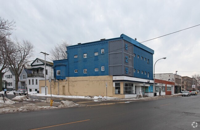
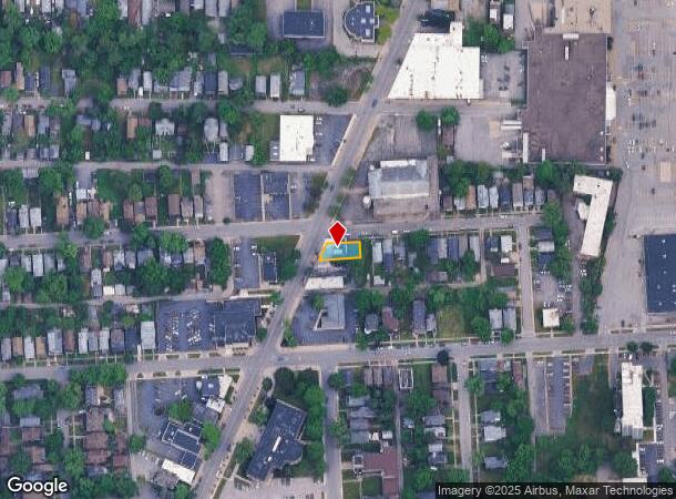
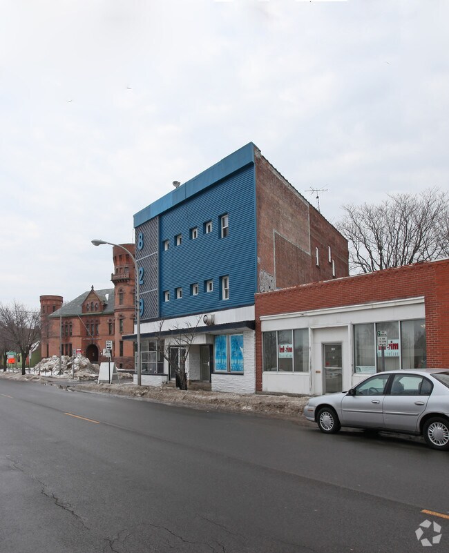
Property Record
829 Main St, Niagara Falls, NY 14301
NEARBY LISTINGS FOR SALE OR LEASE
Property Detail
829 Main St
Buffalo-Cheektowaga-Niagara Falls, NY
Mile Reserve
291100-144-078-0001-003-000
TM 31 BL C LOT 73 PT 71 AVG REAR 41 85
Commercialofficeresidentialmixeduse
Niagara
X
New York
36029C0010J
3.000
2025
0.10 AC
2024
Niagara Falls
020500
Buffalo/Niagara Falls
8,967 SF
DEMOGRAPHICS near 829 Main St
1 Mile
3 Mile
5 Mile
2024 Total Population
14,187
35,214
56,896
2029 Population
14,274
35,002
56,411
Pop Growth 2024-2029
+ 0.61%
(0.60%)
(0.85%)
Average Age
40
39
41
2024 Total Households
6,505
15,442
24,810
HH Growth 2024-2029
+ 0.55%
(0.63%)
(0.87%)
Median Household Inc
$29,163
$35,795
$44,137
Avg Household Size
2.00
2.10
2.20
2024 Avg HH Vehicles
1.00
1.00
1.00
Median Home Value
$63,028
$74,352
$100,499
Median Year Built
1946
1947
1949
Nearby Places
- Restaurants
- Banks
- Shops
- Fitness
- Groceries
PUBLIC TRANSPORTATION
COMMUTER RAIL
Niagara Falls Station (Toronto - New York - VIA Rail)
DRIVE
WALK
Distance
Niagara Falls Station (Toronto - New York - VIA Rail)
3 min
17 min
0.9 mi
Cbn (Maple Leaf - Amtrak)
DRIVE
WALK
Distance
Cbn (Maple Leaf - Amtrak)
3 min
1.3 mi
AIRPORT
Niagara Falls International
DRIVE
WALK
Distance
Niagara Falls International
14 min
6.4 mi
Buffalo Niagara International
DRIVE
WALK
Distance
Buffalo Niagara International
39 min
25.3 mi
Freight Ports
Port of Toledo
DRIVE
WALK
Distance
Port of Toledo
366 min
298.5 mi
Nearby Properties
Address
Land Use
TOTAL SIZE
Lot Size
Zoning
Address
Land Use
TOTAL SIZE
Lot Size
Zoning
305,119 SF
11.80 AC
D1-D
Address
Land Use
TOTAL SIZE
Lot Size
Zoning
34.59 AC
I2
Address
Land Use
TOTAL SIZE
Lot Size
Zoning
23,280 SF
163.20 AC
Address
Land Use
TOTAL SIZE
Lot Size
Zoning
170.93 AC
OS
Address
Land Use
TOTAL SIZE
Lot Size
Zoning
14.70 AC
I2
Address
Land Use
TOTAL SIZE
Lot Size
Zoning
95,628 SF
5.10 AC
C2-A
Address
Land Use
TOTAL SIZE
Lot Size
Zoning
86,660 SF
11.60 AC
I2
Address
Land Use
TOTAL SIZE
Lot Size
Zoning
441,749 SF
20.54 AC
I2
Address
Land Use
TOTAL SIZE
Lot Size
Zoning
375,735 SF
6.90 AC
OS
Address
Land Use
TOTAL SIZE
Lot Size
Zoning
0.89 AC
I2
Address
Land Use
TOTAL SIZE
Lot Size
Zoning
61.20 AC
02 - SINGL
Address
Land Use
TOTAL SIZE
Lot Size
Zoning
6,496 SF
9.50 AC
INS
Address
Land Use
TOTAL SIZE
Lot Size
Zoning
18,829 SF
2.76 AC
OS
Address
Land Use
TOTAL SIZE
Lot Size
Zoning
64,006 SF
447.28 AC
OS
Address
Land Use
TOTAL SIZE
Lot Size
Zoning
270,580 SF
2.10 AC
D1-A
Address
Land Use
TOTAL SIZE
Lot Size
Zoning
250,062 SF
2.60 AC
INS
Address
Land Use
TOTAL SIZE
Lot Size
Zoning
74,558 SF
1.90 AC
INS
Address
Land Use
TOTAL SIZE
Lot Size
Zoning
247.60 AC
Address
Land Use
TOTAL SIZE
Lot Size
Zoning
59,474 SF
10.14 AC
06 - INDUS
Address
Land Use
TOTAL SIZE
Lot Size
Zoning
3.30 AC
D1-D
Address
Land Use
TOTAL SIZE
Lot Size
Zoning
628,572 SF
4.22 AC
D1-B
Address
Land Use
TOTAL SIZE
Lot Size
Zoning
2,000 SF
4.90 AC
D2
Address
Land Use
TOTAL SIZE
Lot Size
Zoning
Address
Land Use
TOTAL SIZE
Lot Size
Zoning
106,800 SF
3.15 AC
D1-A
Address
Land Use
TOTAL SIZE
Lot Size
Zoning
296.91 AC
OS
Address
Land Use
TOTAL SIZE
Lot Size
Zoning
129,664 SF
5 AC
INS
Address
Land Use
TOTAL SIZE
Lot Size
Zoning
36,120 SF
83.58 AC
I1
Address
Land Use
TOTAL SIZE
Lot Size
Zoning
160,807 SF
3.80 AC
R4-A
Address
Land Use
TOTAL SIZE
Lot Size
Zoning
123,682 SF
3.30 AC
Address
Land Use
TOTAL SIZE
Lot Size
Zoning
336 SF
15.90 AC
D1-D
The World's #1 Commercial Real Estate Marketplace
Connect with us
© 2025 CoStar Group
The information above has been obtained from sources believed reliable. While we do not doubt its accuracy we have not verified it and make no guarantee, warranty or representation about it. It is your responsibility to independently confirm its accuracy and completeness. Any projections, opinions, assumptions, or estimates used are for example only and do not represent the current or future performance of the property. The value of this transaction to you depends on tax and other factors which should be evaluated by your tax, financial, and legal advisors. You and your advisors should conduct a careful, independent investigation of the property to determine to your satisfaction the suitability of the property for your needs.