Property Record
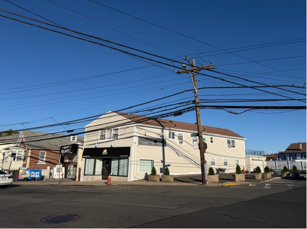
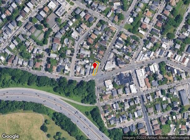
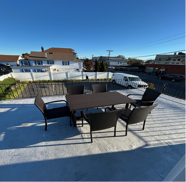
829 Midland Ave, Yonkers, NY 10704

This Property Is For Sale
NEARBY LISTINGS FOR SALE OR LEASE
Property Detail
829 Midland Ave
1800-005-000-05039-000-0016
Section Of Two Map Showing Subdivision O
Commercialofficeresidentialmixeduse
Westchester
X
New York
36119C0336F
16.000
2025
0.07 AC
2024
Southwest
002300
Westchester/So Connecticut
2,394 SF
New York-Jersey City-White Plains, NY-NJ
DEMOGRAPHICS near 829 Midland Ave
1 Mile
3 Mile
5 Mile
2024 Total Population
21,221
316,547
802,836
2029 Population
20,316
305,257
762,698
Pop Growth 2024-2029
(4.26%)
(3.57%)
(5.00%)
Average Age
42
41
40
2024 Total Households
7,907
120,335
298,753
HH Growth 2024-2029
(4.44%)
(3.70%)
(5.30%)
Median Household Inc
$89,056
$74,037
$69,968
Avg Household Size
2.50
2.50
2.60
2024 Avg HH Vehicles
2.00
1.00
1.00
Median Home Value
$458,160
$480,977
$551,620
Median Year Built
1955
1952
1952
Nearby Places
- Restaurants
- Banks
- Shops
- Fitness
- Groceries
PUBLIC TRANSPORTATION
COMMUTER RAIL
Fleetwood Station (Harlem Line - Metro-North Commuter Railroad Company (Metro-North))
DRIVE
WALK
Distance
Fleetwood Station (Harlem Line - Metro-North Commuter Railroad Company (Metro-North))
5 min
1.8 mi
Bronxville Station (Harlem Line - Metro-North Commuter Railroad Company (Metro-North))
DRIVE
WALK
Distance
Bronxville Station (Harlem Line - Metro-North Commuter Railroad Company (Metro-North))
5 min
2.2 mi
AIRPORT
LaGuardia
DRIVE
WALK
Distance
LaGuardia
27 min
16.6 mi
Westchester County
DRIVE
WALK
Distance
Westchester County
28 min
18.5 mi
John F Kennedy International
DRIVE
WALK
Distance
John F Kennedy International
36 min
24.4 mi
Freight Ports
NY - Red Hook Container Terminal
DRIVE
WALK
Distance
NY - Red Hook Container Terminal
40 min
24.8 mi
Nearby Properties
Address
Land Use
TOTAL SIZE
Lot Size
Zoning
Address
Land Use
TOTAL SIZE
Lot Size
Zoning
18,000 SF
13.85 AC
A
Address
Land Use
TOTAL SIZE
Lot Size
Zoning
201,590 SF
4.13 AC
BA
Address
Land Use
TOTAL SIZE
Lot Size
Zoning
301,156 SF
13.94 AC
A
Address
Land Use
TOTAL SIZE
Lot Size
Zoning
70,737 SF
1.67 AC
BB
Address
Land Use
TOTAL SIZE
Lot Size
Zoning
617,567 SF
3.19 AC
R7-1
Address
Land Use
TOTAL SIZE
Lot Size
Zoning
450,784 SF
42.36 AC
R4
Address
Land Use
TOTAL SIZE
Lot Size
Zoning
64,165 SF
3.24 AC
B
Address
Land Use
TOTAL SIZE
Lot Size
Zoning
61,055 SF
343.42 AC
R6
Address
Land Use
TOTAL SIZE
Lot Size
Zoning
5,170 SF
9.08 AC
B
Address
Land Use
TOTAL SIZE
Lot Size
Zoning
193,520 SF
4.32 AC
R4
Address
Land Use
TOTAL SIZE
Lot Size
Zoning
Address
Land Use
TOTAL SIZE
Lot Size
Zoning
159,260 SF
12.19 AC
R4
Address
Land Use
TOTAL SIZE
Lot Size
Zoning
192,939 SF
12.57 AC
R4
Address
Land Use
TOTAL SIZE
Lot Size
Zoning
103,158 SF
1.82 AC
R4
Address
Land Use
TOTAL SIZE
Lot Size
Zoning
38,912 SF
19.25 AC
R4
Address
Land Use
TOTAL SIZE
Lot Size
Zoning
7,855 SF
1.10 AC
C
Address
Land Use
TOTAL SIZE
Lot Size
Zoning
109,914 SF
2.09 AC
R4
Address
Land Use
TOTAL SIZE
Lot Size
Zoning
13,225 SF
136.69 AC
PARK
Address
Land Use
TOTAL SIZE
Lot Size
Zoning
Address
Land Use
TOTAL SIZE
Lot Size
Zoning
83,366 SF
5.92 AC
R4
Address
Land Use
TOTAL SIZE
Lot Size
Zoning
8.47 AC
PARK
Address
Land Use
TOTAL SIZE
Lot Size
Zoning
36,413 SF
0.89 AC
A
Address
Land Use
TOTAL SIZE
Lot Size
Zoning
125,976 SF
1.42 AC
R4
Address
Land Use
TOTAL SIZE
Lot Size
Zoning
34,560 SF
0.28 AC
BA
Address
Land Use
TOTAL SIZE
Lot Size
Zoning
23,116 SF
1.82 AC
C
Address
Land Use
TOTAL SIZE
Lot Size
Zoning
7,771 SF
1.21 AC
A
Address
Land Use
TOTAL SIZE
Lot Size
Zoning
162.42 AC
T
Address
Land Use
TOTAL SIZE
Lot Size
Zoning
1,658 SF
3.28 AC
A
Address
Land Use
TOTAL SIZE
Lot Size
Zoning
36,000 SF
0.28 AC
BA
Address
Land Use
TOTAL SIZE
Lot Size
Zoning
30.12 AC
I
The World's #1 Commercial Real Estate Marketplace
Connect with us
© 2025 CoStar Group
The information above has been obtained from sources believed reliable. While we do not doubt its accuracy we have not verified it and make no guarantee, warranty or representation about it. It is your responsibility to independently confirm its accuracy and completeness. Any projections, opinions, assumptions, or estimates used are for example only and do not represent the current or future performance of the property. The value of this transaction to you depends on tax and other factors which should be evaluated by your tax, financial, and legal advisors. You and your advisors should conduct a careful, independent investigation of the property to determine to your satisfaction the suitability of the property for your needs.