Property Record
829 Normal Rd, Dekalb, IL 60115


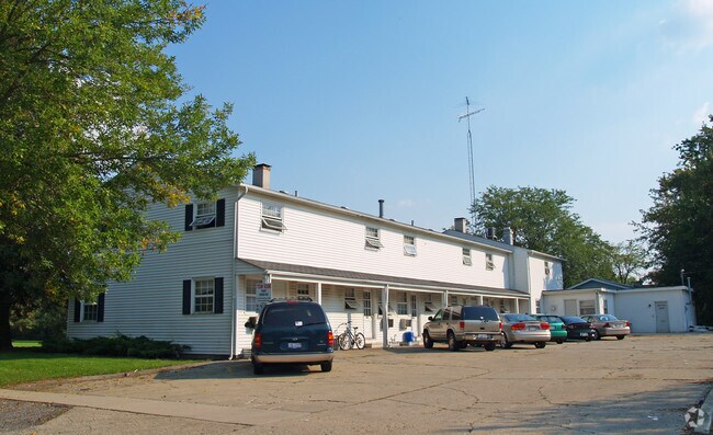

Property Detail
829 Normal Rd
Chicago-Naperville-Elgin, IL-IN
ROLLING MEADOWS SUB - LOT 1 BLOCK 6
08-15-179-007
DeKalb
Commercialnec
Illinois
B and X Area of moderate flood hazard, usually the area between the limits of the 100-year and 500-year floods.
1
2023
0.37 AC
2024
DeKalb
000900
Chicago
NEARBY LISTINGS FOR SALE OR LEASE
DEMOGRAPHICS near 829 Normal Rd
1 mile
3 mile
5 mile
2025 Total Population
18,384
42,808
57,815
2030 Population
18,826
43,348
58,527
Pop Growth 2025-2030
+ 2.40%
+ 1.26%
+ 1.23%
Average Age
28
34
35
2025 Total Households
6,333
16,301
22,281
HH Growth 2025-2030
+ 2.94%
+ 1.44%
+ 1.36%
Median Household Inc
$30,751
$50,995
$59,818
Avg Household Size
2.20
2.30
2.30
2025 Avg HH Vehicles
2.00
2.00
2.00
Median Home Value
$247,521
$215,258
$219,944
Median Year Built
1979
1977
1977
Nearby Places
Map Layers
Map Styles
 Street
 Aerial
Transit
 Traffic
 Biking
Places
Listings with unknown addresses are not visible on the map
- Restaurants
- Banks
- Shops
- Fitness
- Groceries
PUBLIC TRANSPORTATION
AIRPORT
Chicago/Rockford International
Drive
Walk
Distance
Chicago/Rockford International
52 min
34.0 mi
Nearby Properties
Address
Land Use
TOTAL SIZE
Lot Size
Zoning
Address
Land Use
TOTAL SIZE
Lot Size
Zoning
49.71 AC
Address
Land Use
TOTAL SIZE
Lot Size
Zoning
26.65 AC
Address
Land Use
TOTAL SIZE
Lot Size
Zoning
49.73 AC
Address
Land Use
TOTAL SIZE
Lot Size
Zoning
98.56 AC
Address
Land Use
TOTAL SIZE
Lot Size
Zoning
94.65 AC
Address
Land Use
TOTAL SIZE
Lot Size
Zoning
21.61 AC
Address
Land Use
TOTAL SIZE
Lot Size
Zoning
15.79 AC
Address
Land Use
TOTAL SIZE
Lot Size
Zoning
25.70 AC
Address
Land Use
TOTAL SIZE
Lot Size
Zoning
13.48 AC
BC
Address
Land Use
TOTAL SIZE
Lot Size
Zoning
Address
Land Use
TOTAL SIZE
Lot Size
Zoning
Address
Land Use
TOTAL SIZE
Lot Size
Zoning
20.83 AC
Address
Land Use
TOTAL SIZE
Lot Size
Zoning
9.39 AC
Address
Land Use
TOTAL SIZE
Lot Size
Zoning
70,481 SF
7.93 AC
Address
Land Use
TOTAL SIZE
Lot Size
Zoning
9.04 AC
Address
Land Use
TOTAL SIZE
Lot Size
Zoning
8.70 AC
A1
Address
Land Use
TOTAL SIZE
Lot Size
Zoning
11.50 AC
Address
Land Use
TOTAL SIZE
Lot Size
Zoning
0.05 AC
Address
Land Use
TOTAL SIZE
Lot Size
Zoning
57.46 AC
Address
Land Use
TOTAL SIZE
Lot Size
Zoning
13.48 AC
Address
Land Use
TOTAL SIZE
Lot Size
Zoning
9.56 AC
RC2
Address
Land Use
TOTAL SIZE
Lot Size
Zoning
8.14 AC
Address
Land Use
TOTAL SIZE
Lot Size
Zoning
21.35 AC
Address
Land Use
TOTAL SIZE
Lot Size
Zoning
24.39 AC
Address
Land Use
TOTAL SIZE
Lot Size
Zoning
23.25 AC
Address
Land Use
TOTAL SIZE
Lot Size
Zoning
7.41 AC
Address
Land Use
TOTAL SIZE
Lot Size
Zoning
202,500 SF
15.65 AC
Address
Land Use
TOTAL SIZE
Lot Size
Zoning
5.59 AC
Address
Land Use
TOTAL SIZE
Lot Size
Zoning
5.77 AC
RC2
Address
Land Use
TOTAL SIZE
Lot Size
Zoning
8.78 AC
The World's #1 Commercial Real Estate Marketplace
Connect with us
© 2026 CoStar Group
The information above has been obtained from sources believed reliable. While we do not doubt its accuracy we have not verified it and make no guarantee, warranty or representation about it. It is your responsibility to independently confirm its accuracy and completeness. Any projections, opinions, assumptions, or estimates used are for example only and do not represent the current or future performance of the property. The value of this transaction to you depends on tax and other factors which should be evaluated by your tax, financial, and legal advisors. You and your advisors should conduct a careful, independent investigation of the property to determine to your satisfaction the suitability of the property for your needs.