Property Record
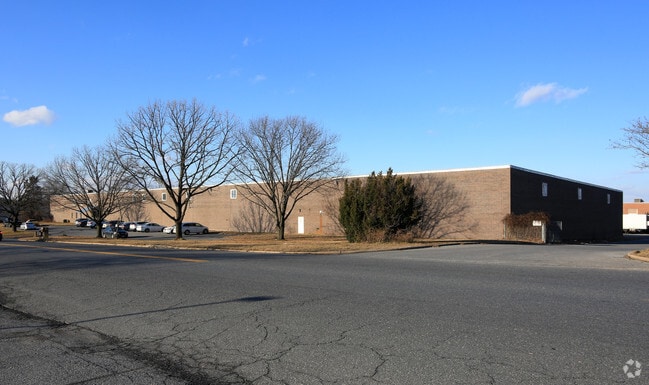
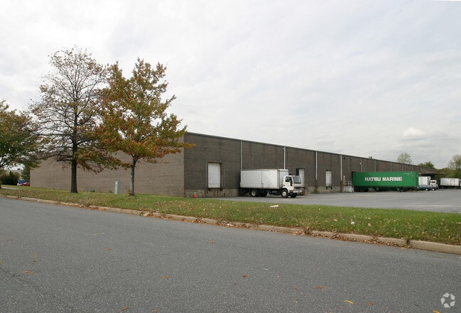
8290 Patuxent Range Rd, Jessup, MD 20794


NEARBY LISTINGS FOR SALE OR LEASE
Property Detail
8290 Patuxent Range Rd
Baltimore-Columbia-Towson, MD
Baltimore-Washington Industria
06-410960
PAR A 3.46 A. 8290 PATUXENT RANGE RD ANNAPOLIS JCT BLK E S 1
Distributionwarehouseregional
Howard
X
Maryland
24027C0170D
a
2024
3.46 AC
2025
Route 1 Corridor
606901
Baltimore
59,200 SF
DEMOGRAPHICS near 8290 Patuxent Range Rd
1 mile
3 mile
5 mile
2024 Total Population
2,134
61,661
207,432
2029 Population
2,213
63,563
212,988
Pop Growth 2024-2029
+ 3.70%
+ 3.08%
+ 2.68%
Average Age
40
36
37
2024 Total Households
701
22,298
75,542
HH Growth 2024-2029
+ 3.85%
+ 3.05%
+ 2.66%
Median Household Inc
$80,722
$118,154
$114,248
Avg Household Size
2.70
2.60
2.70
2024 Avg HH Vehicles
2.00
2.00
2.00
Median Home Value
$167,187
$398,352
$401,651
Median Year Built
1993
1995
1990
Nearby Places
Map Layers
Map Styles
 Street
 Aerial
Transit
 Traffic
 Biking
Places
Listings with unknown addresses are not visible on the map
- Restaurants
- Banks
- Shops
- Fitness
- Groceries
PUBLIC TRANSPORTATION
COMMUTER RAIL
Jessup (Camden Line - Maryland Area Regional Commuter Trains (The MARC))
Drive
Walk
Distance
Jessup (Camden Line - Maryland Area Regional Commuter Trains (The MARC))
5 min
2.0 mi
Savage (Camden Line - Maryland Area Regional Commuter Trains (The MARC))
Drive
Walk
Distance
Savage (Camden Line - Maryland Area Regional Commuter Trains (The MARC))
6 min
2.6 mi
AIRPORT
Baltimore/Washington International Thurgood Marshall
Drive
Walk
Distance
Baltimore/Washington International Thurgood Marshall
19 min
12.9 mi
Ronald Reagan Washington Ntl
Drive
Walk
Distance
Ronald Reagan Washington Ntl
47 min
30.0 mi
Freight Ports
Port of Baltimore
Drive
Walk
Distance
Port of Baltimore
24 min
15.8 mi
Nearby Properties
Address
Land Use
TOTAL SIZE
Lot Size
Zoning
Address
Land Use
TOTAL SIZE
Lot Size
Zoning
1,007,900 SF
88.77 AC
M2
Address
Land Use
TOTAL SIZE
Lot Size
Zoning
594.68 AC
R1
Address
Land Use
TOTAL SIZE
Lot Size
Zoning
238,700 SF
7.43 AC
TOD
Address
Land Use
TOTAL SIZE
Lot Size
Zoning
853,520 SF
47.33 AC
M2
Address
Land Use
TOTAL SIZE
Lot Size
Zoning
31,730 SF
43.99 AC
RA15
Address
Land Use
TOTAL SIZE
Lot Size
Zoning
500,970 SF
18.88 AC
MXD-E
Address
Land Use
TOTAL SIZE
Lot Size
Zoning
796,368 SF
11.80 AC
R5
Address
Land Use
TOTAL SIZE
Lot Size
Zoning
376,918 SF
8.55 AC
W1
Address
Land Use
TOTAL SIZE
Lot Size
Zoning
295,684 SF
33.25 AC
RSCMX
Address
Land Use
TOTAL SIZE
Lot Size
Zoning
77,028 SF
18.68 AC
NT
Address
Land Use
TOTAL SIZE
Lot Size
Zoning
307,626 SF
5.46 AC
CACLI
Address
Land Use
TOTAL SIZE
Lot Size
Zoning
234,264 SF
5.03 AC
W1
Address
Land Use
TOTAL SIZE
Lot Size
Zoning
221,100 SF
1.75 AC
MXD-E
Address
Land Use
TOTAL SIZE
Lot Size
Zoning
988,378 SF
115.55 AC
M1
Address
Land Use
TOTAL SIZE
Lot Size
Zoning
256,156 SF
14.56 AC
M1
Address
Land Use
TOTAL SIZE
Lot Size
Zoning
192,703 SF
6.67 AC
W-1
Address
Land Use
TOTAL SIZE
Lot Size
Zoning
490,875 SF
9.52 AC
MXD-E
Address
Land Use
TOTAL SIZE
Lot Size
Zoning
551,529 SF
9.52 AC
W1
Address
Land Use
TOTAL SIZE
Lot Size
Zoning
370,240 SF
4.18 AC
CACLI
Address
Land Use
TOTAL SIZE
Lot Size
Zoning
539,758 SF
48.32 AC
M1
Address
Land Use
TOTAL SIZE
Lot Size
Zoning
612,900 SF
37.43 AC
M2
Address
Land Use
TOTAL SIZE
Lot Size
Zoning
161,528 SF
10.86 AC
W1
Address
Land Use
TOTAL SIZE
Lot Size
Zoning
55,400 SF
10.19 AC
CACLI
Address
Land Use
TOTAL SIZE
Lot Size
Zoning
164,448 SF
3.87 AC
W1
Address
Land Use
TOTAL SIZE
Lot Size
Zoning
126,960 SF
13.72 AC
MXDR
Address
Land Use
TOTAL SIZE
Lot Size
Zoning
291,250 SF
30.09 AC
CECLI
Address
Land Use
TOTAL SIZE
Lot Size
Zoning
6,201 SF
71.87 AC
M 2
Address
Land Use
TOTAL SIZE
Lot Size
Zoning
162,729 SF
10.18 AC
W1
Address
Land Use
TOTAL SIZE
Lot Size
Zoning
125,480 SF
11.30 AC
W1
Address
Land Use
TOTAL SIZE
Lot Size
Zoning
135,000 SF
11.69 AC
W1
The World's #1 Commercial Real Estate Marketplace
Connect with us
© 2026 CoStar Group
The information above has been obtained from sources believed reliable. While we do not doubt its accuracy we have not verified it and make no guarantee, warranty or representation about it. It is your responsibility to independently confirm its accuracy and completeness. Any projections, opinions, assumptions, or estimates used are for example only and do not represent the current or future performance of the property. The value of this transaction to you depends on tax and other factors which should be evaluated by your tax, financial, and legal advisors. You and your advisors should conduct a careful, independent investigation of the property to determine to your satisfaction the suitability of the property for your needs.