Property Record
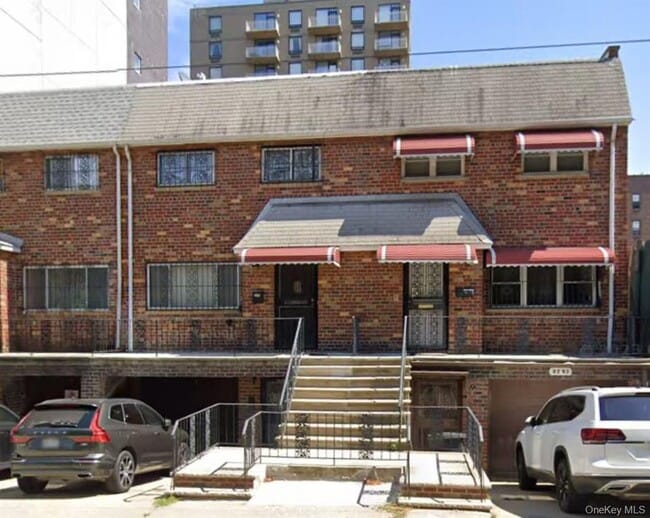
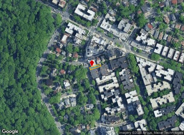
8291 116Th St, Richmond Hill, NY 11418
This Property Is For Sale
NEARBY LISTINGS FOR SALE OR LEASE
-
-
-
-
-
-
-
-
-
-
-
-
-
-
-
-
No Photo
-
-
-
-
-
View all Richmond Hill listings for sale on LoopNet.com
Property Detail
8291 116Th St
New York-Jersey City-White Plains, NY-NJ
Queens
03321-0376
New York
Duplex
0.05 AC
X
Central Queens
3604970229F
Long Island (New York)
1,800 SF
DEMOGRAPHICS near 8291 116Th St
1 Mile
3 Mile
5 Mile
2024 Total Population
81,686
772,268
1,947,099
2029 Population
77,004
717,399
1,810,664
Pop Growth 2024-2029
(5.73%)
(7.10%)
(7.01%)
Average Age
42
41
41
2024 Total Households
32,317
262,666
659,975
HH Growth 2024-2029
(5.62%)
(7.13%)
(7.20%)
Median Household Inc
$84,151
$72,945
$66,425
Avg Household Size
2.40
2.80
2.80
2024 Avg HH Vehicles
1.00
1.00
1.00
Median Home Value
$624,451
$661,688
$668,446
Median Year Built
1948
1952
1952
Nearby Places
- Restaurants
- Banks
- Shops
- Fitness
- Groceries
Nearby Properties
Address
Land Use
TOTAL SIZE
Lot Size
Zoning
Address
Land Use
TOTAL SIZE
Lot Size
Zoning
4,528,000 SF
94.27 AC
R4
Address
Land Use
TOTAL SIZE
Lot Size
Zoning
2,078,606 SF
58.93 AC
R4
Address
Land Use
TOTAL SIZE
Lot Size
Zoning
1,845,252 SF
172 AC
C8-1
Address
Land Use
TOTAL SIZE
Lot Size
Zoning
1,069,367 SF
14.65 AC
R4
Address
Land Use
TOTAL SIZE
Lot Size
Zoning
772,163 SF
5.24 AC
C4-5X
Address
Land Use
TOTAL SIZE
Lot Size
Zoning
54,170 SF
229.57 AC
PARK
Address
Land Use
TOTAL SIZE
Lot Size
Zoning
1,292,074 SF
C4-2F
Address
Land Use
TOTAL SIZE
Lot Size
Zoning
234,891 SF
3.17 AC
C4-5X
Address
Land Use
TOTAL SIZE
Lot Size
Zoning
1,516,458 SF
5.97 AC
R7-1
Address
Land Use
TOTAL SIZE
Lot Size
Zoning
532,011 SF
2.48 AC
R6
Address
Land Use
TOTAL SIZE
Lot Size
Zoning
15,000 SF
255.27 AC
PARK
Address
Land Use
TOTAL SIZE
Lot Size
Zoning
126.85 AC
PARK
Address
Land Use
TOTAL SIZE
Lot Size
Zoning
1,000 SF
210.07 AC
R3-2
Address
Land Use
TOTAL SIZE
Lot Size
Zoning
1,572,198 SF
22.06 AC
M1-2
Address
Land Use
TOTAL SIZE
Lot Size
Zoning
738,000 SF
1.92 AC
C6-3
Address
Land Use
TOTAL SIZE
Lot Size
Zoning
344,116 SF
0.92 AC
R7-1
Address
Land Use
TOTAL SIZE
Lot Size
Zoning
577,654 SF
5.38 AC
R6
Address
Land Use
TOTAL SIZE
Lot Size
Zoning
291,589 SF
1.55 AC
C6-3
Address
Land Use
TOTAL SIZE
Lot Size
Zoning
2,193 SF
94.72 AC
PARK
Address
Land Use
TOTAL SIZE
Lot Size
Zoning
521,944 SF
16.68 AC
R4
Address
Land Use
TOTAL SIZE
Lot Size
Zoning
360,000 SF
5.88 AC
C4-2
Address
Land Use
TOTAL SIZE
Lot Size
Zoning
307,038 SF
7.84 AC
M1-1
Address
Land Use
TOTAL SIZE
Lot Size
Zoning
234,452 SF
2.99 AC
R4
Address
Land Use
TOTAL SIZE
Lot Size
Zoning
474,715 SF
1.72 AC
M14R8A
Address
Land Use
TOTAL SIZE
Lot Size
Zoning
490,600 SF
12.01 AC
M1-1
Address
Land Use
TOTAL SIZE
Lot Size
Zoning
320,535 SF
1.52 AC
C4-4A
Address
Land Use
TOTAL SIZE
Lot Size
Zoning
248,200 SF
1.25 AC
R6
Address
Land Use
TOTAL SIZE
Lot Size
Zoning
384,249 SF
5.56 AC
R5
Address
Land Use
TOTAL SIZE
Lot Size
Zoning
364,424 SF
C5-3
Address
Land Use
TOTAL SIZE
Lot Size
Zoning
478,384 SF
1.23 AC
C6-3
The World's #1 Commercial Real Estate Marketplace
Connect with us
© 2025 CoStar Group
The information above has been obtained from sources believed reliable. While we do not doubt its accuracy we have not verified it and make no guarantee, warranty or representation about it. It is your responsibility to independently confirm its accuracy and completeness. Any projections, opinions, assumptions, or estimates used are for example only and do not represent the current or future performance of the property. The value of this transaction to you depends on tax and other factors which should be evaluated by your tax, financial, and legal advisors. You and your advisors should conduct a careful, independent investigation of the property to determine to your satisfaction the suitability of the property for your needs.