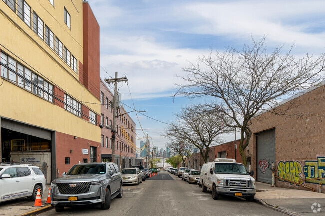
Property Record
83 Apollo St, Brooklyn, NY 11222
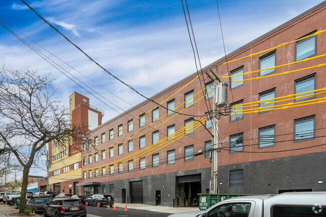

Property Detail
83 Apollo St
02661-0016
Kings
Warehouse
New York
M1-2
16
B and X Area of moderate flood hazard, usually the area between the limits of the 100-year and 500-year floods.
0.31 AC
2024
North Brooklyn
2025
Long Island (New York)
057300
New York-Jersey City-White Plains, NY-NJ
13,328 SF
NEARBY LISTINGS FOR SALE OR LEASE
DEMOGRAPHICS near 83 Apollo St
1 mile
3 mile
5 mile
2025 Total Population
53,175
1,292,991
3,356,882
2030 Population
53,583
1,319,260
3,410,347
Pop Growth 2025-2030
+ 0.77%
+ 2.03%
+ 1.59%
Average Age
38
39
40
2025 Total Households
24,294
555,910
1,430,793
HH Growth 2025-2030
+ 0.31%
+ 2.41%
+ 2.06%
Median Household Inc
$126,168
$98,139
$100,790
Avg Household Size
2.10
2.20
2.20
2025 Avg HH Vehicles
.00
.00
.00
Median Home Value
$1,071,058
$904,821
$945,895
Median Year Built
1948
1955
1952
Nearby Places
Map Layers
Map Styles
 Street
 Aerial
Transit
 Traffic
 Biking
Places
Listings with unknown addresses are not visible on the map
- Restaurants
- Banks
- Shops
- Fitness
- Groceries
PUBLIC TRANSPORTATION
TRANSIT/SUBWAY
Nassau Avenue (G - New York MTA Subway (The Subway))
Drive
Walk
Distance
Nassau Avenue (G - New York MTA Subway (The Subway))
5 min
15 min
0.8 mi
Lorimer Street (L Line) (L - New York MTA Subway (The Subway))
Drive
Walk
Distance
Lorimer Street (L Line) (L - New York MTA Subway (The Subway))
6 min
17 min
0.9 mi
COMMUTER RAIL
Hunterspoint Avenue Station (Hempstead Branch - Long Island Rail Road, Oyster Bay Branch - Long Island Rail Road)
Drive
Walk
Distance
Hunterspoint Avenue Station (Hempstead Branch - Long Island Rail Road, Oyster Bay Branch - Long Island Rail Road)
7 min
1.9 mi
Woodside Station (Babylon Branch - Long Island Rail Road, Far Rockaway Branch - Long Island Rail Road, Hempstead Branch - Long Island Rail Road, Long Beach Branch - Long Island Rail Road, Montauk Branch - Long Island Rail Road, Port Jefferson Branch - Long Island Rail Road, Port Washington Branch - Long Island Rail Road, Ronkonkoma Branch - Long Island Rail Road)
Drive
Walk
Distance
Woodside Station (Babylon Branch - Long Island Rail Road, Far Rockaway Branch - Long Island Rail Road, Hempstead Branch - Long Island Rail Road, Long Beach Branch - Long Island Rail Road, Montauk Branch - Long Island Rail Road, Port Jefferson Branch - Long Island Rail Road, Port Washington Branch - Long Island Rail Road, Ronkonkoma Branch - Long Island Rail Road)
9 min
3.9 mi
AIRPORT
LaGuardia
Drive
Walk
Distance
LaGuardia
10 min
6.2 mi
John F Kennedy International
Drive
Walk
Distance
John F Kennedy International
21 min
14.3 mi
Newark Liberty International
Drive
Walk
Distance
Newark Liberty International
34 min
16.3 mi
Freight Ports
NY - Red Hook Container Terminal
Drive
Walk
Distance
NY - Red Hook Container Terminal
1 min
4.6 mi
SALE & LEASE HISTORY
LISTING DATE
SALE/LEASE

Sep 25, 2018
For Sale
Oct 30, 2023
For Sale
Nov 27, 2018
For Lease
Nov 27, 2018
For Lease
Nov 27, 2018
For Lease
Nov 06, 2019
For Sale
Mar 26, 2018
For Sale
Feb 04, 2019
For Sale
Feb 01, 2021
For Sale
Aug 23, 2018
For Sale
Nearby Properties
Address
Land Use
TOTAL SIZE
Lot Size
Zoning
Address
Land Use
TOTAL SIZE
Lot Size
Zoning
8,462,176 SF
61.41 AC
R7-2
Address
Land Use
TOTAL SIZE
Lot Size
Zoning
1,678,135 SF
1.01 AC
C5-3
Address
Land Use
TOTAL SIZE
Lot Size
Zoning
2,812,739 SF
2.10 AC
C5-3
Address
Land Use
TOTAL SIZE
Lot Size
Zoning
1,586,876 SF
1.87 AC
C5-3
Address
Land Use
TOTAL SIZE
Lot Size
Zoning
2,344,406 SF
1.84 AC
C5-3
Address
Land Use
TOTAL SIZE
Lot Size
Zoning
2,400,000 SF
15.14 AC
C5-2
Address
Land Use
TOTAL SIZE
Lot Size
Zoning
2,124,441 SF
17.29 AC
R8
Address
Land Use
TOTAL SIZE
Lot Size
Zoning
1,160,500 SF
1.62 AC
C6-6
Address
Land Use
TOTAL SIZE
Lot Size
Zoning
2,230,742 SF
6.33 AC
R9
Address
Land Use
TOTAL SIZE
Lot Size
Zoning
1,015,287 SF
1 AC
C5-3
Address
Land Use
TOTAL SIZE
Lot Size
Zoning
1,233,394 SF
1.78 AC
C5-3
Address
Land Use
TOTAL SIZE
Lot Size
Zoning
1,134,017 SF
1.05 AC
C5-3
Address
Land Use
TOTAL SIZE
Lot Size
Zoning
822,014 SF
1.38 AC
C52.5
Address
Land Use
TOTAL SIZE
Lot Size
Zoning
1,104,505 SF
2.32 AC
C4-7
Address
Land Use
TOTAL SIZE
Lot Size
Zoning
916,553 SF
1.39 AC
C5-3
Address
Land Use
TOTAL SIZE
Lot Size
Zoning
539,643 SF
C5-2
Address
Land Use
TOTAL SIZE
Lot Size
Zoning
1,033,031 SF
1.87 AC
C52.5
Address
Land Use
TOTAL SIZE
Lot Size
Zoning
1,064,223 SF
0.88 AC
C52.5
Address
Land Use
TOTAL SIZE
Lot Size
Zoning
940,000 SF
1.44 AC
C6-2
Address
Land Use
TOTAL SIZE
Lot Size
Zoning
1,242,587 SF
1.49 AC
C6-6
Address
Land Use
TOTAL SIZE
Lot Size
Zoning
1,174,988 SF
0.99 AC
C5-3
Address
Land Use
TOTAL SIZE
Lot Size
Zoning
1,050,990 SF
1.21 AC
C52.5
Address
Land Use
TOTAL SIZE
Lot Size
Zoning
782,503 SF
0.88 AC
C5-3
Address
Land Use
TOTAL SIZE
Lot Size
Zoning
984,485 SF
1.03 AC
C6-6
Address
Land Use
TOTAL SIZE
Lot Size
Zoning
693,256 SF
1.18 AC
C5-3
Address
Land Use
TOTAL SIZE
Lot Size
Zoning
7,058,736 SF
147.61 AC
M3-1
Address
Land Use
TOTAL SIZE
Lot Size
Zoning
624,883 SF
0.75 AC
C6-6
Address
Land Use
TOTAL SIZE
Lot Size
Zoning
810,426 SF
0.81 AC
C52.5
Address
Land Use
TOTAL SIZE
Lot Size
Zoning
3,122,165 SF
19.02 AC
R7-2
Address
Land Use
TOTAL SIZE
Lot Size
Zoning
1,212,596 SF
1.59 AC
C5-3
The World's #1 Commercial Real Estate Marketplace
Connect with us
© 2026 CoStar Group
The information above has been obtained from sources believed reliable. While we do not doubt its accuracy we have not verified it and make no guarantee, warranty or representation about it. It is your responsibility to independently confirm its accuracy and completeness. Any projections, opinions, assumptions, or estimates used are for example only and do not represent the current or future performance of the property. The value of this transaction to you depends on tax and other factors which should be evaluated by your tax, financial, and legal advisors. You and your advisors should conduct a careful, independent investigation of the property to determine to your satisfaction the suitability of the property for your needs.