Property Record
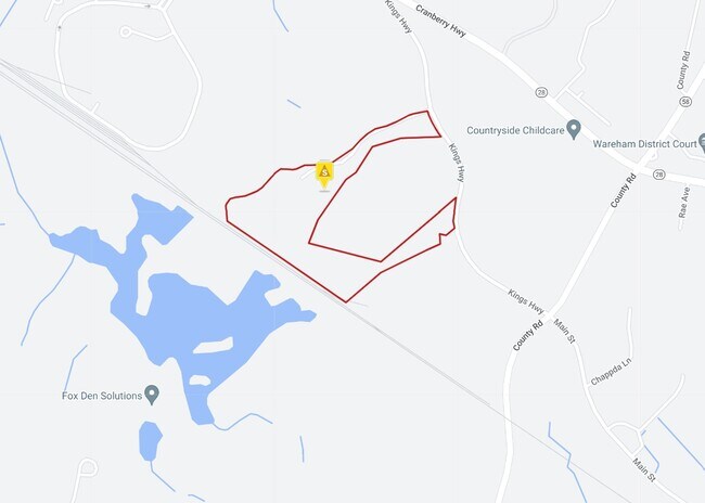
83 Kings Hwy, West Wareham, MA 02576

NEARBY LISTINGS FOR SALE OR LEASE
Property Detail
83 Kings Hwy
ROCH-000170-000000-000021A
Plymouth
Industrialacreage
Massachusetts
X
21-a
25023C0466K
19.90 AC
2025
Route 3 South
2025
Boston
541100
Boston-Cambridge-Newton, MA-NH
DEMOGRAPHICS near 83 Kings Hwy
1 Mile
3 Mile
5 Mile
2024 Total Population
523
6,647
21,191
2029 Population
526
6,699
21,447
Pop Growth 2024-2029
+ 0.57%
+ 0.78%
+ 1.21%
Average Age
46
45
45
2024 Total Households
215
2,624
8,467
HH Growth 2024-2029
+ 0.47%
+ 0.69%
+ 1.22%
Median Household Inc
$64,444
$73,758
$78,949
Avg Household Size
2.40
2.50
2.50
2024 Avg HH Vehicles
2.00
2.00
2.00
Median Home Value
$375,999
$397,058
$408,428
Median Year Built
1985
1984
1981
Nearby Places
Map Layers
Map Styles
 Street
 Aerial
- Restaurants
- Banks
- Shops
- Fitness
- Groceries
PUBLIC TRANSPORTATION
COMMUTER RAIL
Wareham Village (CapeFLYER - Cape Cod Regional Transit Authority)
DRIVE
WALK
Distance
Wareham Village (CapeFLYER - Cape Cod Regional Transit Authority)
8 min
4.8 mi
AIRPORT
Martha's Vineyard
DRIVE
WALK
Distance
Martha's Vineyard
106 min
45.1 mi
Freight Ports
Port of New Bedford Harbor
DRIVE
WALK
Distance
Port of New Bedford Harbor
26 min
18.9 mi
Nearby Properties
Address
Land Use
TOTAL SIZE
Lot Size
Zoning
Address
Land Use
TOTAL SIZE
Lot Size
Zoning
44.75 AC
Address
Land Use
TOTAL SIZE
Lot Size
Zoning
62.24 AC
I
Address
Land Use
TOTAL SIZE
Lot Size
Zoning
38.29 AC
Address
Land Use
TOTAL SIZE
Lot Size
Zoning
93,333 SF
1.19 AC
Address
Land Use
TOTAL SIZE
Lot Size
Zoning
151,614 SF
21.68 AC
Address
Land Use
TOTAL SIZE
Lot Size
Zoning
88,000 SF
12.71 AC
Address
Land Use
TOTAL SIZE
Lot Size
Zoning
95,790 SF
60.72 AC
A/R
Address
Land Use
TOTAL SIZE
Lot Size
Zoning
68,028 SF
15.56 AC
Address
Land Use
TOTAL SIZE
Lot Size
Zoning
135,083 SF
12.29 AC
Address
Land Use
TOTAL SIZE
Lot Size
Zoning
67,086 SF
6.72 AC
Address
Land Use
TOTAL SIZE
Lot Size
Zoning
126,525 SF
7.67 AC
Address
Land Use
TOTAL SIZE
Lot Size
Zoning
179,900 SF
17.30 AC
Address
Land Use
TOTAL SIZE
Lot Size
Zoning
36,492 SF
5.68 AC
Address
Land Use
TOTAL SIZE
Lot Size
Zoning
62,698 SF
5.63 AC
Address
Land Use
TOTAL SIZE
Lot Size
Zoning
43.44 AC
Address
Land Use
TOTAL SIZE
Lot Size
Zoning
2,274 SF
1.58 AC
Address
Land Use
TOTAL SIZE
Lot Size
Zoning
40,392 SF
2.88 AC
Address
Land Use
TOTAL SIZE
Lot Size
Zoning
119,430 SF
8.62 AC
Address
Land Use
TOTAL SIZE
Lot Size
Zoning
Address
Land Use
TOTAL SIZE
Lot Size
Zoning
5.10 AC
Address
Land Use
TOTAL SIZE
Lot Size
Zoning
10 AC
IA
Address
Land Use
TOTAL SIZE
Lot Size
Zoning
67,000 SF
6.01 AC
Address
Land Use
TOTAL SIZE
Lot Size
Zoning
60,000 SF
1.85 AC
Address
Land Use
TOTAL SIZE
Lot Size
Zoning
2,638 SF
8.90 AC
Address
Land Use
TOTAL SIZE
Lot Size
Zoning
12,080 SF
5.95 AC
Address
Land Use
TOTAL SIZE
Lot Size
Zoning
79.26 AC
A/R
Address
Land Use
TOTAL SIZE
Lot Size
Zoning
62,326 SF
8.91 AC
Address
Land Use
TOTAL SIZE
Lot Size
Zoning
72,504 SF
10.63 AC
Address
Land Use
TOTAL SIZE
Lot Size
Zoning
3,650 SF
4.03 AC
Address
Land Use
TOTAL SIZE
Lot Size
Zoning
15.46 AC
The World's #1 Commercial Real Estate Marketplace
Connect with us
© 2025 CoStar Group
The information above has been obtained from sources believed reliable. While we do not doubt its accuracy we have not verified it and make no guarantee, warranty or representation about it. It is your responsibility to independently confirm its accuracy and completeness. Any projections, opinions, assumptions, or estimates used are for example only and do not represent the current or future performance of the property. The value of this transaction to you depends on tax and other factors which should be evaluated by your tax, financial, and legal advisors. You and your advisors should conduct a careful, independent investigation of the property to determine to your satisfaction the suitability of the property for your needs.