Property Record
830 9Th St S, Jacksonville Beach, FL 32250
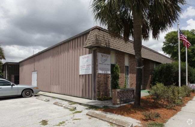


Property Detail
830 9Th St S
176620-0000
8-13 04-3S-29E OCEANSIDE PARK LOTS 11,12 BLK 90
Lightindustrial
Duval
JI-1
Florida
B and X Area of moderate flood hazard, usually the area between the limits of the 100-year and 500-year floods.
11,12
2025
0.26 AC
2026
Beaches
014204
Jacksonville (Florida)
7,080 SF
Jacksonville, FL
NEARBY LISTINGS FOR SALE OR LEASE
-
-
View all Jacksonville Beach listings for sale on LoopNet.com
DEMOGRAPHICS near 830 9Th St S
1 mile
3 mile
5 mile
2025 Total Population
11,886
47,330
113,370
2030 Population
12,749
50,807
121,959
Pop Growth 2025-2030
+ 7.26%
+ 7.35%
+ 7.58%
Average Age
43
43
43
2025 Total Households
5,870
21,824
50,500
HH Growth 2025-2030
+ 7.72%
+ 7.69%
+ 7.92%
Median Household Inc
$112,612
$112,735
$105,588
Avg Household Size
2.00
2.10
2.20
2025 Avg HH Vehicles
2.00
2.00
2.00
Median Home Value
$612,175
$646,717
$564,624
Median Year Built
1985
1987
1991
Nearby Places
Map Layers
Map Styles
 Street
 Aerial
Layers
 Traffic
 Biking
Places
Listings with unknown addresses are not visible on the map
- Restaurants
- Banks
- Shops
- Fitness
- Groceries
PUBLIC TRANSPORTATION
AIRPORT
Jacksonville International
Drive
Walk
Distance
Jacksonville International
43 min
28.4 mi
Freight Ports
Jacksonville Port
Drive
Walk
Distance
Jacksonville Port
34 min
18.9 mi
SALE & LEASE HISTORY
LISTING DATE
SALE/LEASE

Dec 09, 2021
For Sale
Nearby Properties
Address
Land Use
TOTAL SIZE
Lot Size
Zoning
Address
Land Use
TOTAL SIZE
Lot Size
Zoning
231,215 SF
22.79 AC
JPUD
Address
Land Use
TOTAL SIZE
Lot Size
Zoning
152,210 SF
9.59 AC
Address
Land Use
TOTAL SIZE
Lot Size
Zoning
243,583 SF
23 AC
PUD
Address
Land Use
TOTAL SIZE
Lot Size
Zoning
422,503 SF
285.32 AC
R2
Address
Land Use
TOTAL SIZE
Lot Size
Zoning
235,939 SF
11.25 AC
JRM-1
Address
Land Use
TOTAL SIZE
Lot Size
Zoning
298,551 SF
29.03 AC
JPUD
Address
Land Use
TOTAL SIZE
Lot Size
Zoning
115,119 SF
1.14 AC
JRD
Address
Land Use
TOTAL SIZE
Lot Size
Zoning
214,856 SF
15.07 AC
JPUD
Address
Land Use
TOTAL SIZE
Lot Size
Zoning
50,124 SF
2.53 AC
JRM-2
Address
Land Use
TOTAL SIZE
Lot Size
Zoning
312,261 SF
28.54 AC
RG1
Address
Land Use
TOTAL SIZE
Lot Size
Zoning
174,748 SF
6.39 AC
PUD
Address
Land Use
TOTAL SIZE
Lot Size
Zoning
90,729 SF
0.99 AC
JRD
Address
Land Use
TOTAL SIZE
Lot Size
Zoning
244,454 SF
14.76 AC
NR-5
Address
Land Use
TOTAL SIZE
Lot Size
Zoning
268,953 SF
3.66 AC
PUD
Address
Land Use
TOTAL SIZE
Lot Size
Zoning
265,048 SF
16.20 AC
RMD-D
Address
Land Use
TOTAL SIZE
Lot Size
Zoning
256,228 SF
19.47 AC
PUD
Address
Land Use
TOTAL SIZE
Lot Size
Zoning
44,526 SF
1.98 AC
JRM-2
Address
Land Use
TOTAL SIZE
Lot Size
Zoning
122,370 SF
4.99 AC
PUD
Address
Land Use
TOTAL SIZE
Lot Size
Zoning
215,372 SF
19.20 AC
RG1
Address
Land Use
TOTAL SIZE
Lot Size
Zoning
166,277 SF
12.41 AC
JC-1
Address
Land Use
TOTAL SIZE
Lot Size
Zoning
203,317 SF
11.96 AC
RMD-D
Address
Land Use
TOTAL SIZE
Lot Size
Zoning
41,330 SF
2.64 AC
PUD
Address
Land Use
TOTAL SIZE
Lot Size
Zoning
219,659 SF
21.37 AC
NR-1
Address
Land Use
TOTAL SIZE
Lot Size
Zoning
65,741 SF
6.30 AC
PUD
Address
Land Use
TOTAL SIZE
Lot Size
Zoning
206,190 SF
12.10 AC
RMD-D
Address
Land Use
TOTAL SIZE
Lot Size
Zoning
183,674 SF
22.19 AC
PUD
Address
Land Use
TOTAL SIZE
Lot Size
Zoning
26,510 SF
1.36 AC
JCBD
Address
Land Use
TOTAL SIZE
Lot Size
Zoning
110,007 SF
22.02 AC
CO
Address
Land Use
TOTAL SIZE
Lot Size
Zoning
122,836 SF
26.31 AC
JPUD
Address
Land Use
TOTAL SIZE
Lot Size
Zoning
74,004 SF
26.19 AC
JI-1
The World's #1 Commercial Real Estate Marketplace
Connect with us
© 2026 CoStar Group
The information above has been obtained from sources believed reliable. While we do not doubt its accuracy we have not verified it and make no guarantee, warranty or representation about it. It is your responsibility to independently confirm its accuracy and completeness. Any projections, opinions, assumptions, or estimates used are for example only and do not represent the current or future performance of the property. The value of this transaction to you depends on tax and other factors which should be evaluated by your tax, financial, and legal advisors. You and your advisors should conduct a careful, independent investigation of the property to determine to your satisfaction the suitability of the property for your needs.