Property Record
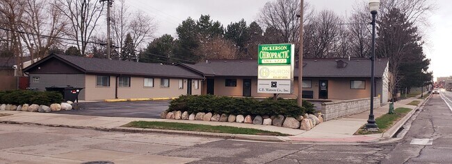
830 E 4Th St, Royal Oak, MI 48067


Current Lease Availabilities
Property Detail
830 E 4Th St
25-22-134-005
T1N, R11E, SEC 22 FOURTH AVENUE SUB LOTS 180 TO 185 INCL
Medicalbuilding
Oakland
MIX USE 2
Michigan
B and X Area of moderate flood hazard, usually the area between the limits of the 100-year and 500-year floods.
180-185
2024
0.29 AC
2025
Royal Oak
184400
Detroit
3,426 SF
Detroit-Warren-Dearborn, MI
NEARBY LISTINGS FOR SALE OR LEASE
DEMOGRAPHICS near 830 E 4Th St
1 mile
3 mile
5 mile
2025 Total Population
18,777
139,421
357,418
2030 Population
19,233
141,906
362,449
Pop Growth 2025-2030
+ 2.43%
+ 1.78%
+ 1.41%
Average Age
40
41
41
2025 Total Households
9,782
65,874
158,551
HH Growth 2025-2030
+ 2.60%
+ 1.92%
+ 1.57%
Median Household Inc
$103,629
$87,406
$71,461
Avg Household Size
1.90
2.10
2.20
2025 Avg HH Vehicles
2.00
2.00
2.00
Median Home Value
$327,544
$266,832
$235,904
Median Year Built
1952
1954
1956
Nearby Places
Map Layers
Map Styles
 Street
 Aerial
Layers
 Traffic
 Biking
Places
Listings with unknown addresses are not visible on the map
- Restaurants
- Banks
- Shops
- Fitness
- Groceries
PUBLIC TRANSPORTATION
COMMUTER RAIL
Royal Oak Amtrak (Wolverine - Amtrak)
Drive
Walk
Distance
Royal Oak Amtrak (Wolverine - Amtrak)
2 min
13 min
0.7 mi
Troy Amtrak Station (Wolverine - Amtrak)
Drive
Walk
Distance
Troy Amtrak Station (Wolverine - Amtrak)
14 min
6.1 mi
AIRPORT
Windsor International
Drive
Walk
Distance
Windsor International
41 min
22.5 mi
Detroit Metro Wayne County
Drive
Walk
Distance
Detroit Metro Wayne County
46 min
32.1 mi
Freight Ports
Port of Toledo
Drive
Walk
Distance
Port of Toledo
91 min
73.0 mi
Nearby Properties
Address
Land Use
TOTAL SIZE
Lot Size
Zoning
Address
Land Use
TOTAL SIZE
Lot Size
Zoning
4.20 AC
REG BUS
Address
Land Use
TOTAL SIZE
Lot Size
Zoning
910,140 SF
47.78 AC
Address
Land Use
TOTAL SIZE
Lot Size
Zoning
0.81 AC
CBD
Address
Land Use
TOTAL SIZE
Lot Size
Zoning
10,734 SF
3.52 AC
SPEC REDEV
Address
Land Use
TOTAL SIZE
Lot Size
Zoning
649,140 SF
43.98 AC
Address
Land Use
TOTAL SIZE
Lot Size
Zoning
576,924 SF
31.35 AC
Address
Land Use
TOTAL SIZE
Lot Size
Zoning
157,004 SF
1.78 AC
PUD
Address
Land Use
TOTAL SIZE
Lot Size
Zoning
228,421 SF
17.18 AC
RMMUL
Address
Land Use
TOTAL SIZE
Lot Size
Zoning
306,345 SF
Address
Land Use
TOTAL SIZE
Lot Size
Zoning
348,256 SF
46.10 AC
MZ
Address
Land Use
TOTAL SIZE
Lot Size
Zoning
349,226 SF
21.62 AC
RMMUL
Address
Land Use
TOTAL SIZE
Lot Size
Zoning
576,924 SF
36.24 AC
Address
Land Use
TOTAL SIZE
Lot Size
Zoning
1.46 AC
CBD
Address
Land Use
TOTAL SIZE
Lot Size
Zoning
804 SF
1.50 AC
CBD
Address
Land Use
TOTAL SIZE
Lot Size
Zoning
150,703 SF
Address
Land Use
TOTAL SIZE
Lot Size
Zoning
339,780 SF
22.29 AC
RM-1
Address
Land Use
TOTAL SIZE
Lot Size
Zoning
132,512 SF
0.50 AC
CBD
Address
Land Use
TOTAL SIZE
Lot Size
Zoning
233,900 SF
15.56 AC
M-2
Address
Land Use
TOTAL SIZE
Lot Size
Zoning
171,259 SF
1.26 AC
CBD
Address
Land Use
TOTAL SIZE
Lot Size
Zoning
62,528 SF
5.27 AC
M-1 LT
Address
Land Use
TOTAL SIZE
Lot Size
Zoning
13.89 AC
PUD
Address
Land Use
TOTAL SIZE
Lot Size
Zoning
199,592 SF
17.02 AC
B3
Address
Land Use
TOTAL SIZE
Lot Size
Zoning
103,320 SF
Address
Land Use
TOTAL SIZE
Lot Size
Zoning
220,561 SF
10.62 AC
M-2
Address
Land Use
TOTAL SIZE
Lot Size
Zoning
128,309 SF
1.74 AC
Address
Land Use
TOTAL SIZE
Lot Size
Zoning
1.07 AC
MIX USE 2
Address
Land Use
TOTAL SIZE
Lot Size
Zoning
0.61 AC
CBD
Address
Land Use
TOTAL SIZE
Lot Size
Zoning
46,894 SF
0.52 AC
CBD
Address
Land Use
TOTAL SIZE
Lot Size
Zoning
137,161 SF
9.95 AC
MZ
Address
Land Use
TOTAL SIZE
Lot Size
Zoning
184,668 SF
10.83 AC
R-3
The World's #1 Commercial Real Estate Marketplace
Connect with us
© 2026 CoStar Group
The information above has been obtained from sources believed reliable. While we do not doubt its accuracy we have not verified it and make no guarantee, warranty or representation about it. It is your responsibility to independently confirm its accuracy and completeness. Any projections, opinions, assumptions, or estimates used are for example only and do not represent the current or future performance of the property. The value of this transaction to you depends on tax and other factors which should be evaluated by your tax, financial, and legal advisors. You and your advisors should conduct a careful, independent investigation of the property to determine to your satisfaction the suitability of the property for your needs.