Property Record
830 Main St, Blowing Rock, NC 28605
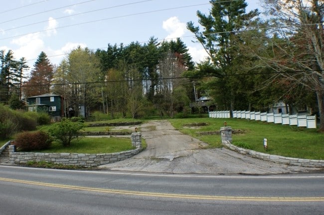

Property Detail
830 Main St
2807-98-6873-000
THE GETAWAY
Hotel
WATAUGA
BRCB
North Carolina
B and X Area of moderate flood hazard, usually the area between the limits of the 100-year and 500-year floods.
0.51 AC
2025
Hickory/Morganton
2025
Other Market Areas
920800
Boone, NC
7,668 SF
NEARBY LISTINGS FOR SALE OR LEASE
DEMOGRAPHICS near 830 Main St
1 mile
3 mile
5 mile
2025 Total Population
2,241
4,610
15,924
2030 Population
2,444
4,912
16,085
Pop Growth 2025-2030
+ 9.06%
+ 6.55%
+ 1.01%
Average Age
50
48
39
2025 Total Households
1,107
2,190
6,422
HH Growth 2025-2030
+ 9.67%
+ 7.12%
+ 1.09%
Median Household Inc
$86,672
$76,020
$59,241
Avg Household Size
2.00
2.10
2.10
2025 Avg HH Vehicles
2.00
2.00
2.00
Median Home Value
$574,142
$491,605
$428,466
Median Year Built
1990
1989
1988
Nearby Places
Map Layers
Map Styles
 Street
 Aerial
Layers
 Traffic
 Biking
Places
Listings with unknown addresses are not visible on the map
- Restaurants
- Banks
- Shops
- Fitness
- Groceries
SALE & LEASE HISTORY
LISTING DATE
SALE/LEASE

Sep 24, 2016
For Sale
Nearby Properties
Address
Land Use
TOTAL SIZE
Lot Size
Zoning
Address
Land Use
TOTAL SIZE
Lot Size
Zoning
38,694 SF
4.51 AC
BRGB
Address
Land Use
TOTAL SIZE
Lot Size
Zoning
57,681 SF
17.09 AC
BRGB
Address
Land Use
TOTAL SIZE
Lot Size
Zoning
25,262 SF
40.42 AC
Address
Land Use
TOTAL SIZE
Lot Size
Zoning
39,500 SF
10 AC
Address
Land Use
TOTAL SIZE
Lot Size
Zoning
19,940 SF
17.48 AC
Address
Land Use
TOTAL SIZE
Lot Size
Zoning
21,019 SF
3.72 AC
BRCB
Address
Land Use
TOTAL SIZE
Lot Size
Zoning
25,645 SF
2.97 AC
BRCB
Address
Land Use
TOTAL SIZE
Lot Size
Zoning
19,142 SF
0.91 AC
Address
Land Use
TOTAL SIZE
Lot Size
Zoning
43,504 SF
4.27 AC
BRGB
Address
Land Use
TOTAL SIZE
Lot Size
Zoning
3,771 SF
3.16 AC
BRCB
Address
Land Use
TOTAL SIZE
Lot Size
Zoning
6,482 SF
9.12 AC
Address
Land Use
TOTAL SIZE
Lot Size
Zoning
45,334 SF
61.79 AC
Address
Land Use
TOTAL SIZE
Lot Size
Zoning
92,696 SF
4.59 AC
BRGB
Address
Land Use
TOTAL SIZE
Lot Size
Zoning
11,791 SF
1 AC
BRCB
Address
Land Use
TOTAL SIZE
Lot Size
Zoning
26,928 SF
0.94 AC
BRCB
Address
Land Use
TOTAL SIZE
Lot Size
Zoning
20,645 SF
5.50 AC
BRR15
Address
Land Use
TOTAL SIZE
Lot Size
Zoning
21,474 SF
1.20 AC
BRGB
Address
Land Use
TOTAL SIZE
Lot Size
Zoning
18,471 SF
0.33 AC
BRMZ
Address
Land Use
TOTAL SIZE
Lot Size
Zoning
8,140 SF
123.33 AC
BRR15
Address
Land Use
TOTAL SIZE
Lot Size
Zoning
2,108 SF
7.88 AC
Address
Land Use
TOTAL SIZE
Lot Size
Zoning
9,333 SF
0.68 AC
BRR6
Address
Land Use
TOTAL SIZE
Lot Size
Zoning
1,568 SF
45.96 AC
Address
Land Use
TOTAL SIZE
Lot Size
Zoning
19,476 SF
1.58 AC
BRGB
Address
Land Use
TOTAL SIZE
Lot Size
Zoning
8.76 AC
BRR6
Address
Land Use
TOTAL SIZE
Lot Size
Zoning
7.76 AC
BRR15
Address
Land Use
TOTAL SIZE
Lot Size
Zoning
7,310 SF
0.93 AC
BRCB
Address
Land Use
TOTAL SIZE
Lot Size
Zoning
65,073 SF
2.80 AC
BRR6
Address
Land Use
TOTAL SIZE
Lot Size
Zoning
1,725 SF
1.96 AC
BRGB
The World's #1 Commercial Real Estate Marketplace
Connect with us
© 2026 CoStar Group
The information above has been obtained from sources believed reliable. While we do not doubt its accuracy we have not verified it and make no guarantee, warranty or representation about it. It is your responsibility to independently confirm its accuracy and completeness. Any projections, opinions, assumptions, or estimates used are for example only and do not represent the current or future performance of the property. The value of this transaction to you depends on tax and other factors which should be evaluated by your tax, financial, and legal advisors. You and your advisors should conduct a careful, independent investigation of the property to determine to your satisfaction the suitability of the property for your needs.