Property Record
8300 Abrams Rd, Dallas, TX 75243


Save to a Folder
{{folder.Name}}
{{folder.ListingIds.length}} Properties
{{folder.ListingIds.length}} Property
Create a New Folder
Property Detail
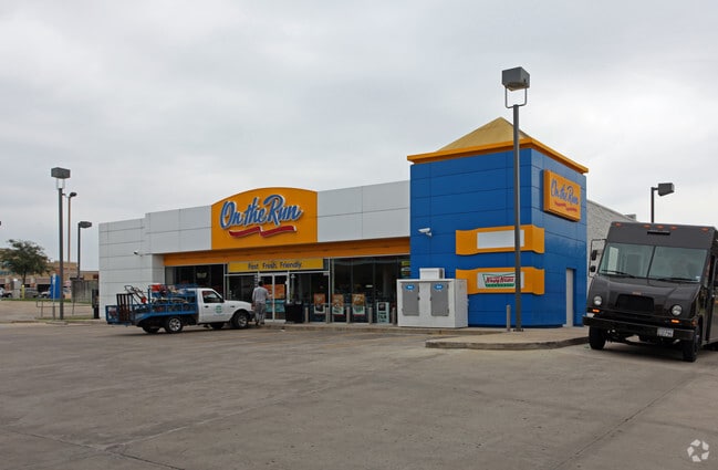
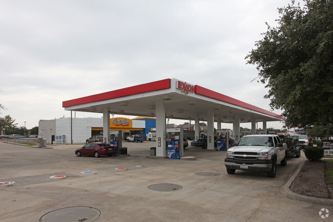
8300 Abrams Rd
008146000F02B0000
TOWNCREEK SQUARE PH 3 BLK F/8146 LOT 2B ACS 1.049 INT202300125532 DD06262023 CO-DC 8146 00F 02B00 0DA8146 00F
Storemultistory
DALLAS
Z59
Texas
B and X Area of moderate flood hazard, usually the area between the limits of the 100-year and 500-year floods.
2b
2025
1.05 AC
2025
Northeast Dallas
007825
Dallas/Ft Worth
4,436 SF
Dallas-Fort Worth-Arlington, TX
NEARBY LISTINGS FOR SALE OR LEASE
DEMOGRAPHICS near 8300 Abrams Rd
1 mile
3 mile
5 mile
2025 Total Population
17,978
179,897
395,024
2030 Population
18,522
186,005
406,814
Pop Growth 2025-2030
+ 3.03%
+ 3.40%
+ 2.98%
Average Age
39
37
38
2025 Total Households
7,491
80,065
162,184
HH Growth 2025-2030
+ 3.12%
+ 3.47%
+ 3.10%
Median Household Inc
$76,616
$65,647
$78,443
Avg Household Size
2.30
2.20
2.40
2025 Avg HH Vehicles
2.00
1.00
2.00
Median Home Value
$638,174
$530,782
$548,130
Median Year Built
1978
1980
1977
Nearby Places
Map Layers
Map Styles
 Street
 Aerial
Layers
 Traffic
 Biking
Places
Listings with unknown addresses are not visible on the map
- Restaurants
- Banks
- Shops
- Fitness
- Groceries
PUBLIC TRANSPORTATION
COMMUTER RAIL
Victory Station (DART LIGHT RAIL - GREEN LINE - Dallas Area Rapid Transit (DART), DART LIGHT RAIL - ORANGE LINE - Dallas Area Rapid Transit (DART), TRINITY RAILWAY - Dallas Area Rapid Transit (DART))
Drive
Walk
Distance
Victory Station (DART LIGHT RAIL - GREEN LINE - Dallas Area Rapid Transit (DART), DART LIGHT RAIL - ORANGE LINE - Dallas Area Rapid Transit (DART), TRINITY RAILWAY - Dallas Area Rapid Transit (DART))
15 min
10.0 mi
AIRPORT
Dallas Love Field
Drive
Walk
Distance
Dallas Love Field
20 min
9.9 mi
Dallas-Fort Worth International
Drive
Walk
Distance
Dallas-Fort Worth International
31 min
24.6 mi
Freight Ports
Port of Shreveport
Drive
Walk
Distance
Port of Shreveport
213 min
196.8 mi
Nearby Properties
Address
Land Use
TOTAL SIZE
Lot Size
Zoning
Address
Land Use
TOTAL SIZE
Lot Size
Zoning
4,157,377 SF
76.79 AC
Z248
Address
Land Use
TOTAL SIZE
Lot Size
Zoning
7,706,477 SF
245.55 AC
Z116
Address
Land Use
TOTAL SIZE
Lot Size
Zoning
2,186,362 SF
48.27 AC
Z239
Address
Land Use
TOTAL SIZE
Lot Size
Zoning
502,529 SF
3.08 AC
Z239
Address
Land Use
TOTAL SIZE
Lot Size
Zoning
1,252,860 SF
57.08 AC
Z239
Address
Land Use
TOTAL SIZE
Lot Size
Zoning
3,423,779 SF
32.42 AC
Z151
Address
Land Use
TOTAL SIZE
Lot Size
Zoning
77.76 AC
Z239
Address
Land Use
TOTAL SIZE
Lot Size
Zoning
1,086,919 SF
5.85 AC
Z239
Address
Land Use
TOTAL SIZE
Lot Size
Zoning
557,392 SF
10.06 AC
Z239
Address
Land Use
TOTAL SIZE
Lot Size
Zoning
395,377 SF
14.61 AC
Z163
Address
Land Use
TOTAL SIZE
Lot Size
Zoning
835,301 SF
9.29 AC
Z239
Address
Land Use
TOTAL SIZE
Lot Size
Zoning
674,474 SF
18.81 AC
Z164
Address
Land Use
TOTAL SIZE
Lot Size
Zoning
776,707 SF
8.47 AC
Address
Land Use
TOTAL SIZE
Lot Size
Zoning
421,798 SF
9 AC
Z151
Address
Land Use
TOTAL SIZE
Lot Size
Zoning
852,562 SF
13.86 AC
Z151
Address
Land Use
TOTAL SIZE
Lot Size
Zoning
399,256 SF
13.19 AC
Z164
Address
Land Use
TOTAL SIZE
Lot Size
Zoning
428,956 SF
18.76 AC
Z291
Address
Land Use
TOTAL SIZE
Lot Size
Zoning
485,067 SF
14.87 AC
Z239
Address
Land Use
TOTAL SIZE
Lot Size
Zoning
462,916 SF
15.67 AC
Z248
Address
Land Use
TOTAL SIZE
Lot Size
Zoning
249,692 SF
244.62 AC
Z239
Address
Land Use
TOTAL SIZE
Lot Size
Zoning
1,009,203 SF
33.32 AC
Z125
Address
Land Use
TOTAL SIZE
Lot Size
Zoning
302,553 SF
15.59 AC
Z164
Address
Land Use
TOTAL SIZE
Lot Size
Zoning
403,339 SF
16.42 AC
Z239
Address
Land Use
TOTAL SIZE
Lot Size
Zoning
592,314 SF
4.19 AC
Z96
Address
Land Use
TOTAL SIZE
Lot Size
Zoning
456,300 SF
10.92 AC
Z239
Address
Land Use
TOTAL SIZE
Lot Size
Zoning
573,575 SF
6.43 AC
Z239
Address
Land Use
TOTAL SIZE
Lot Size
Zoning
999,432 SF
5.78 AC
Z96
Address
Land Use
TOTAL SIZE
Lot Size
Zoning
424,666 SF
12.19 AC
Z151
Address
Land Use
TOTAL SIZE
Lot Size
Zoning
306,323 SF
10.99 AC
Z164
Address
Land Use
TOTAL SIZE
Lot Size
Zoning
900,244 SF
7.03 AC
Z96
The World's #1 Commercial Real Estate Marketplace
Connect with us
© 2026 CoStar Group
The information above has been obtained from sources believed reliable. While we do not doubt its accuracy we have not verified it and make no guarantee, warranty or representation about it. It is your responsibility to independently confirm its accuracy and completeness. Any projections, opinions, assumptions, or estimates used are for example only and do not represent the current or future performance of the property. The value of this transaction to you depends on tax and other factors which should be evaluated by your tax, financial, and legal advisors. You and your advisors should conduct a careful, independent investigation of the property to determine to your satisfaction the suitability of the property for your needs.