Property Record
8300 Bustleton Ave, Philadelphia, PA 19152


Property Detail
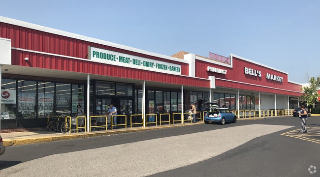
8300 Bustleton Ave
882926725
NWC FOX CHASE RD
Storesoffices
PHILADELPHIA
CMX1
Pennsylvania
B and X Area of moderate flood hazard, usually the area between the limits of the 100-year and 500-year floods.
201
2024
0.06 AC
2026
Northeast Philadelphia
033701
Philadelphia
2,240 SF
Philadelphia-Camden-Wilmington, PA-NJ-DE-MD
NEARBY LISTINGS FOR SALE OR LEASE
DEMOGRAPHICS near 8300 Bustleton Ave
1 mile
3 mile
5 mile
2025 Total Population
29,383
252,494
540,773
2030 Population
28,463
245,588
529,507
Pop Growth 2025-2030
(3.13%)
(2.74%)
(2.08%)
Average Age
42
40
40
2025 Total Households
11,696
92,559
200,423
HH Growth 2025-2030
(3.33%)
(2.89%)
(2.16%)
Median Household Inc
$56,207
$64,528
$65,485
Avg Household Size
2.40
2.60
2.60
2025 Avg HH Vehicles
1.00
1.00
1.00
Median Home Value
$273,286
$262,879
$259,895
Median Year Built
1962
1957
1957
Nearby Places
Map Layers
Map Styles
 Street
 Aerial
Layers
 Traffic
 Biking
Places
Listings with unknown addresses are not visible on the map
- Restaurants
- Banks
- Shops
- Fitness
- Groceries
PUBLIC TRANSPORTATION
COMMUTER RAIL
Fox Chase (R8 - Southeastern Pennsylvania Transportation Authority Regional Rail (SEPTA Regional Rail))
Drive
Walk
Distance
Fox Chase (R8 - Southeastern Pennsylvania Transportation Authority Regional Rail (SEPTA Regional Rail))
5 min
2.3 mi
Ryers (R8 - Southeastern Pennsylvania Transportation Authority Regional Rail (SEPTA Regional Rail))
Drive
Walk
Distance
Ryers (R8 - Southeastern Pennsylvania Transportation Authority Regional Rail (SEPTA Regional Rail))
6 min
2.7 mi
AIRPORT
Philadelphia International
Drive
Walk
Distance
Philadelphia International
37 min
21.5 mi
Trenton Mercer
Drive
Walk
Distance
Trenton Mercer
36 min
22.1 mi
Freight Ports
Port of Philadelphia
Drive
Walk
Distance
Port of Philadelphia
15 min
7.3 mi
SALE & LEASE HISTORY
LISTING DATE
SALE/LEASE

Sep 25, 2016
For Lease
Nearby Properties
Address
Land Use
TOTAL SIZE
Lot Size
Zoning
Address
Land Use
TOTAL SIZE
Lot Size
Zoning
1,015,495 SF
70.51 AC
I1
Address
Land Use
TOTAL SIZE
Lot Size
Zoning
597,188 SF
120.50 AC
RM2
Address
Land Use
TOTAL SIZE
Lot Size
Zoning
432,175 SF
16.70 AC
I2
Address
Land Use
TOTAL SIZE
Lot Size
Zoning
627,076 SF
36.89 AC
RSA1
Address
Land Use
TOTAL SIZE
Lot Size
Zoning
234,945 SF
10.14 AC
CA1
Address
Land Use
TOTAL SIZE
Lot Size
Zoning
290,454 SF
58.56 AC
RSA1
Address
Land Use
TOTAL SIZE
Lot Size
Zoning
180,000 SF
23.05 AC
RSA1
Address
Land Use
TOTAL SIZE
Lot Size
Zoning
37.21 AC
SPPOA
Address
Land Use
TOTAL SIZE
Lot Size
Zoning
107,391 SF
13.68 AC
SPINS
Address
Land Use
TOTAL SIZE
Lot Size
Zoning
410,400 SF
34.14 AC
RSA1
Address
Land Use
TOTAL SIZE
Lot Size
Zoning
282,736 SF
21.32 AC
I1
Address
Land Use
TOTAL SIZE
Lot Size
Zoning
213,065 SF
16.12 AC
CA2
Address
Land Use
TOTAL SIZE
Lot Size
Zoning
264,852 SF
12.30 AC
CA2
Address
Land Use
TOTAL SIZE
Lot Size
Zoning
260,178 SF
20.87 AC
CA2
Address
Land Use
TOTAL SIZE
Lot Size
Zoning
314,694 SF
96.36 AC
RSA3
Address
Land Use
TOTAL SIZE
Lot Size
Zoning
2,500,000 SF
134.14 AC
I2
Address
Land Use
TOTAL SIZE
Lot Size
Zoning
233,520 SF
14.03 AC
I1
Address
Land Use
TOTAL SIZE
Lot Size
Zoning
325,000 SF
12.47 AC
RMX1
Address
Land Use
TOTAL SIZE
Lot Size
Zoning
526,165 SF
12.68 AC
RSA3
Address
Land Use
TOTAL SIZE
Lot Size
Zoning
28,239 SF
1.48 AC
SPINS
Address
Land Use
TOTAL SIZE
Lot Size
Zoning
16,832 SF
65.87 AC
SPPOA
Address
Land Use
TOTAL SIZE
Lot Size
Zoning
223,050 SF
12.31 AC
RSA5
Address
Land Use
TOTAL SIZE
Lot Size
Zoning
41.25 AC
RSA1
Address
Land Use
TOTAL SIZE
Lot Size
Zoning
403,010 SF
9 AC
SPINS
Address
Land Use
TOTAL SIZE
Lot Size
Zoning
43.93 AC
RSD1
Address
Land Use
TOTAL SIZE
Lot Size
Zoning
184,500 SF
5.40 AC
RSD3
Address
Land Use
TOTAL SIZE
Lot Size
Zoning
283,262 SF
7.85 AC
RM2
Address
Land Use
TOTAL SIZE
Lot Size
Zoning
222,500 SF
14.58 AC
I1
Address
Land Use
TOTAL SIZE
Lot Size
Zoning
437,192 SF
28.03 AC
I2
Address
Land Use
TOTAL SIZE
Lot Size
Zoning
182,289 SF
8.16 AC
CA1
The World's #1 Commercial Real Estate Marketplace
Connect with us
© 2026 CoStar Group
The information above has been obtained from sources believed reliable. While we do not doubt its accuracy we have not verified it and make no guarantee, warranty or representation about it. It is your responsibility to independently confirm its accuracy and completeness. Any projections, opinions, assumptions, or estimates used are for example only and do not represent the current or future performance of the property. The value of this transaction to you depends on tax and other factors which should be evaluated by your tax, financial, and legal advisors. You and your advisors should conduct a careful, independent investigation of the property to determine to your satisfaction the suitability of the property for your needs.