Property Record
8300 E Sprague Ave, Spokane Valley, WA 99212


NEARBY LISTINGS FOR SALE OR LEASE
Property Detail
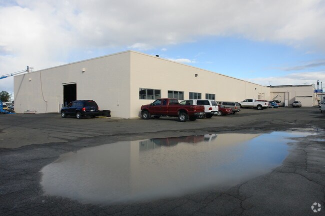
8300 E Sprague Ave
Spokane-Spokane Valley, WA
West Dishman 1St Add
45195.9178
WEST DISHMAN 1ST ADD ; LTS 1,2,3,4,5 BLK 1 TOG/W VAC ALLEY EXC RD AND 19-25-44 PTN NW1/4 NE1/4 DAF: PTN OF NW1/4 OF NE1/4 SEC 19 DAF: BEG AT A PT ON S R/W SPRAGUE AVE 50FT S OF & AT R/A TO N LN OF NE1/4 AND 2310FT W OF NE COR OF SD SEC TH W ALG S R/W
Storebuilding
Spokane
X
Washington
53063C0568D
1
2025
7.85 AC
2025
Valley
012401
Spokane
45,362 SF
DEMOGRAPHICS near 8300 E Sprague Ave
1 Mile
3 Mile
5 Mile
2024 Total Population
7,843
62,094
177,133
2029 Population
8,313
66,012
188,803
Pop Growth 2024-2029
+ 5.99%
+ 6.31%
+ 6.59%
Average Age
41
40
40
2024 Total Households
3,249
25,262
71,072
HH Growth 2024-2029
+ 6.06%
+ 6.45%
+ 6.78%
Median Household Inc
$59,944
$61,847
$63,769
Avg Household Size
2.30
2.40
2.40
2024 Avg HH Vehicles
2.00
2.00
2.00
Median Home Value
$260,116
$307,440
$331,554
Median Year Built
1969
1974
1977
Nearby Places
Map Layers
Map Styles
 Street
 Aerial
- Restaurants
- Banks
- Shops
- Fitness
- Groceries
PUBLIC TRANSPORTATION
COMMUTER RAIL
Spokane (Empire Builder - Amtrak)
DRIVE
WALK
Distance
Spokane (Empire Builder - Amtrak)
12 min
6.2 mi
AIRPORT
Spokane International
DRIVE
WALK
Distance
Spokane International
19 min
12.1 mi
Freight Ports
Port of Everett
DRIVE
WALK
Distance
Port of Everett
347 min
307.7 mi
Nearby Properties
Address
Land Use
TOTAL SIZE
Lot Size
Zoning
Address
Land Use
TOTAL SIZE
Lot Size
Zoning
355,192 SF
35.83 AC
I-2
Address
Land Use
TOTAL SIZE
Lot Size
Zoning
378,750 SF
17.38 AC
R-2
Address
Land Use
TOTAL SIZE
Lot Size
Zoning
161,130 SF
6.45 AC
GO
Address
Land Use
TOTAL SIZE
Lot Size
Zoning
84,600 SF
17.95 AC
MF-1
Address
Land Use
TOTAL SIZE
Lot Size
Zoning
58,522 SF
19.91 AC
HI
Address
Land Use
TOTAL SIZE
Lot Size
Zoning
136,518 SF
7.96 AC
O
Address
Land Use
TOTAL SIZE
Lot Size
Zoning
175,936 SF
12.16 AC
MF-2
Address
Land Use
TOTAL SIZE
Lot Size
Zoning
69,202 SF
9.99 AC
R-2
Address
Land Use
TOTAL SIZE
Lot Size
Zoning
87,848 SF
7.36 AC
MF-2
Address
Land Use
TOTAL SIZE
Lot Size
Zoning
72,443 SF
8.90 AC
R-3
Address
Land Use
TOTAL SIZE
Lot Size
Zoning
87,989 SF
5.38 AC
MF-2
Address
Land Use
TOTAL SIZE
Lot Size
Zoning
96,424 SF
9.04 AC
I-1
Address
Land Use
TOTAL SIZE
Lot Size
Zoning
107,442 SF
5.57 AC
MF-2
Address
Land Use
TOTAL SIZE
Lot Size
Zoning
47,612 SF
3.38 AC
CMU
Address
Land Use
TOTAL SIZE
Lot Size
Zoning
134,104 SF
5.89 AC
HDR
Address
Land Use
TOTAL SIZE
Lot Size
Zoning
150,812 SF
17.49 AC
RC
Address
Land Use
TOTAL SIZE
Lot Size
Zoning
123,938 SF
7.70 AC
MF-2
Address
Land Use
TOTAL SIZE
Lot Size
Zoning
102,441 SF
8.38 AC
Address
Land Use
TOTAL SIZE
Lot Size
Zoning
118,818 SF
7.96 AC
HDR
Address
Land Use
TOTAL SIZE
Lot Size
Zoning
72,903 SF
6.35 AC
MF-2
Address
Land Use
TOTAL SIZE
Lot Size
Zoning
418,875 SF
18.79 AC
I-1
Address
Land Use
TOTAL SIZE
Lot Size
Zoning
91,811 SF
6.02 AC
LI
Address
Land Use
TOTAL SIZE
Lot Size
Zoning
68,600 SF
5.25 AC
MF-2
Address
Land Use
TOTAL SIZE
Lot Size
Zoning
104,760 SF
6.96 AC
HDR
Address
Land Use
TOTAL SIZE
Lot Size
Zoning
38,889 SF
114.18 AC
LI
Address
Land Use
TOTAL SIZE
Lot Size
Zoning
200 SF
159.15 AC
LI
Address
Land Use
TOTAL SIZE
Lot Size
Zoning
109,016 SF
8.01 AC
MF-2
Address
Land Use
TOTAL SIZE
Lot Size
Zoning
100,035 SF
5.74 AC
CMU
Address
Land Use
TOTAL SIZE
Lot Size
Zoning
21,502 SF
4.68 AC
GO
Address
Land Use
TOTAL SIZE
Lot Size
Zoning
182,166 SF
6.61 AC
O
The World's #1 Commercial Real Estate Marketplace
Connect with us
© 2026 CoStar Group
The information above has been obtained from sources believed reliable. While we do not doubt its accuracy we have not verified it and make no guarantee, warranty or representation about it. It is your responsibility to independently confirm its accuracy and completeness. Any projections, opinions, assumptions, or estimates used are for example only and do not represent the current or future performance of the property. The value of this transaction to you depends on tax and other factors which should be evaluated by your tax, financial, and legal advisors. You and your advisors should conduct a careful, independent investigation of the property to determine to your satisfaction the suitability of the property for your needs.