Property Record
8300 Fenkell St, Detroit, MI 48238


NEARBY LISTINGS FOR SALE OR LEASE
Property Detail
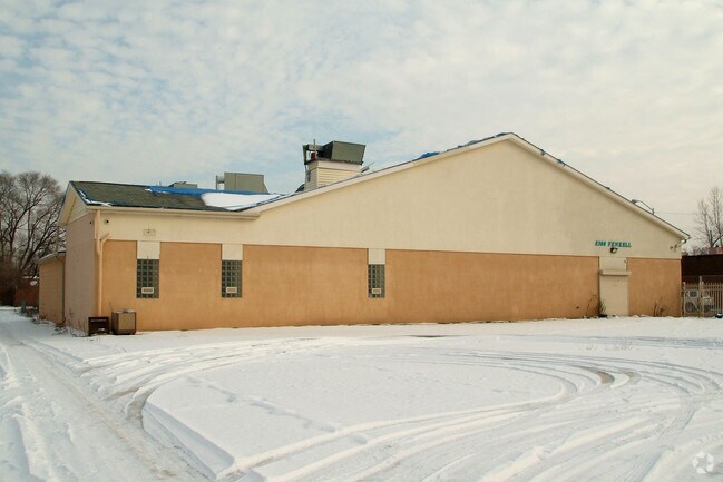
8300 Fenkell St
16-0072104
Graceland
Religious
N FENKELL 117 THRU 121 GRACELAND SUB L38 P66 PLATS, W C R 16/267 108 X 100
X
Wayne
26163C0100E
Michigan
2025
0.25 AC
2025
Detroit W of Woodward
536300
Detroit
11,599 SF
Detroit-Warren-Dearborn, MI
DEMOGRAPHICS near 8300 Fenkell St
1 Mile
3 Mile
5 Mile
2024 Total Population
17,969
166,874
446,156
2029 Population
17,985
166,623
443,657
Pop Growth 2024-2029
+ 0.09%
(0.15%)
(0.56%)
Average Age
38
39
38
2024 Total Households
6,842
67,301
175,545
HH Growth 2024-2029
+ 0.18%
(0.04%)
(0.40%)
Median Household Inc
$34,030
$35,518
$38,934
Avg Household Size
2.50
2.40
2.50
2024 Avg HH Vehicles
1.00
1.00
1.00
Median Home Value
$60,971
$83,977
$95,536
Median Year Built
1947
1948
1948
Nearby Places
Map Layers
Map Styles
 Street
 Aerial
- Restaurants
- Banks
- Shops
- Fitness
- Groceries
PUBLIC TRANSPORTATION
COMMUTER RAIL
DRIVE
WALK
Distance
11 min
5.7 mi
DRIVE
WALK
Distance
20 min
7.3 mi
AIRPORT
Windsor International
DRIVE
WALK
Distance
Windsor International
37 min
18.1 mi
Detroit Metro Wayne County
DRIVE
WALK
Distance
Detroit Metro Wayne County
38 min
23.1 mi
Freight Ports
DRIVE
WALK
Distance
83 min
66.0 mi
SALE & LEASE HISTORY
LISTING DATE
SALE/LEASE

May 14, 2018
For Lease
Nearby Properties
Address
Land Use
TOTAL SIZE
Lot Size
Zoning
Address
Land Use
TOTAL SIZE
Lot Size
Zoning
925,367 SF
12.82 AC
R6
Address
Land Use
TOTAL SIZE
Lot Size
Zoning
783,976 SF
52.57 AC
M4
Address
Land Use
TOTAL SIZE
Lot Size
Zoning
446,500 SF
27.90 AC
Address
Land Use
TOTAL SIZE
Lot Size
Zoning
165,829 SF
5.56 AC
R5
Address
Land Use
TOTAL SIZE
Lot Size
Zoning
292,032 SF
20.25 AC
B4
Address
Land Use
TOTAL SIZE
Lot Size
Zoning
54,672 SF
1.37 AC
R6
Address
Land Use
TOTAL SIZE
Lot Size
Zoning
90,958 SF
11.78 AC
R5
Address
Land Use
TOTAL SIZE
Lot Size
Zoning
150,689 SF
4.87 AC
R5
Address
Land Use
TOTAL SIZE
Lot Size
Zoning
63,216 SF
2.87 AC
R5
Address
Land Use
TOTAL SIZE
Lot Size
Zoning
66,870 SF
2.77 AC
Address
Land Use
TOTAL SIZE
Lot Size
Zoning
2,216,908 SF
44.80 AC
Address
Land Use
TOTAL SIZE
Lot Size
Zoning
315,973 SF
12.18 AC
M4
Address
Land Use
TOTAL SIZE
Lot Size
Zoning
110,000 SF
1.36 AC
Address
Land Use
TOTAL SIZE
Lot Size
Zoning
81,031 SF
8.15 AC
PD
Address
Land Use
TOTAL SIZE
Lot Size
Zoning
64,566 SF
3.64 AC
PD
Address
Land Use
TOTAL SIZE
Lot Size
Zoning
147,717 SF
8.61 AC
PD
Address
Land Use
TOTAL SIZE
Lot Size
Zoning
7.10 AC
Address
Land Use
TOTAL SIZE
Lot Size
Zoning
91,233 SF
11.36 AC
Address
Land Use
TOTAL SIZE
Lot Size
Zoning
Address
Land Use
TOTAL SIZE
Lot Size
Zoning
155,532 SF
1.72 AC
Address
Land Use
TOTAL SIZE
Lot Size
Zoning
84,453 SF
4.58 AC
Address
Land Use
TOTAL SIZE
Lot Size
Zoning
68,729 SF
0.52 AC
B4
Address
Land Use
TOTAL SIZE
Lot Size
Zoning
46,292 SF
2.76 AC
R1
Address
Land Use
TOTAL SIZE
Lot Size
Zoning
87,232 SF
53.99 AC
R1
Address
Land Use
TOTAL SIZE
Lot Size
Zoning
122,319 SF
M4
Address
Land Use
TOTAL SIZE
Lot Size
Zoning
51,999 SF
1.14 AC
B4
Address
Land Use
TOTAL SIZE
Lot Size
Zoning
57,632 SF
1.08 AC
R4
Address
Land Use
TOTAL SIZE
Lot Size
Zoning
52,264 SF
0.89 AC
R5
Address
Land Use
TOTAL SIZE
Lot Size
Zoning
46,350 SF
3.18 AC
R1
Address
Land Use
TOTAL SIZE
Lot Size
Zoning
62,874 SF
2.60 AC
R6
The World's #1 Commercial Real Estate Marketplace
Connect with us
© 2026 CoStar Group
The information above has been obtained from sources believed reliable. While we do not doubt its accuracy we have not verified it and make no guarantee, warranty or representation about it. It is your responsibility to independently confirm its accuracy and completeness. Any projections, opinions, assumptions, or estimates used are for example only and do not represent the current or future performance of the property. The value of this transaction to you depends on tax and other factors which should be evaluated by your tax, financial, and legal advisors. You and your advisors should conduct a careful, independent investigation of the property to determine to your satisfaction the suitability of the property for your needs.