Property Record
8300 Old Saint Louis Rd, Belleville, IL 62223


NEARBY LISTINGS FOR SALE OR LEASE
Property Detail
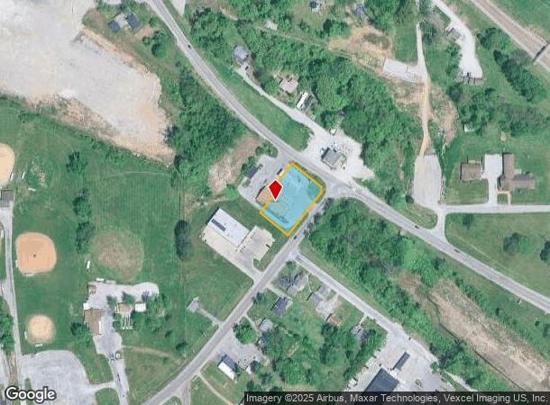
8300 Old Saint Louis Rd
St. Louis, MO-IL
Head Commercial Development
07-11.0-302-008
HEAD COMMERCIAL DEVELOPMENT LOT/SEC-1 DOC A02557108
Conveniencestore
St. Clair
2024
Illinois
2024
0.60 AC
503202
SE Metro Illinois
2,800 SF
St. Louis
DEMOGRAPHICS near 8300 Old Saint Louis Rd
1 Mile
3 Mile
5 Mile
2024 Total Population
2,667
22,911
66,906
2029 Population
2,592
22,355
65,738
Pop Growth 2024-2029
(2.81%)
(2.43%)
(1.75%)
Average Age
45
42
42
2024 Total Households
1,162
10,008
28,131
HH Growth 2024-2029
(2.75%)
(2.44%)
(1.81%)
Median Household Inc
$66,297
$60,311
$57,172
Avg Household Size
2.30
2.20
2.30
2024 Avg HH Vehicles
2.00
2.00
2.00
Median Home Value
$195,302
$143,704
$122,339
Median Year Built
1968
1965
1965
Nearby Places
Map Layers
Map Styles
 Street
 Aerial
- Restaurants
- Banks
- Shops
- Fitness
- Groceries
PUBLIC TRANSPORTATION
COMMUTER RAIL
Memorial Hospital (Lambert Airport Shiloh-Scott - St. Louis MetroLink (MetroLink))
DRIVE
WALK
Distance
Memorial Hospital (Lambert Airport Shiloh-Scott - St. Louis MetroLink (MetroLink))
7 min
3.8 mi
Swansea (Lambert Airport Shiloh-Scott - St. Louis MetroLink (MetroLink))
DRIVE
WALK
Distance
Swansea (Lambert Airport Shiloh-Scott - St. Louis MetroLink (MetroLink))
11 min
5.1 mi
AIRPORT
Scott AFB/Midamerica St Louis
DRIVE
WALK
Distance
Scott AFB/Midamerica St Louis
31 min
17.0 mi
St Louis Lambert International
DRIVE
WALK
Distance
St Louis Lambert International
37 min
24.0 mi
Nearby Properties
Address
Land Use
TOTAL SIZE
Lot Size
Zoning
Address
Land Use
TOTAL SIZE
Lot Size
Zoning
127,590 SF
10.53 AC
Address
Land Use
TOTAL SIZE
Lot Size
Zoning
18,734 SF
10.48 AC
Address
Land Use
TOTAL SIZE
Lot Size
Zoning
104,230 SF
11.08 AC
Address
Land Use
TOTAL SIZE
Lot Size
Zoning
147,888 SF
52.30 AC
Address
Land Use
TOTAL SIZE
Lot Size
Zoning
82,500 SF
14.61 AC
Address
Land Use
TOTAL SIZE
Lot Size
Zoning
49,248 SF
2 AC
Address
Land Use
TOTAL SIZE
Lot Size
Zoning
10,505 SF
20.08 AC
Address
Land Use
TOTAL SIZE
Lot Size
Zoning
130,254 SF
11.44 AC
Address
Land Use
TOTAL SIZE
Lot Size
Zoning
16,958 SF
24.53 AC
Address
Land Use
TOTAL SIZE
Lot Size
Zoning
4,420 SF
3.82 AC
Address
Land Use
TOTAL SIZE
Lot Size
Zoning
16,549 SF
5.44 AC
Address
Land Use
TOTAL SIZE
Lot Size
Zoning
54,179 SF
9.26 AC
Address
Land Use
TOTAL SIZE
Lot Size
Zoning
18.43 AC
Address
Land Use
TOTAL SIZE
Lot Size
Zoning
26.26 AC
C2
Address
Land Use
TOTAL SIZE
Lot Size
Zoning
18,837 SF
134.15 AC
Address
Land Use
TOTAL SIZE
Lot Size
Zoning
15,480 SF
1.35 AC
Address
Land Use
TOTAL SIZE
Lot Size
Zoning
4,638 SF
13.10 AC
Address
Land Use
TOTAL SIZE
Lot Size
Zoning
51,739 SF
1.99 AC
Address
Land Use
TOTAL SIZE
Lot Size
Zoning
14,748 SF
1.78 AC
Address
Land Use
TOTAL SIZE
Lot Size
Zoning
6.65 AC
Address
Land Use
TOTAL SIZE
Lot Size
Zoning
68,968 SF
3.55 AC
Address
Land Use
TOTAL SIZE
Lot Size
Zoning
16,637 SF
4.59 AC
Address
Land Use
TOTAL SIZE
Lot Size
Zoning
5,512 SF
10.36 AC
Address
Land Use
TOTAL SIZE
Lot Size
Zoning
102,418 SF
9.70 AC
Address
Land Use
TOTAL SIZE
Lot Size
Zoning
12,950 SF
1.81 AC
Address
Land Use
TOTAL SIZE
Lot Size
Zoning
13,741 SF
0.44 AC
Address
Land Use
TOTAL SIZE
Lot Size
Zoning
19.66 AC
Address
Land Use
TOTAL SIZE
Lot Size
Zoning
3,666 SF
2.86 AC
Address
Land Use
TOTAL SIZE
Lot Size
Zoning
14.70 AC
Address
Land Use
TOTAL SIZE
Lot Size
Zoning
20,924 SF
6.16 AC
The World's #1 Commercial Real Estate Marketplace
Connect with us
© 2025 CoStar Group
The information above has been obtained from sources believed reliable. While we do not doubt its accuracy we have not verified it and make no guarantee, warranty or representation about it. It is your responsibility to independently confirm its accuracy and completeness. Any projections, opinions, assumptions, or estimates used are for example only and do not represent the current or future performance of the property. The value of this transaction to you depends on tax and other factors which should be evaluated by your tax, financial, and legal advisors. You and your advisors should conduct a careful, independent investigation of the property to determine to your satisfaction the suitability of the property for your needs.