Property Record
8301 Buffaloe Rd, Knightdale, NC 27545
NEARBY LISTINGS FOR SALE OR LEASE
Property Detail
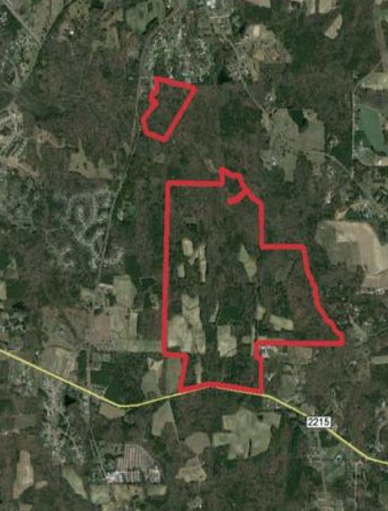
8301 Buffaloe Rd
Raleigh, NC
Buffaloe Park Llc
1756.03-42-1236-000
BUFFALOE PARK LLC TR2 BM2008-01098
Vacantlandnec
Wake
AE
North Carolina
3720175600K
270.09 AC
0
Northeast Wake County
2025
Raleigh/Durham
054111
DEMOGRAPHICS near 8301 Buffaloe Rd
1 Mile
3 Mile
5 Mile
2024 Total Population
1,116
17,348
91,486
2029 Population
1,203
18,883
99,719
Pop Growth 2024-2029
+ 7.80%
+ 8.85%
+ 9.00%
Average Age
40
38
38
2024 Total Households
400
6,174
33,267
HH Growth 2024-2029
+ 7.75%
+ 8.79%
+ 9.05%
Median Household Inc
$88,942
$89,515
$80,983
Avg Household Size
2.70
2.80
2.70
2024 Avg HH Vehicles
2.00
2.00
2.00
Median Home Value
$377,048
$290,194
$274,764
Median Year Built
1996
2001
2002
Nearby Places
Map Layers
Map Styles
 Street
 Aerial
- Restaurants
- Banks
- Shops
- Fitness
- Groceries
PUBLIC TRANSPORTATION
AIRPORT
Raleigh-Durham International
DRIVE
WALK
Distance
Raleigh-Durham International
33 min
23.6 mi
Freight Ports
Port of Wilmington
DRIVE
WALK
Distance
Port of Wilmington
170 min
140.4 mi
SALE & LEASE HISTORY
LISTING DATE
SALE/LEASE

Sep 24, 2016
For Sale
Mar 30, 2017
For Sale
Nearby Properties
Address
Land Use
TOTAL SIZE
Lot Size
Zoning
Address
Land Use
TOTAL SIZE
Lot Size
Zoning
263,074 SF
83.23 AC
GR8
Address
Land Use
TOTAL SIZE
Lot Size
Zoning
133,847 SF
47.62 AC
R-4
Address
Land Use
TOTAL SIZE
Lot Size
Zoning
325,406 SF
18.84 AC
RX-3
Address
Land Use
TOTAL SIZE
Lot Size
Zoning
101,316 SF
25.68 AC
R-4
Address
Land Use
TOTAL SIZE
Lot Size
Zoning
136,430 SF
52.66 AC
GR8
Address
Land Use
TOTAL SIZE
Lot Size
Zoning
103,924 SF
16.92 AC
GR8
Address
Land Use
TOTAL SIZE
Lot Size
Zoning
63,386 SF
14.10 AC
R-4
Address
Land Use
TOTAL SIZE
Lot Size
Zoning
25,749 SF
8.53 AC
RMX
Address
Land Use
TOTAL SIZE
Lot Size
Zoning
25.52 AC
OX-3
Address
Land Use
TOTAL SIZE
Lot Size
Zoning
68,721 SF
14.57 AC
CX-3
Address
Land Use
TOTAL SIZE
Lot Size
Zoning
149.26 AC
NMX P
Address
Land Use
TOTAL SIZE
Lot Size
Zoning
18,336 SF
8.55 AC
R-4
Address
Land Use
TOTAL SIZE
Lot Size
Zoning
26,734 SF
7.69 AC
R-40
Address
Land Use
TOTAL SIZE
Lot Size
Zoning
988 SF
109.69 AC
RT
Address
Land Use
TOTAL SIZE
Lot Size
Zoning
20,096 SF
2.06 AC
NX-3
Address
Land Use
TOTAL SIZE
Lot Size
Zoning
175.82 AC
R-30
Address
Land Use
TOTAL SIZE
Lot Size
Zoning
812 SF
83.64 AC
RT
Address
Land Use
TOTAL SIZE
Lot Size
Zoning
24.97 AC
PD
Address
Land Use
TOTAL SIZE
Lot Size
Zoning
29,050 SF
11.94 AC
MI
Address
Land Use
TOTAL SIZE
Lot Size
Zoning
77.61 AC
GR3 P
Address
Land Use
TOTAL SIZE
Lot Size
Zoning
9,849 SF
2.74 AC
CX-3
Address
Land Use
TOTAL SIZE
Lot Size
Zoning
93.91 AC
R-30
Address
Land Use
TOTAL SIZE
Lot Size
Zoning
28,830 SF
11.31 AC
O&I
Address
Land Use
TOTAL SIZE
Lot Size
Zoning
12.09 AC
CX-3
Address
Land Use
TOTAL SIZE
Lot Size
Zoning
933 SF
60.07 AC
RT
Address
Land Use
TOTAL SIZE
Lot Size
Zoning
6,356 SF
1.23 AC
CX-3
Address
Land Use
TOTAL SIZE
Lot Size
Zoning
11,750 SF
1.85 AC
IX-3
Address
Land Use
TOTAL SIZE
Lot Size
Zoning
82.60 AC
R-30
Address
Land Use
TOTAL SIZE
Lot Size
Zoning
52.99 AC
RT
The World's #1 Commercial Real Estate Marketplace
Connect with us
© 2026 CoStar Group
The information above has been obtained from sources believed reliable. While we do not doubt its accuracy we have not verified it and make no guarantee, warranty or representation about it. It is your responsibility to independently confirm its accuracy and completeness. Any projections, opinions, assumptions, or estimates used are for example only and do not represent the current or future performance of the property. The value of this transaction to you depends on tax and other factors which should be evaluated by your tax, financial, and legal advisors. You and your advisors should conduct a careful, independent investigation of the property to determine to your satisfaction the suitability of the property for your needs.