Property Record
8301 Scenic Hwy, Pensacola, FL 32514

NEARBY LISTINGS FOR SALE OR LEASE
-
-
View all Pensacola listings for sale on LoopNet.com
Property Detail
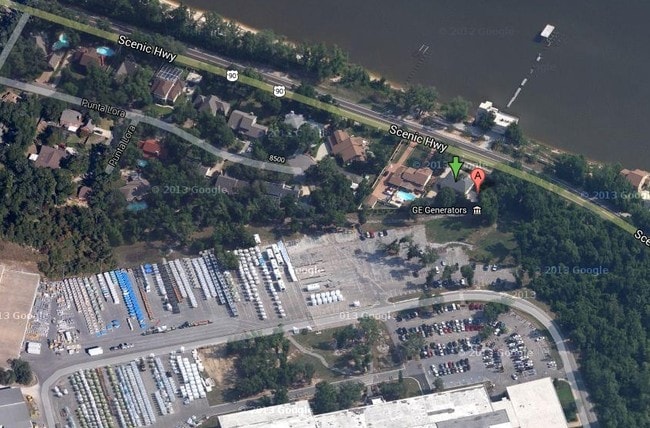
8301 Scenic Hwy
06-1S-29-1004-000-000
Subdivision Number: 1004
Heavyindustrial
BEG AT NE COR OF SEC ON WLY SHORE LI OF ESCAMBIA BAY S 86 DEG 1 MIN 36 SEC W ALG N LI OF SEC 426 FT TO SWLY R/W LI OF STATE RD NO 10A 200 FT R/W FOR POB CONT SAME COURSE 1364 13/100 FT TO POINT IN CENTER OF MISSING LINK FERRY RD S 8 DEG 9 MIN 24 SEC
VE
Escambia
12113C0420H
Florida
0
102.57 AC
2025
Ferry Pass/N Pensacola
003506
Pensacola
396,100 SF
Pensacola-Ferry Pass-Brent, FL
DEMOGRAPHICS near 8301 Scenic Hwy
1 Mile
3 Mile
5 Mile
2024 Total Population
4,430
29,405
70,994
2029 Population
4,475
29,785
72,533
Pop Growth 2024-2029
+ 1.02%
+ 1.29%
+ 2.17%
Average Age
41
41
40
2024 Total Households
1,895
12,698
29,179
HH Growth 2024-2029
+ 1.00%
+ 1.26%
+ 2.15%
Median Household Inc
$63,256
$58,499
$58,730
Avg Household Size
2.20
2.20
2.20
2024 Avg HH Vehicles
2.00
2.00
2.00
Median Home Value
$207,834
$217,257
$234,056
Median Year Built
1981
1979
1981
Nearby Places
Map Layers
Map Styles
 Street
 Aerial
- Restaurants
- Banks
- Shops
- Fitness
- Groceries
PUBLIC TRANSPORTATION
AIRPORT
Pensacola International
DRIVE
WALK
Distance
Pensacola International
14 min
6.6 mi
Freight Ports
Port of Mobile
DRIVE
WALK
Distance
Port of Mobile
66 min
57.7 mi
Nearby Properties
Address
Land Use
TOTAL SIZE
Lot Size
Zoning
Address
Land Use
TOTAL SIZE
Lot Size
Zoning
431,154 SF
35.83 AC
ARZ
Address
Land Use
TOTAL SIZE
Lot Size
Zoning
784,999 SF
20.06 AC
COM
Address
Land Use
TOTAL SIZE
Lot Size
Zoning
553,808 SF
35.16 AC
HDR
Address
Land Use
TOTAL SIZE
Lot Size
Zoning
240,998 SF
19.61 AC
HDMU
Address
Land Use
TOTAL SIZE
Lot Size
Zoning
203,587 SF
20.11 AC
HDR
Address
Land Use
TOTAL SIZE
Lot Size
Zoning
191,157 SF
11.77 AC
MDR
Address
Land Use
TOTAL SIZE
Lot Size
Zoning
517,415 SF
27.78 AC
HC/LI
Address
Land Use
TOTAL SIZE
Lot Size
Zoning
144,978 SF
9.22 AC
R-2A
Address
Land Use
TOTAL SIZE
Lot Size
Zoning
193,321 SF
15.03 AC
HDR
Address
Land Use
TOTAL SIZE
Lot Size
Zoning
151,275 SF
6.79 AC
R-2A
Address
Land Use
TOTAL SIZE
Lot Size
Zoning
236,704 SF
35.17 AC
R-1AA
Address
Land Use
TOTAL SIZE
Lot Size
Zoning
149,680 SF
7.70 AC
COM
Address
Land Use
TOTAL SIZE
Lot Size
Zoning
225,899 SF
26.47 AC
C-1,R-1AA
Address
Land Use
TOTAL SIZE
Lot Size
Zoning
102,514 SF
2.79 AC
HDMU
Address
Land Use
TOTAL SIZE
Lot Size
Zoning
124,128 SF
7.12 AC
R-2A
Address
Land Use
TOTAL SIZE
Lot Size
Zoning
116,349 SF
9.63 AC
R-2A
Address
Land Use
TOTAL SIZE
Lot Size
Zoning
160,058 SF
12.38 AC
HDR
Address
Land Use
TOTAL SIZE
Lot Size
Zoning
170,946 SF
16.99 AC
C-1
Address
Land Use
TOTAL SIZE
Lot Size
Zoning
152,148 SF
22.69 AC
HC/LI
Address
Land Use
TOTAL SIZE
Lot Size
Zoning
98,088 SF
6.50 AC
R-2A
Address
Land Use
TOTAL SIZE
Lot Size
Zoning
74,829 SF
5.57 AC
COM,HDMU
Address
Land Use
TOTAL SIZE
Lot Size
Zoning
197,602 SF
10 AC
HC/LI
Address
Land Use
TOTAL SIZE
Lot Size
Zoning
97,532 SF
9.17 AC
C-1
Address
Land Use
TOTAL SIZE
Lot Size
Zoning
60,150 SF
6.12 AC
HDR
Address
Land Use
TOTAL SIZE
Lot Size
Zoning
69,077 SF
2.58 AC
HC/LI
Address
Land Use
TOTAL SIZE
Lot Size
Zoning
79,636 SF
10.07 AC
HDR
Address
Land Use
TOTAL SIZE
Lot Size
Zoning
71,518 SF
3.81 AC
R-2A
Address
Land Use
TOTAL SIZE
Lot Size
Zoning
72,250 SF
8.76 AC
COM
Address
Land Use
TOTAL SIZE
Lot Size
Zoning
51,157 SF
1.74 AC
HDMU
The World's #1 Commercial Real Estate Marketplace
Connect with us
© 2026 CoStar Group
The information above has been obtained from sources believed reliable. While we do not doubt its accuracy we have not verified it and make no guarantee, warranty or representation about it. It is your responsibility to independently confirm its accuracy and completeness. Any projections, opinions, assumptions, or estimates used are for example only and do not represent the current or future performance of the property. The value of this transaction to you depends on tax and other factors which should be evaluated by your tax, financial, and legal advisors. You and your advisors should conduct a careful, independent investigation of the property to determine to your satisfaction the suitability of the property for your needs.